With an average annual rainfall of 3.2,” the Coachella Valley has had to rely upon other sources of water.
Surface Water
Periodically through history, the Colorado River changed course to fill the rift valley (Coachella/Imperial), and then it would resume its course to the Gulf of California. It is believed it last dried up around 1580.
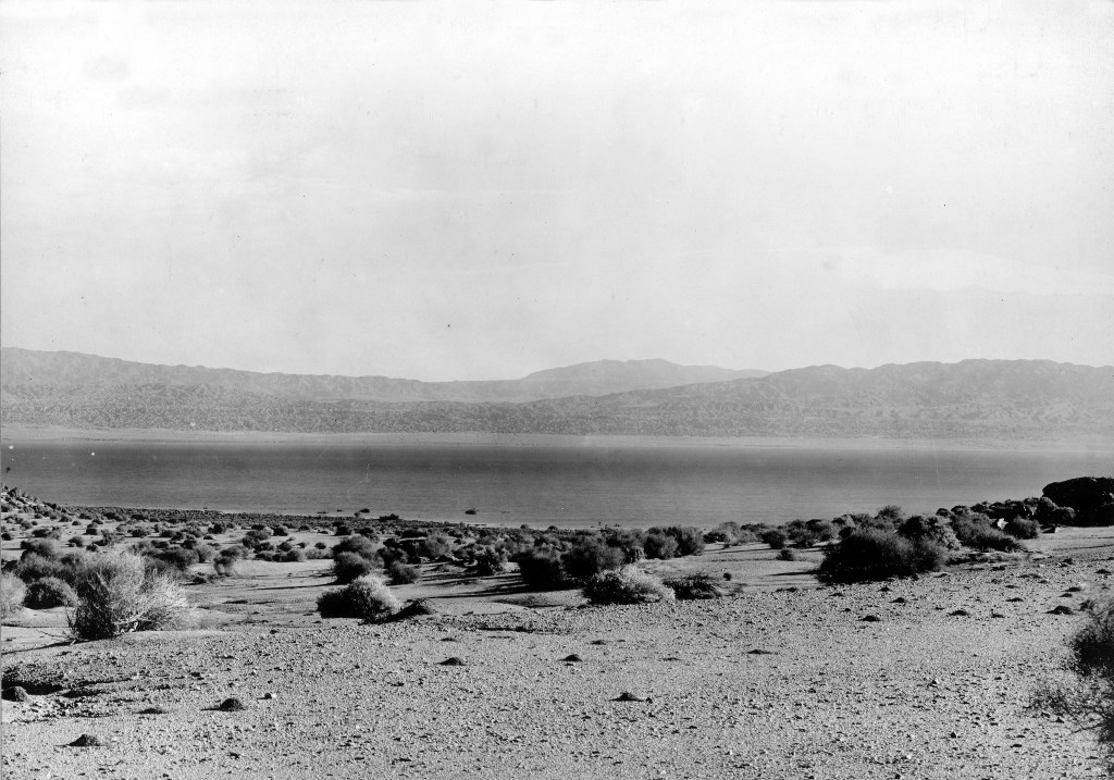
Created by flooding of the Colorado River during construction of inlets to an irrigation canal, the Sea has no outlet and quickly became too saline to support agriculture or for drinking water.
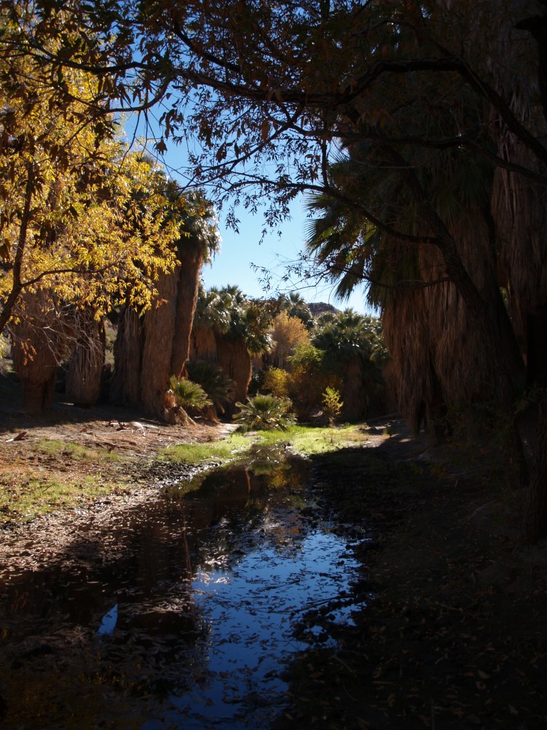
in Palm Canyon in the western valley.
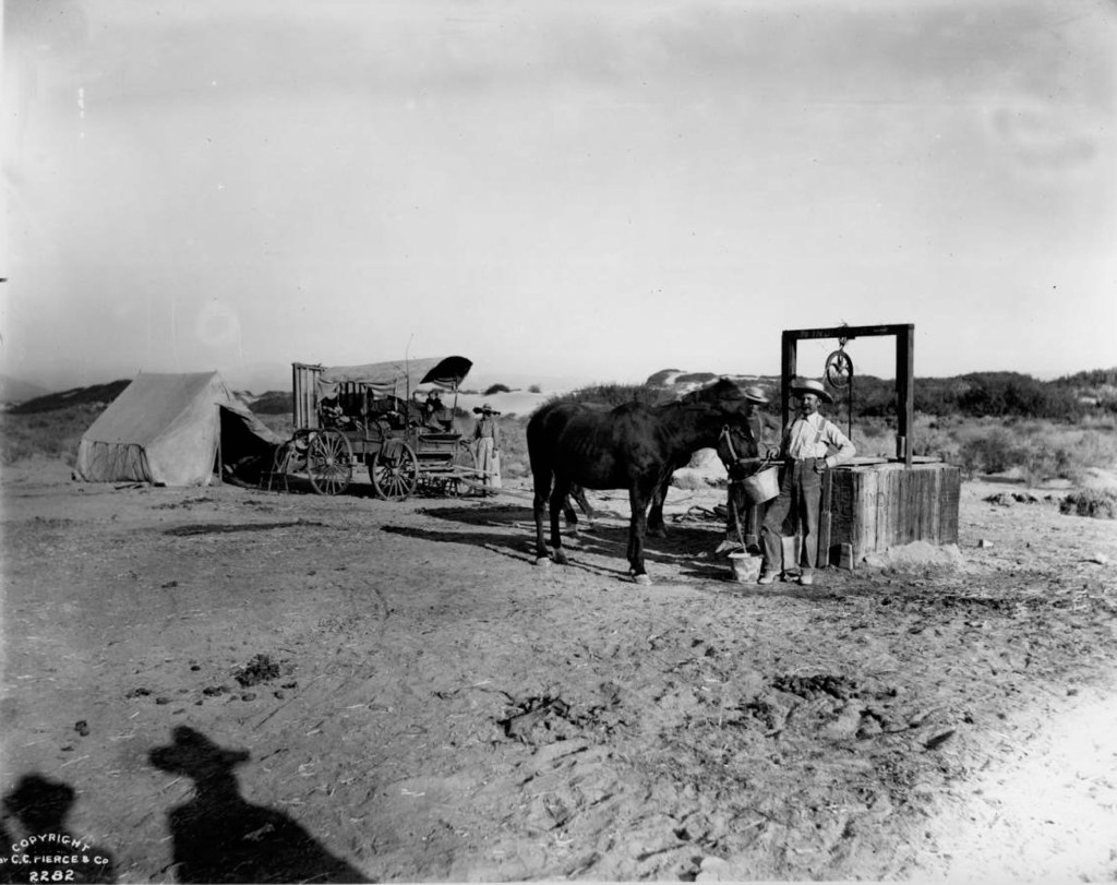
With insufficient rain and surface water, mankind turned to wells
The Southern Pacific Railroad opened its line from Los Angeles to Indio in 1876; by 1877, it was extended to Yuma. In 1883, the line was completed to New Orleans where it could connect to eastern railways. Transportation brought more possibilities of agriculture and tourism.
January 1918: Coachella Valley County Water District was formed.
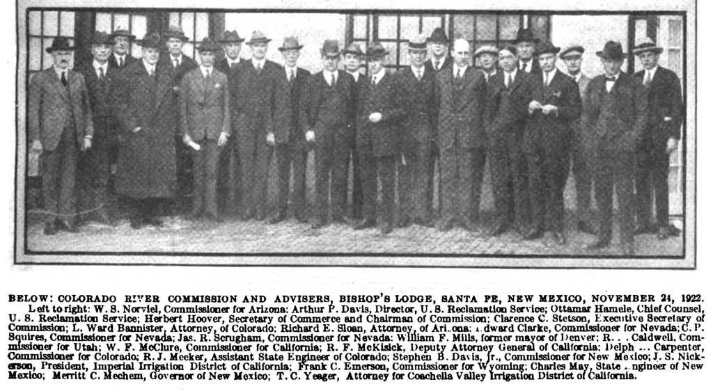
1922 Colorado River Compact: the seven states in the River watershed sent delegates that resulted in the “Law of the River” and the allocation of the river’s water.
On Dec. 21, 1928, President Coolidge signed the Boulder Canyon Project Act, authorizing the construction of Hoover Dam, Imperial Dam, and the All American Canal including its Coachella Branch.
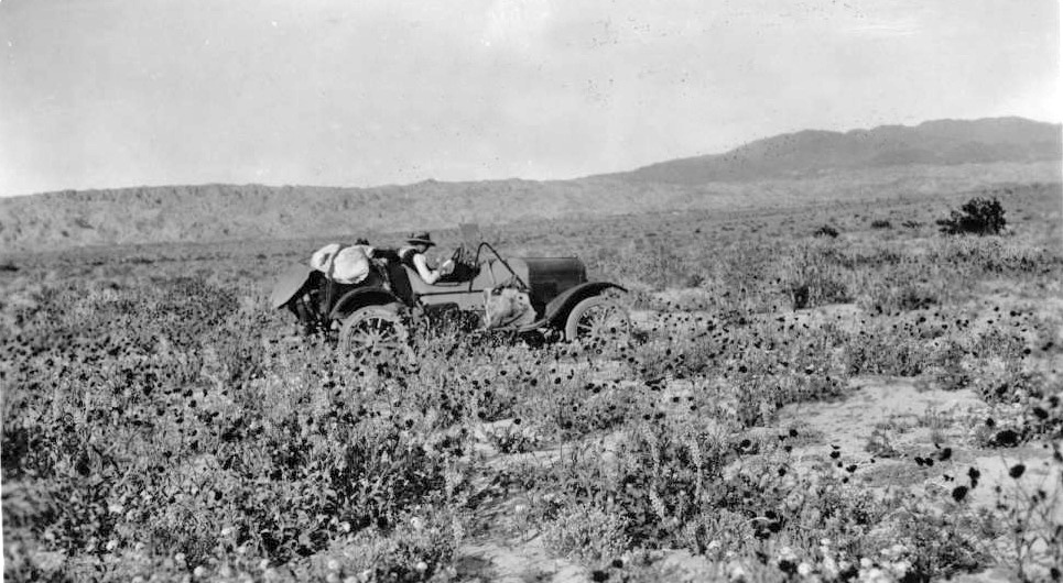
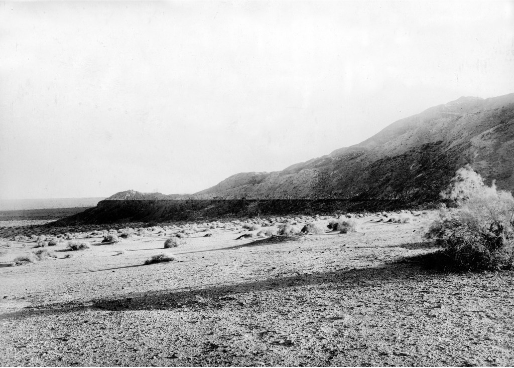
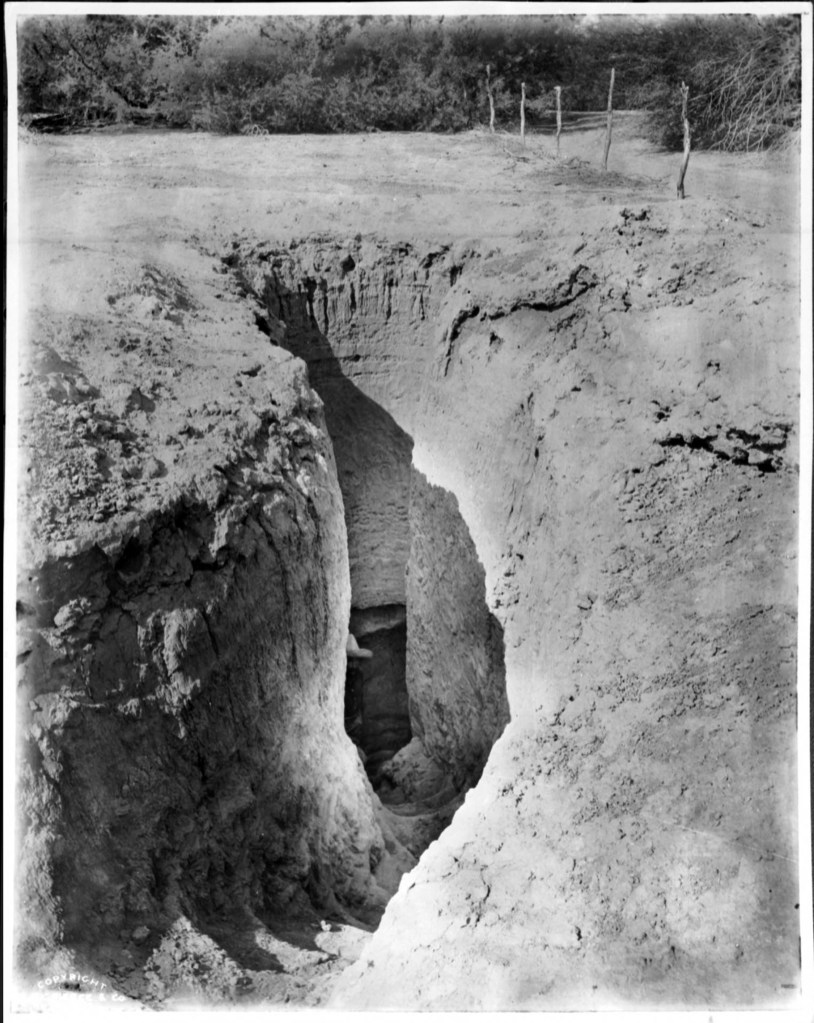
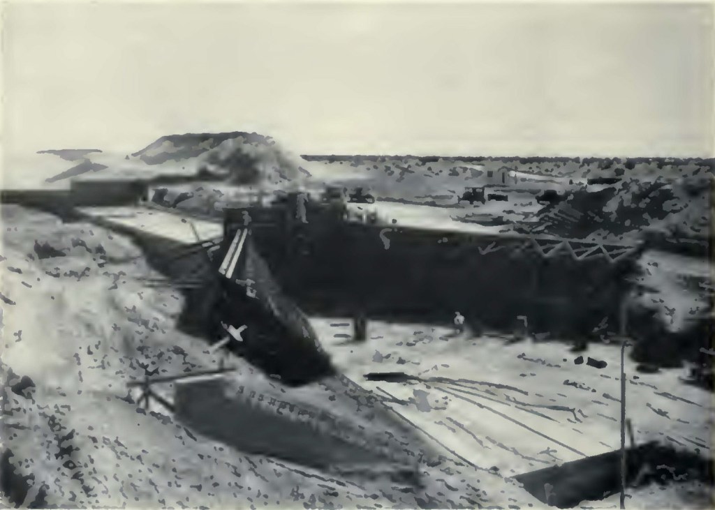
In March, 1930, Attorney Yeager and 4 members of the CVCWD Board drove along the route of the canal survey. While the photo above is not of them, it does show the terrain around Mecca through which they drove their 2 Model T automobiles.
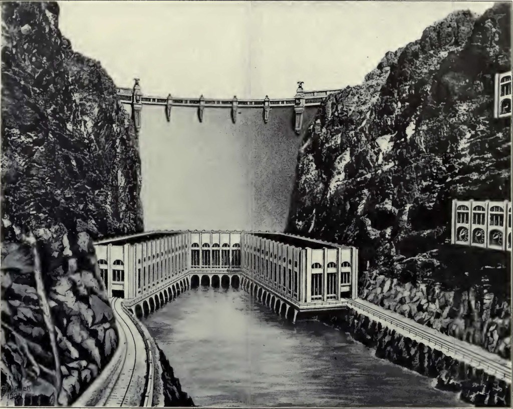
Hoover Dam: Dedicated September 30, 1935
Imperial Dam: Dedicated October 18, 1938
All American Canal
US Bureau of Reclamation photos
US Bureau of Reclamation photo
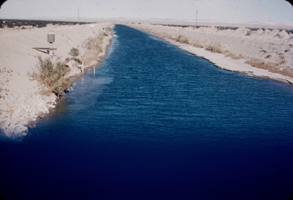
Coachella Branch of the All American Canal
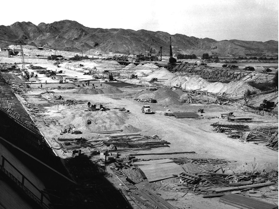
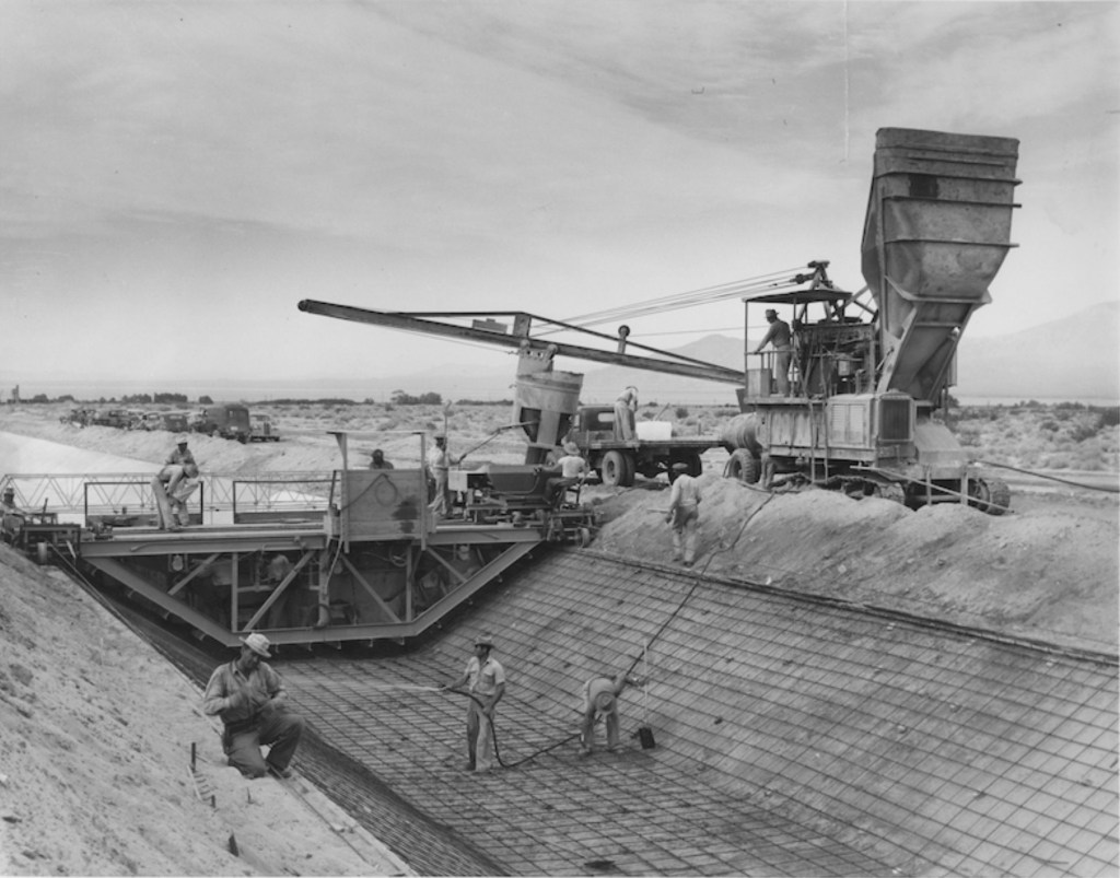
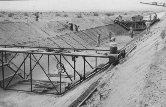
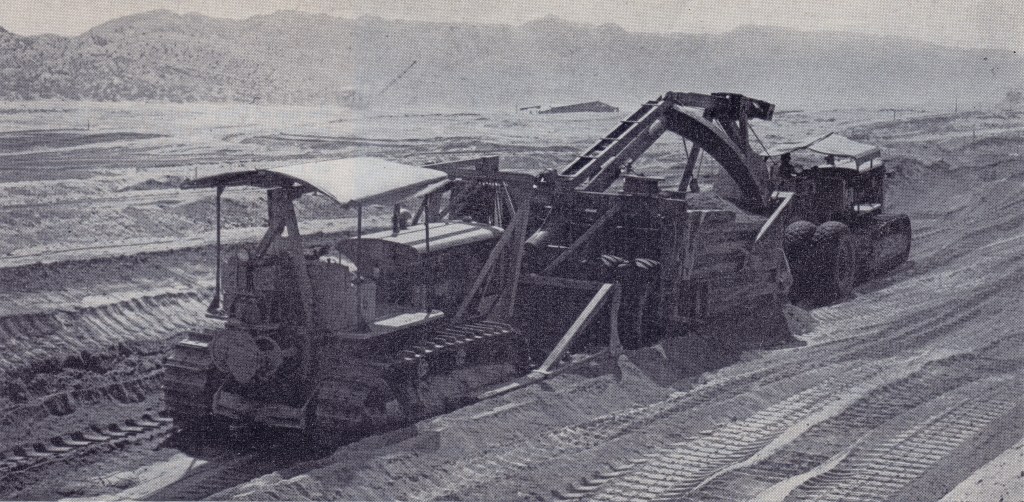
Fraught with complications from labor, fuel and material shortages due to World War II, and with heat, wind and rain by Mother Nature, construction of the 123 mile Coachella Branch Canal took over ten years.
the Coachella Branch Canal, US Bureau of Reclamation photo
Turn out construction completed July 6, 1939
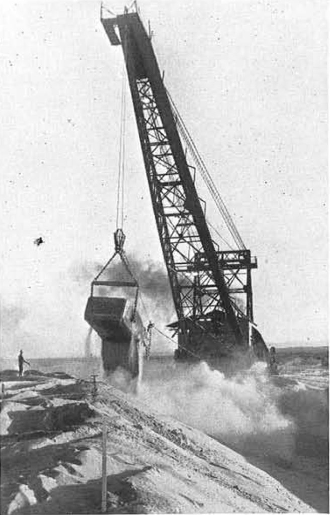
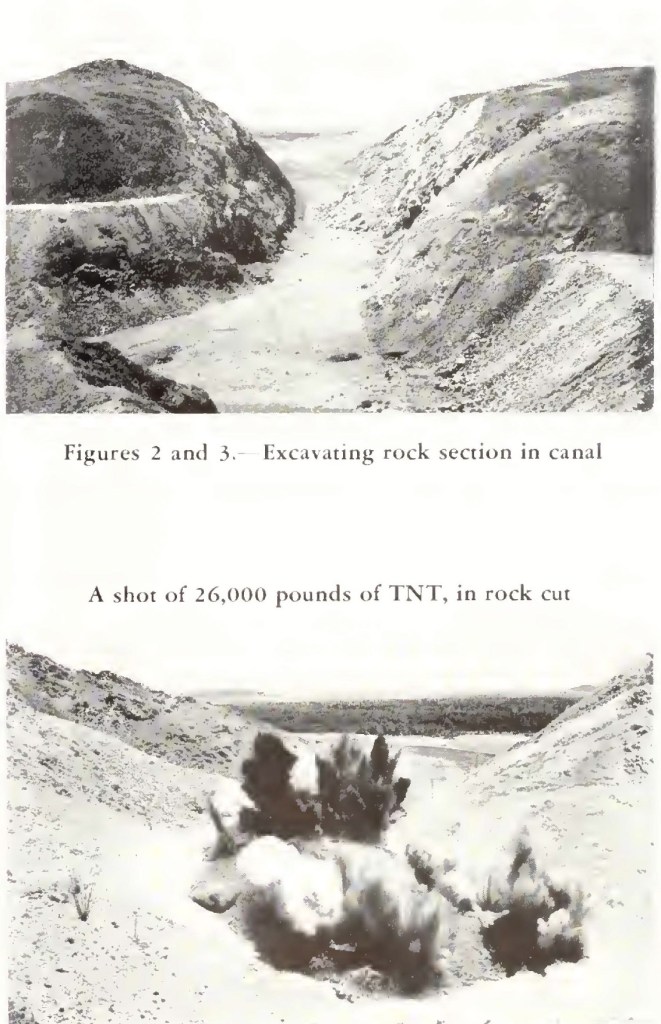
roughing-out Coachella Canal, US Bureau of Reclamation photo
US Bureau of Reclamation photo
(for more information, see “What was That? A Washboard for a Giant?” in the blog posts on the Home Page.)
By the end of 1941, 75 miles of the canal had been completed. The US entry into World War II led to the War Production Board suspending all work except that on Section 2 that was in progress, but that was slow due to shortages and not completed until March 1943. It was not until October 1944 that work could resume, and even then materials were in short supply.
US Bureau of Reclamation photo
Heavy rains in the Indio area in August 1945 washed out part of the work. A waste way and an emergency dike were built to protect the canal, which would lead to construction of 26 miles of dikes along the east side of the Coachella Valley.
US Bureau of Reclamation photo
the Coachella Valley to protect the canal from flash floods.
Civil Engineering magazine photo 1950
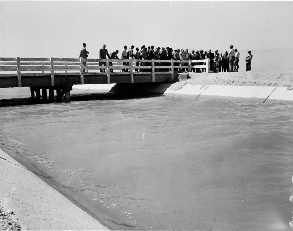
By 1948 canal water reached the Coachella Valley, but there was not yet a way to deliver it to farming land.
US Bureau of Reclamation photo
US Bureau of Reclamation photo
Water well levels in the Coachella Valley were dropping at an alarming rate; from July 1948 through February 1949, emergency canal side water deliveries were made; water trucks carried water to the farms.
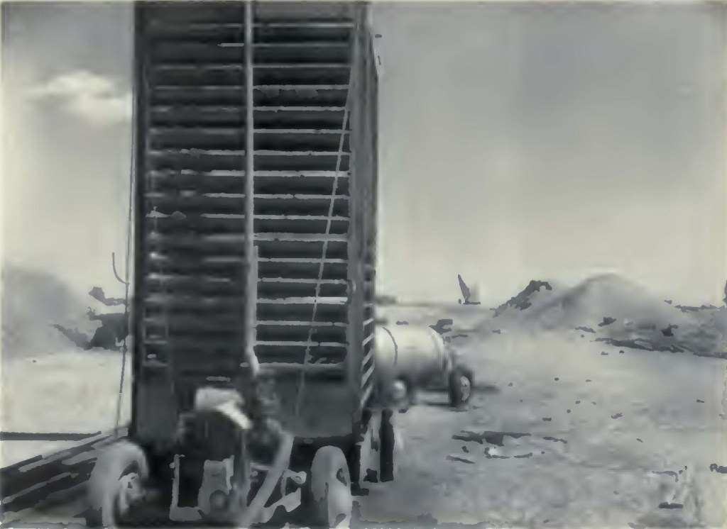
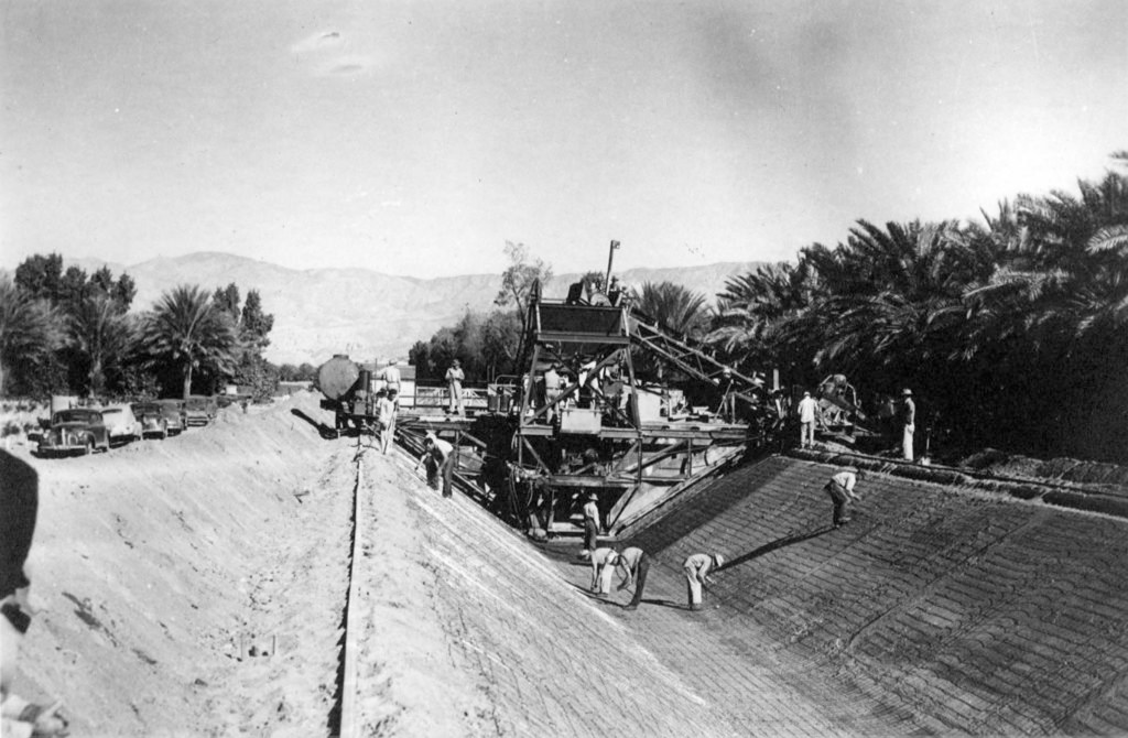
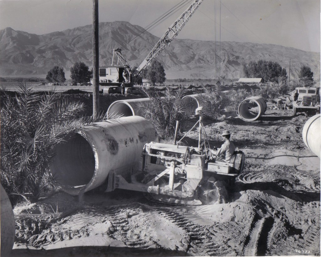
From 1948 to 1954, an underground distribution system was constructed, consisting of 485 miles of low-pressure concrete irrigation laterals ranging in diameter size from 12-inch to 96-inch, to distribute water to the highest point on each 40-acre block of land within Improvement District 1. The laterals were located along section and mid-section lines. Baffle stands were constructed at each turnout point and were located every 1,320 feet to create the head required for each delivery point. The gravity fed system is still in use today.*
The first official water delivery was made March 29, 1949, to the Russell-Alexander Ranch near Thermal, via Lateral 99.8.
Drainage
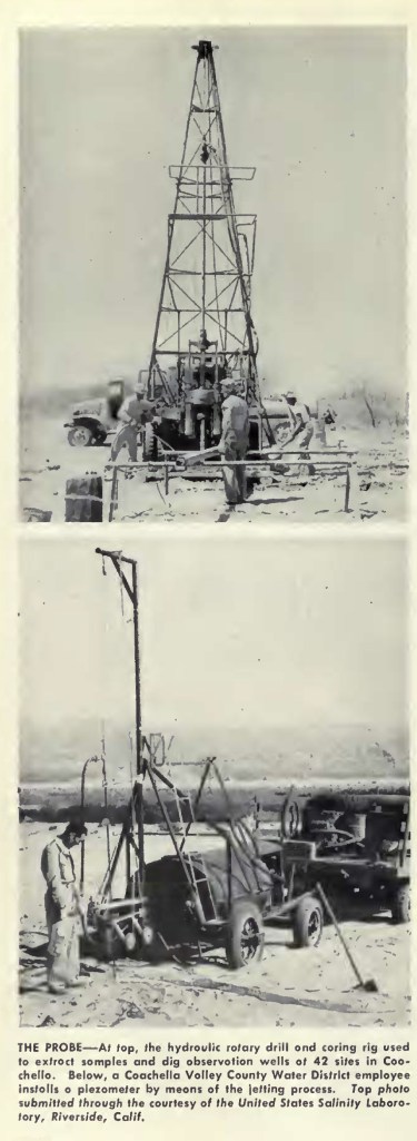
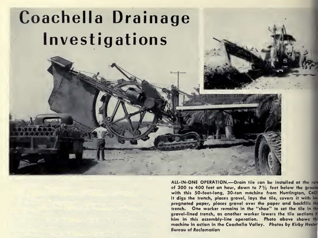
The Coachella Valley does not have “tail water” (i.e. open ditches of runoff from farming), instead, between 1950 and 1978, CVWCD installed an approximately 164 mile underground drainage system (tile drains) to the Whitewater Channel. Many farms have on site tile drains that conduct the water to the system.
The canal in service
May 1, 1953. Los Angeles Examiner, Photographer Miller
In 1958, an agreement was reached to extend the system to the local Tribes.
(In 1961, CVWCD began domestic water delivery.)
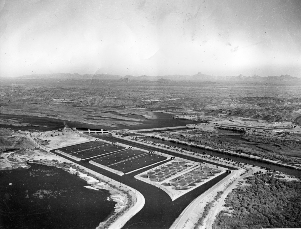
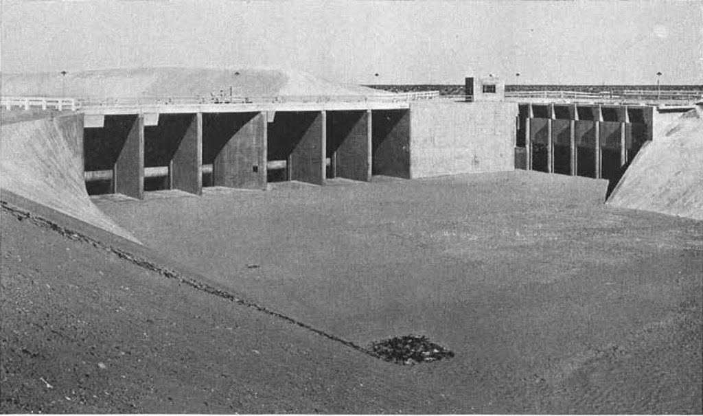
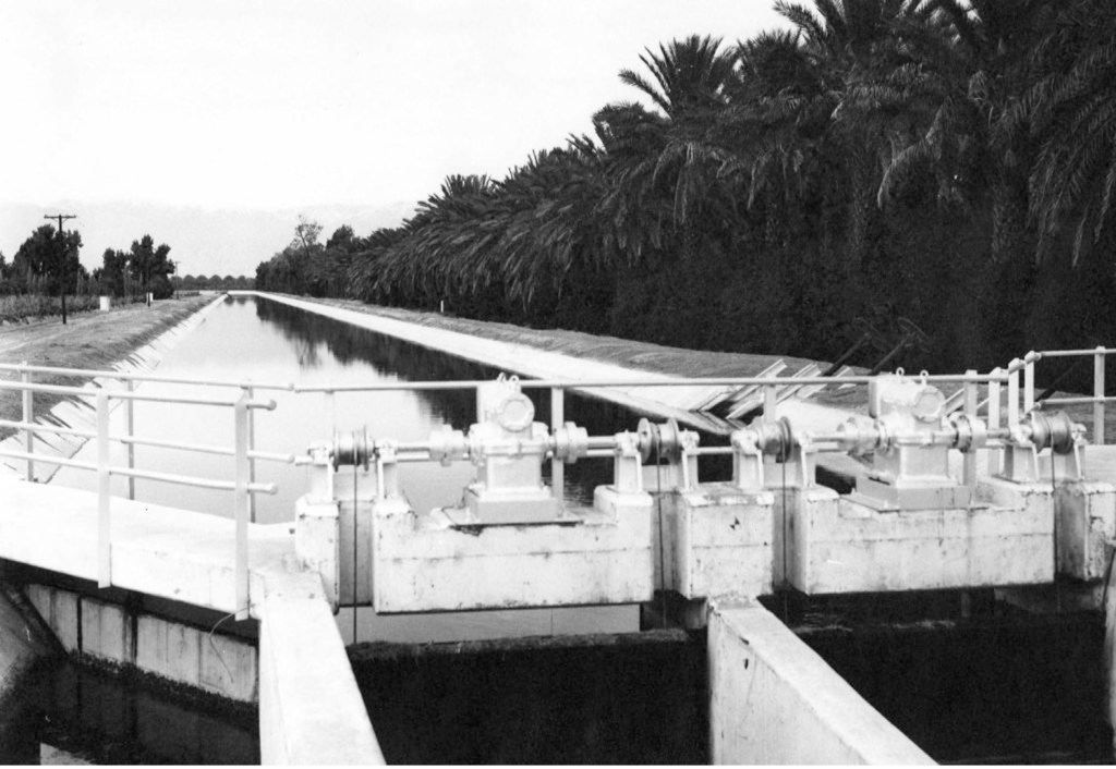
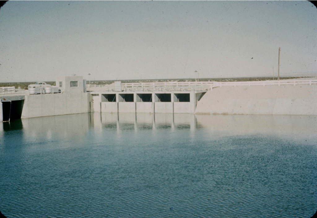
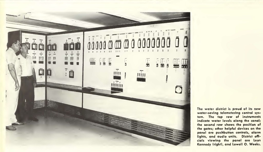
Under a 1963 betterment agreement with the US Bureau of Reclamation, the system had additional renovations, including among other provisions, installation of the first major remote control of any canal system, and creation of a new terminal regulating reservoir:
US Bureau of Reclamation photo
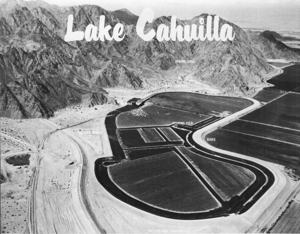
at the time, it was the largest soil cement lined reservoir in the world.
Desert Magazine photo
The challenge to all historians is when to set a cut off point. The canal is not a static project; it continues to evolve with changing technology and demands. I have chosen this point 50 years ago.
- I have the unique privilege of being the daughter of the owners/operators of the heavy earthwork contractors who built the distribution system under contract with the US Bureau of Reclamation.

So informative and amazing, thanks! I’ve seen the Salton Sea just once some years ago.
LikeLiked by 1 person
John, fancy meeting you here! Tell us more about your visit to the Salton Sea. We spent a lot of time on the sea back in the day. It was quite a desert paradise. The Beach Boys had a boat in the marina, and the Hollywood crowd thought of it as Palm Springs South. Saving the sea was a lifelong passion of Sonny Bono.
The fact that the sea even exists is something to ponder. The geography of the area seems so prehistoric especially when you consider the active geothermal volcanoes, or that the Salton Sink — separating Coachella from the Imperial Valley — was formed by crustal stresses along the San Andreas fault.
The evaporation of the sea is an environmental catastrophe. Imagine the bowl-shaped topography of the desert valleys which sit below sea level. Las Vegas, by comparison, although a desert basin, is situated 2000-feet above sea level.
The atmospheric inversion blows 100 tons of dust over the valleys every day. Children are literally born with asthma. The largest number of asthma-related emergency room visits in the entire state of California are in the Imperial Valley. As the sea continues to evaporate, more playa will become exposed thus raising the level of airborne particulates.
The American Lung Association ranks El Centro 7th for particulate pollution. Even healthy children have a 20% reduction in lung capacity.
That’s why I moved to the coast.
The Salton Sea is becoming a ghost of itself. In its heyday, developers laid the foundations and streets for a seaside community. The subdivisions were never built, but the concrete slabs remain to this day. It’s an eerie sight.
One bit of history that many are not aware is that NASA tested their spacecraft recovery systems over the sea. The video and pictures are amazing of unmanned capsules, dropped from cargo planes, with parachutes deployed as they descended into the sea.
My heart belongs to the desert valley. Grandpa got off the boat at Ellis Island, and headed for the Imperial Valley — the land of opportunity — where he carved out a 160-acre farm. Our family history is tied to that land.
Recommended: “The Catastrophe that is the Salton Sea”, San Diego Reader, 04/12/1979.
https://www.sandiegoreader.com/news/1979/apr/12/cover-stout-hearts-and-salt-water/
LikeLiked by 2 people
Wow Dave, thanks so much for your family history in the area! I know that the Colorado River created the lake by accident long ago. What I can’t fathom is why the state of California and Mexico City can’t come up with something to save the lake. Constructing a sea water pipeline for both input and output from the Sea of Cortez seems like a good idea but I’m no authority on this tough subject. The state could benefit from tax dollars if the sea were brought back but with salt water. Just a thought.
LikeLiked by 2 people
I once read a conspiracy theorist who claimed that Sonny Bono did not die in a skiing accident, but was killed by powerful forces wanting to stop his efforts to save the Salton Sea. They didn’t want to spend the money.
A pipeline from the Pacific Ocean, or Sea of Cortez is one of the solutions that have been considered, but the price tag — in the billions of dollars — has, for now, shelved those proposals.
To me, a pipeline is feasible. There’s money for energy pipelines — why not water? Not only would the transfusion save the sea, but it is technologically possible for the pipeline to desalinate the water and generate electricity.
Imagine that! Electricity as a byproduct of saving the sea. Unfortunately, there is resistance in Washington from politicians who believe that the Salton Sea exists only by a freak of nature, and is not worth saving.
Of course, that is very shortsighted thinking which ignores all of the negatives we have discussed here including the destruction of wildlife habitation.
LikeLiked by 2 people
Sorry but almost nothing that comes from that ignorant lot makes sense.
Yet we the little Sheeples pay for the pet projects and ignorance in this specific instance.
I have just once walked a beach and drove through the places I have seen on TV. Same crap, different day that I have seen on the TV.
Politics play as usual, a far too large card in this problem hence the lake continues to die and California continues to decline.
LikeLiked by 1 person
I’m glad you like it! I keep collecting water photos & stories.
LikeLike
If you follow my tags on the Salton Sea (or google HistoryTrove & Salton Sea), you will find a post on the North Shore Yacht Club that shows how low the Sea had shrunk as of last fall. Sadly, there continues to be little focus on the Sea nationally.
I wrote a book on how the current sea was created, & how the Southern Pacific Railroad, not the US Government, stopped the flooding that threatened to wipe out the Imperial Valley & much of the agricultural land of the Coachella Valley. The Colorado as it poured north cut the banks of the Alamo River & threatened to join the New & Alamo Rivers.
Two contemporary quotes stick in my mind:
Elwood Mead (later head of the Bureau of Reclamation): “Finally, when it was known that the river was out of control, and the most appalling calamity that ever menaced the State of California was impending, it should not have been left to a bankrupt company and impoverished settlers to cope unaided with this disaster. It was the duty of the State or Nation to take charge,…it was not until this railroad company took charge that we have the first refreshing example of generosity and public spirit. Nothing could be finer than the action of Mr. Harriman….”
In an address to the National Geographic Society on November 23, 1906, Arthur P. Davis, head of the Bureau before Mead, stated that had the railroad not stopped the River, “This cutting would be continued until the 200 odd feet of excess fall in the channel had been distributed up the Colorado River, eventually, perhaps as far as The Needles. It certainly would have cut a deep channel up to Parker — so deep that it would probably have been entirely impracticable to dam and divert the Colorado River at any point below Bill Williams Fork,…”
Bill Williams fork is close to the beginning of the Colorado River Aqueduct.
Ironically, less than 40 years later (WWII), our country depended on food grown in these valleys to feed our soldiers & home front, as well as the energy produced by the dams on the Colorado River for our war effort. If you want to speculate on alternative histories, perhaps we would be speaking Japanese or German if the Southern Pacific had refused to act.
And, yes, I remember the Sea in all its glory. My parents loaned equipment to launch speed boats for races in the 50s.
LikeLiked by 1 person
Interesting site full of great archival photos. I followed a link in David Lynch’s paper about microhabitats along the Coachella Canal to get here.
LikeLike
Interesting site full of great archival photos. I followed a link in David Lynch’s paper about microhabitats along the Coachella Canal to get here. “Recently formed microhabitat wetlands along the Coachella Canal, Imperial County, California
LikeLike