Where Does Santa Claus Go in the Off-Season?

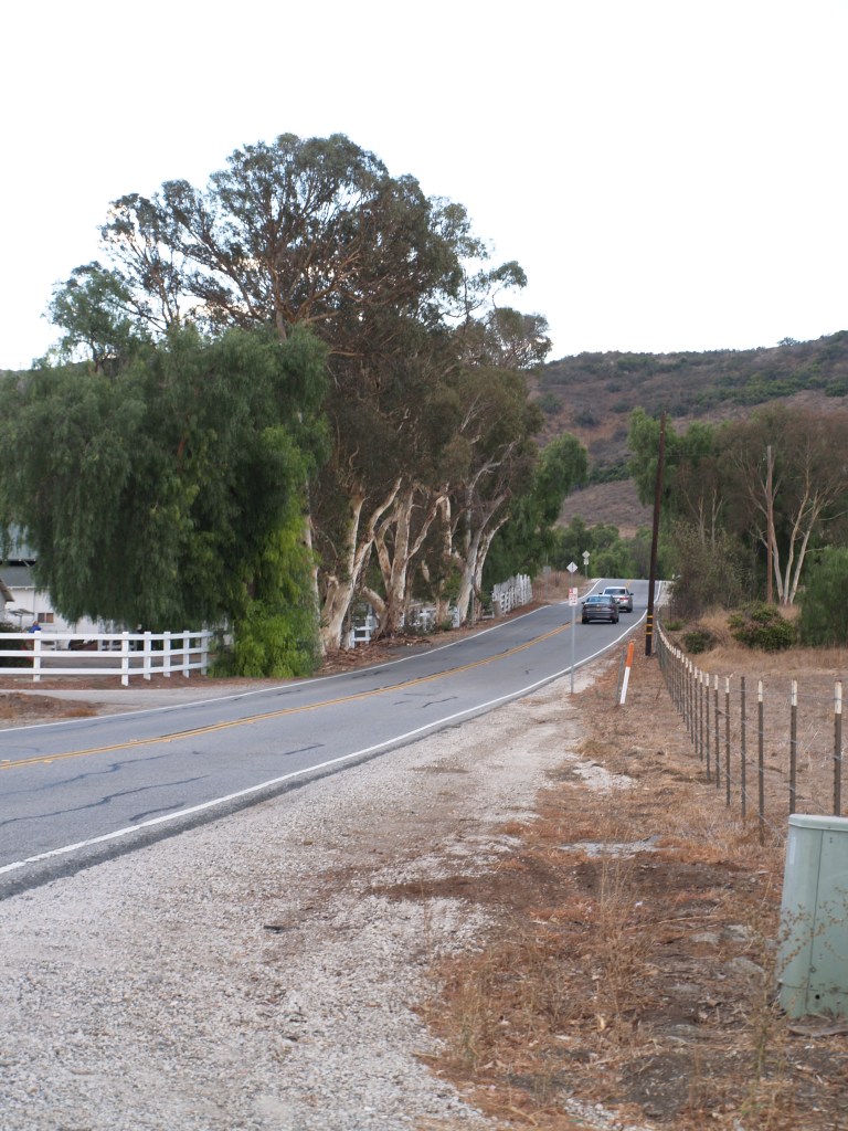
Today the trip from northern Conejo Valley (Thousand Oaks) to Oxnard and Port Hueneme on the Pacific, or Moorpark to the north, can be made via modern roads, but prior to the building of the Norwegian Grade, the journey was long and treacherous, especially when hauling dry farming crops.
The Norwegian Colony in the Conejo was founded by 5 families seeking a better future in the US. In 1890, they purchased 651 acres in the northern part of the valley from George Edwards, which they divided into 5 lots, which were then allocated by lottery:
Lot #1 – 199 acres to Ole Andersen;
Lot #2 – 111 acres to Lars Pedersen;
Lot #3 – 139 acres to Nils Olsen;
Lot #4 – 97 acres to Ole Nilsen;
Lot #5 – 105 acres to George Hansen.
With no source of irrigation water available, they were dry land farmers, working other jobs in the off season. Transporting their crops to market required traveling west to leave the valley over the Potrero and Conejo grades, or north on a precarious stagecoach road over a saddle in the mountains and down into the Santa Rosa Valley.*
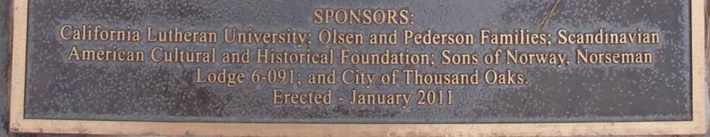
After an accident with the wagons, leaving George Hansen bedridden for a year, the families combined the upper right of way, donated by Nils Olsen, with a 40-foot right of way bought for $50 from Adolf and Roumaine Wyseur.

“Historic Norwegian Grade was built by hand between 1900 and 1911, using picks, shovels, crow bars, farm equipment and $60 worth of dynamite given by the County of Ventura.
“The grade was constructed by members of the Norwegian Colony and their hired help to provide a safe way to move bales of hay and sacks of wheat and barley to the farmers on the Oxnard Plain and to the Hueneme Wharf.
“The route for the grade was selected because it provided a gradual descent with no hairpin turns and would be safer than existing routes to the Oxnard Plain and Moorpark.**
“In the early 1900’s, there were no bulldozers, earth moving equipment, etc. Work was done by hand using a star drill and a sledge hammer to pound holes into the very hard volcanic rock; dynamite was inserted into the holes, fuses lit, everyone ran for cover, and it blew. The resulting rocks and debris were moved by hand and a horse-drawn fresno (scraper), to build the narrow one lane roadway.
“Construction was done in the winter and early spring months because baling and harvesting took precedence during the summer and fall. The road was later widened to two lanes.”
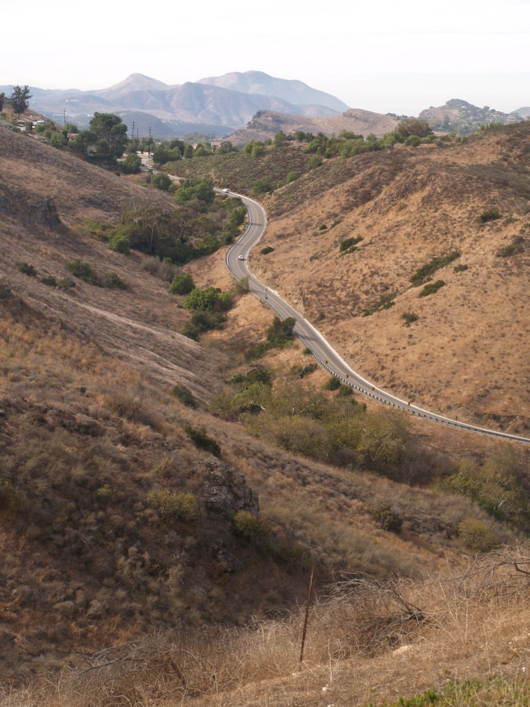
The new route cut a full day off the trip. Today the farms are long gone from the Conejo; the Santa Rosa Valley has farms and scattered housing developments. In 2010, the City of Thousand Oaks renovated the deteriorating road, and unveiled the memorial plaque at its reopening.
*I am still trying to pin down the location of the wagon trail north to the Santa Rosa Valley. Accounts I have read say it was partially obliterated by grading in the 1950’s.

Open Saturday & Sunday (except holidays) 1-4 pm.

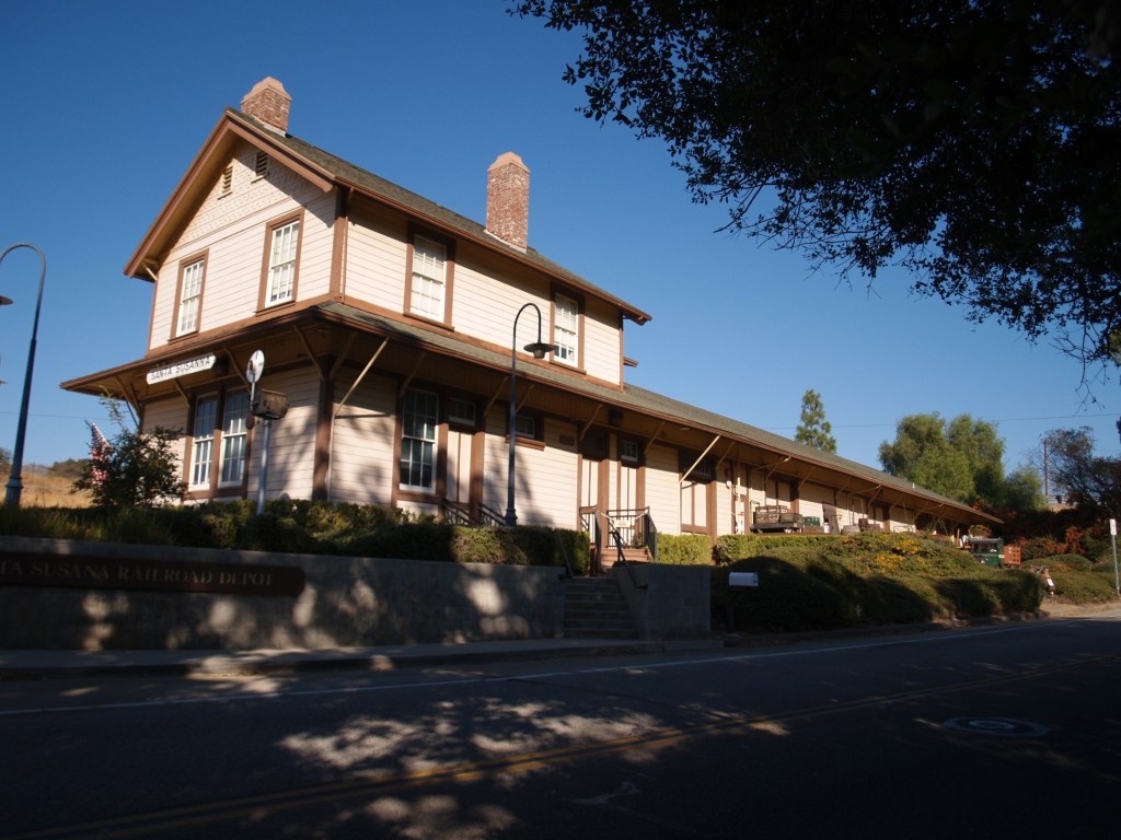
Built in 1903, Southern Pacific Santa Susana Depot sat on Los Angeles Ave. East of Tapo Street; it served the Rancho Simi area until the early 1970s when the SP closed it. Falling prey to age and vandalism, the deteriorating building was sold by the railroad for $1.06, and moved 2 miles east to its present site in May 1975 (6503 Katherine Road). After extensive restoration, the depot was reopened in 2000, as a museum and home of the local model railroaders club.
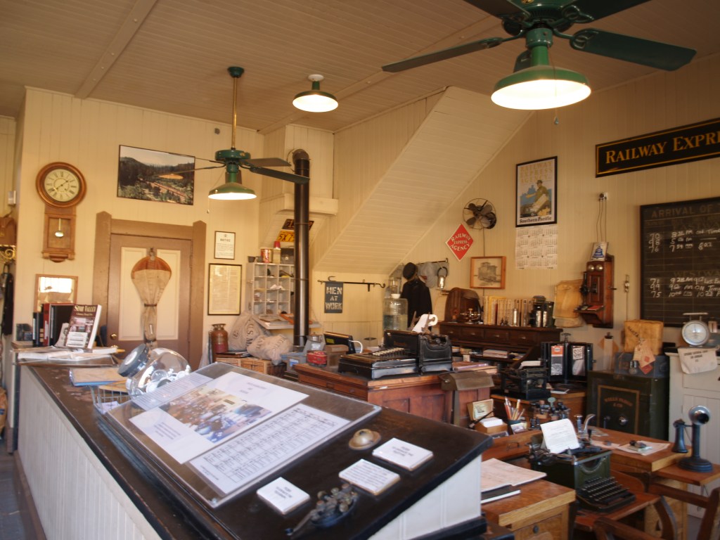
A passenger station, freight station, and telegraph office, it was based on Southern Pacific’s standard No. 22, combination depot plans; the depot has a recently restored stationmaster’s apartment on the second story.


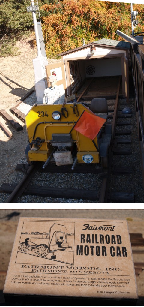
Exhibits between today’s Union Pacific tracks and the depot:

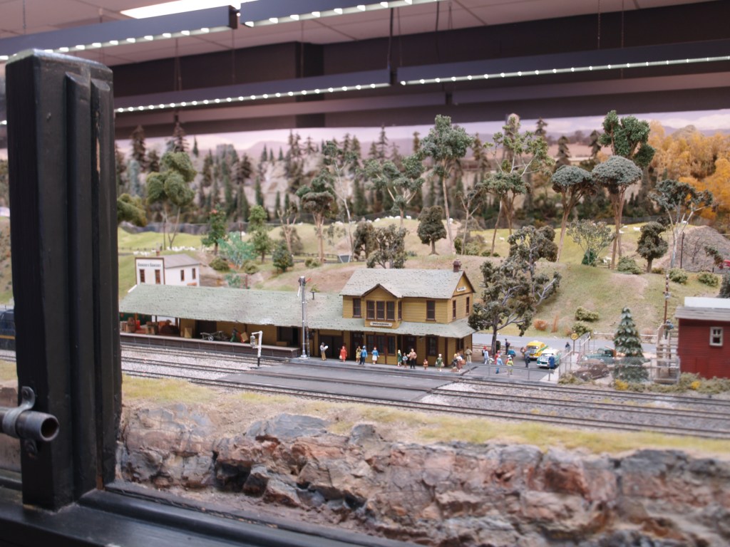
HO Model Railroad in depot:

Freight Deck:
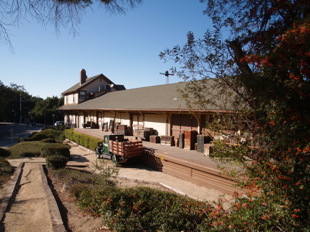
Also on the grounds:


On the second floor of this building, above the Santa Paula Hardware Company and the US Post Office, Union Oil Co. was founded October 17, 1890; when corporate headquarters were moved to Los Angeles in 1900, production offices remained in Santa Paula. In 1950, the building became Union Oil Museum. In 1988, Unocal announced a $2million restoration of the site, creating the California Oil Museum of today.
Much of the stone in the Queen Anne building came from the Santa Paul creek, and the purple Sespe sandstone trim came from a Fillmore quarry. The first floor has permanent interactive exhibits centered on the oil industry in California and rooms for changing exhibits; upstairs the building has been restored to its 19th century corporate Board Room and office space. The rig room, a modern structure adjacent to the original building, has a working, restored 1890s oil rig!
See https://www.caoilmuseum.org/about for more photos and information about current exhibits. I have a personal preference for museums that are interesting for both kids and adults!
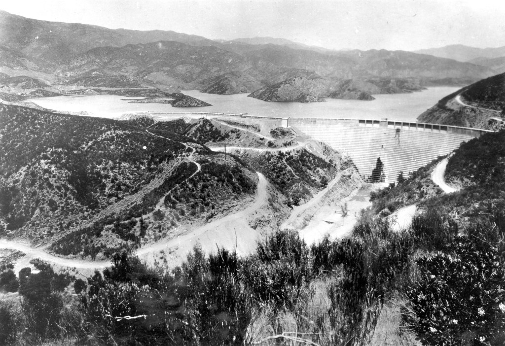
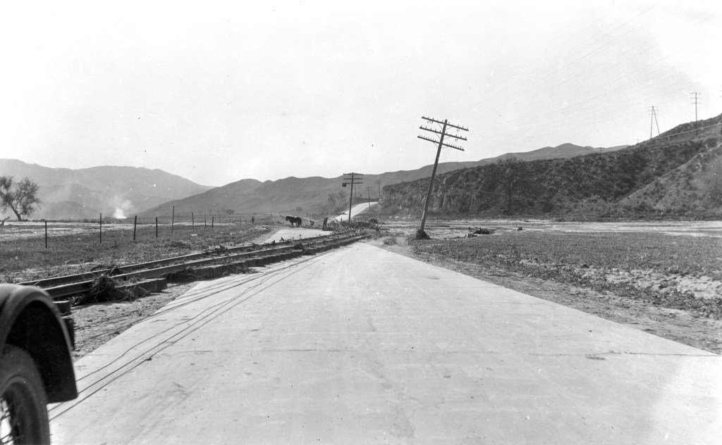
Just a quick note on the power of water: I found this dramatic March 18, 1928 USGS photo of the railroad tracks between Castaic Junction and Piru (Calif.), having been moved onto the highway by the flood caused by the Saint Francis Dam failure.
Below is a photo of the dam before it failed on March 12, 1928. From the USGS archives, courtesy of Los Angeles Bureau of Power & Light. Harold Thornton Stearns, photographer