THE TORS or SHUMWAY RANCH

Being an aging Desert Rat myself, I am drawn to the story of Nina Paul Shumway. She came to the Coachella Valley with her parents, brother & first husband in June 1909, where her father started a date ranch and eventually became president of the Coachella Valley Date Growers Assn. She wrote about her life in the desert valley in Your Desert and Mine (I cherish my mother’s autographed first edition).

But, even confirmed Desert Rats yearn for cooler weather when the temps top 120F (48.9C) in the summer. She and her husband, Percy Stephen (Steve) Shumway* had long explored the Santa Rosa Mountains and in 1932, discovered Section 25,Township 6 south, Range 5 east of the San Bernardino Meridian; they subsequently were advised by the Land Office in Los Angeles, that a grazing Homestead of 640 acres** could be claimed, under the Stock-Raising Homestead Act of 1916.*** They had to wait months for the application papers to be sent from Montana. To qualify, they had to increase the value of the land by at least $1.25/acre, and at least half of that had to be done within 3 years; they also had to establish residence on the land, which Nina fulfilled by staying there for 7 months out of the year, while Steve worked in the Coachella Valley and traveled to the homestead as often as he could (usually twice a week).

The house, with it’s screened porch is the building on the left

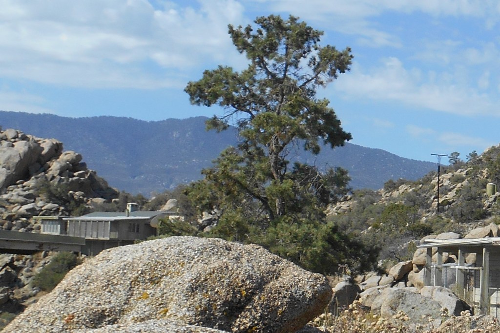
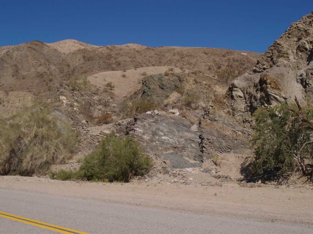
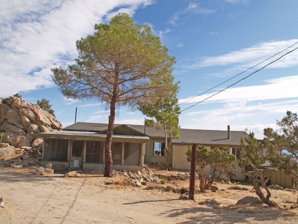
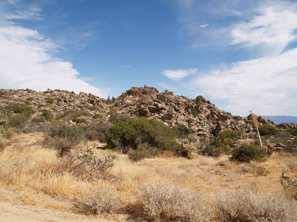
Named “The Tors” by the Shumways, the rocky section was not a place for cultivation of crops, required under earlier homestead acts. Cattle belonging to neighbors did forage on the land.

Starting with her staying in a dugout/tent combination, Nina and Steve built a home in the rocky landscape. The original room of the house is on the left and became the kitchen.
They collected the sandstone slabs for the floor of the main room from the Salton Basin in the eastern Coachella Valley where it merges with Imperial Valley, and 2-5″ stone slabs for the fireplace from the Eagle Mountains east of the Coachella Valley where Steve’s brother Earl was prospecting.

I have seen photos of the Shumways at the fireplace; on the mantel they had several Cahuilla pots they had found, and which were ultimately given to the Desert Museum (today the Palm Springs Art Museum).

On the 13th of July, 1938, the last grazing homestead patent in California was issued to them, signed by Franklin D. Roosevelt. Sadly, in 1945, after a “beautiful day entertaining guests on the mountain,” Steve Shumway passed away from a massive heart attack.

By 1946, Nina was able to furnish “The Tors” the way she thought appropriate, including 2 bed-couches, 2 four-foot love seats and a large chair, all made by Selden Belden in Idyllwild of local pine. The chair above was bought by my parents around 1950-1952 from Pinecraft in Idyllwild (Selden Belden). From the passage in Mountain of Discovery, where she describes furnishing The Tors and the photos of the main room in her book, her furniture was this same design. She chose brown/while cow hide upholstery for the loveseats and a solid color hide for the chair. Due to a fire at our ranch house, ours chairs needed to be reupholstered (due to soot damage), but the yellow is the original color, so I imagine her chair may have had yellow too.

Nina eventually had a house built in Palm Desert and spent part of the year there, and part at “The Tors.” By 1963, she was ready to move on, spending 10 years in Tucson, Arizona, and another 10 years in Palm Desert, passing away in 1984 at the age of 95.

Irene Rich, a silent screen actress and her daughter, Frances Rich, actress and sculptor, had purchased the “The Tors,” renamed it Shumway Ranch, and preserved the house built by the Shumways. Before her death in 2007, Frances Rich donated the Ranch to the Living Desert in Palm Desert. I went on a tour of the property once while the Living Desert owned it; a caretaker lived on the property and the Shumway house was empty.

Overlooking the Coachella Valley
The Salton Sea can be seen on the right

Not able to feasibly integrate a program on the ranch with their zoo on the valley floor, in 2014, the Living Desert contacted the Coachella Valley Mountains Conservancy (CVMC), offering to sell the ranch. From January 2007 to the present, I have been the Calif. State Senate Appointee to the Governing Board of CVMC**** and, I am happy to say after a lot of negotiating, on June 26, 2017, the California Department of Fish and Wildlife took title to the ranch. In September the Department transferred jurisdiction over approximately 10 acres with the historic Shumway buildings to CVMC.

Conservancy operations and funding are limited by State statute, so while it retains title to the 10 acres, it is not really suited to open and operate the property, especially the structures, to the public. An operating/lease agreement has been signed with a separate non-profit organization, ShumwayRanch.org,***** created by community members with the hope they can open it despite the challenges of providing public restrooms, parking, fire fighting access, etc.

June 13, 2021, Highway 74, near the turn off to Shumway Ranch, photo courtesy of the San Bernardino National Forest, US Forest Service.

Ironically, on June 13, when I started putting together this article, a wildfire broke out about 3 miles from the Ranch. It burned 341acres and was fully extinguished June 21st, after destroying 2 houses and damaging 3 in nearby Pinyon Crest. Thanks to the valiant efforts of the fire fighters in an intense heatwave, the Ranch was not touched.

This blog is based on Nina Paul Shumway’s book, Mountain of Discovery (1992) and her article, Hard Rock Homesteaders (Desert Magazine, Sept. 1939); and my lifetime in the region

*or Steven; I have seen both spellings, but it is STEPHEN on his gravestone

** 640 acres is one square mile; 259 hectare. The ranch is now part of the Santa Rosa and San Jacinto National Monument, and is adjacent the San Bernardino National Forest.

*** To be eligible to be a homestead the US Secretary of the Interior had to decide that the lands were “chiefly valuable for grazing and raising forage crops, do not contain merchantable timber, are not susceptible of irrigation from any known source of water supply, and are of such character that six hundred and forty acres are reasonably required for the support of a family.” Sec. 2 of the Stock-Raising Homestead Act of 1916.

****Property bought with a grant from the CVMC, or directly by the Conservancy, is subject to a deed restriction placing it in conservation in perpetuity. The total sale was $1.565 million from a combination of government agencies.

*****Although sympathetic to their goals, I am not affiliated with ShumwayRanch.org.

Traveling Mud Pot

Natural History in the Making

Imperial Valley Mud Pot, December 2020

While it may not look like much, there is a traveling mud pot in Imperial Valley, California, headed toward the Salton Sea. I went down there in November 2018, when the LA Times ran an article on it (https://www.latimes.com/local/lanow/la-me-ln-niland-mud-pot-20181101-story.html). At that time I couldn’t see it since the Union Pacific Railroad had guards protecting their work site as the mud pot (geyser) threatened their main line through the area (former Southern Pacific line).

The mud pot has been known to exist since the 1950s, but in 2015/16, it started moving at the rate of approximately 20 feet per year (https://www.nationalgeographic.com/science/2018/11/bubbling-pool-mud-moving-california-dont-know-why-geology/)! It is the only known moving mud pot.

In the Times article you will see an excellent map & an illustration showing its travel path and how the railroad installed a metal barrier in the ground, trying to stop it. The geyser just dove underground and came back up on the other side of the barrier.

Last week I went again and took these photos. The mud pot is now about 35 feet from the asphalt edge of State Highway 111. Traffic is now routed on a bypass, just to the west (https://dot.ca.gov/caltrans-near-me/district-11/current-projects/sr111-nilandgeyser). I was able to park just north of the bypass and walk down the “real” highway to the site of the mud pot. Although there are three low concrete barriers, you can easily walk around them.

Union Pacific rail line can be seen behind the mud pot; the channel cut in the side of the circle drains the water to go under the road.

Will it continue it’s journey to the west? Into the Salton Sea? Only time will tell.

This year has been a struggle for many of us; I am hoping to get back to HistoryTrove more often. This post is a change of pace, but needing to get out and go somewhere that I wouldn’t meet anyone, this trip was perfect.

The First Salton Sea

Prehistorically, the Gulf of California extended north through the Imperial and Coachella Valleys; over time geologic shifts and water borne silt changed the topography of the land near the Mexican Border, cutting it off from the Gulf to create the Salton Sink. Subsequently, the Colorado River would change course, on and off creating a vast inland sea, now called Ancient Lake Cahuilla. Around 1580, the last vast lake evaporated.

Tufa deposits mark the shoreline of Ancient Lake Cahuilla, Coachella Valley

Before construction of Laguna Dam in the early twentieth century, the Colorado was still an active river, draining much of the Western US. Springing from watershed high in the snowy Rockies, the “Red River” raced southward and downward, carving the Grand Canyon and other marvelous canyons as it dashed on to the Sea of Cortez. As it approached the Gulf of California, the landscape changed, leaving behind the rock canyons and allowing the river to meander, creating an alluvial delta with the material carried downstream. Captain J. H. Mellon, who operated steamboats on the Lower Colorado, estimated the silt extended the delta fan into the Gulf by more than 6 miles over the course of the 40 years prior to 1905. (H.T. Cory, The Imperial Valley and The Salton Sink, Part IV, (John J. Newbegin, 1915), a reprint of Irrigation and River Control in the Colorado River Delta, from Vol. LXXVI, Transactions American Society of Engineers, p. 1214.)

Smaller overflows of the Colorado River banks continued into the nineteenth century, down the New and Alamo River channels, flowing into the Salton Basin and duly evaporating.

The winter of 1890/91 was the wettest since readings began being kept in 1850. In February, 1891, a number of breaks in the west bank of the Colorado allowed water to spill over into the delta and the New River channel. In June, when Spring runoff brought high water again, more water spilled into the streams running north into the Salton Trough reaching Salton, site of the New Liverpool Salt Works.

From The Californian: Illustrated Magazine, Vol. I, No. 1 October 1891.

The sea was approximately 40 miles long and 10 miles wide, but only 4 feet deep. (B. A. Cecil-Stephens, “The Colorado Desert and its Recent Flooding,” Journal of the American Geographical Society of New York, Vol. 23 (1891), pp. 367-377)

In July 1891, the New York Times printed remarks by John Wesley Powell, Director of the U.S. Geological Survey, that even if the lake were filled to the level of the river, it would evaporate at the rate of approximately 6 feet per year.

In 1892, a wood engraving (based on the Cecil-Stephens map) was published in La Nouvelle Géographie universelle, la terre et les hommes, 19 vol. (1875-94), text by Elisee Reclus. The Cartographer was Charles Perron (vol 16, pg 575). A hand-colored copy of the engraving is shown here.

The first Salton Sea did indeed evaporate due to the extreme heat and lack of sufficient incoming water sources. The situation was totally different following the 1905/07 flooding, as the entire river was diverted into the trough creating the lake, and runoff from agriculture in the Imperial Valley provided a new source of water to replenish that lost to evaporation.

For information on the 1905/07 flooding that created the current Salton Sea, my blog page Creation of the Salton Sea has a preview of a book I’ve written. historytrove.com/creation-of-the-salton-sea/

Needles, CA

Snoopy’s brother Spike lives near Needles with his Cactus companion. As he said in Peanuts on October 12, 1993: “Life in the desert is exciting. Last night the sun went down and this morning the sun came up. There’s always something happening.”*

The Needles rock formation that lent its name to the city.

Needles was, and is, a railroad town

The Atchison Topeka and Santa Fe Railroad founded the town in 1883.

After the first station burned in 1906, ATSF built a new station, El Garces Hotel, and a Harvey House restaurant that was considered the jewel of the system.
Vehicle approach to El Graces today.
The hotel & restaurant were closed in 1949 and the building was totally abandoned in 1988. In 1999, the City purchased the building; in 2007, renovation was begun with the goal of reopening a hotel, shops, restaurant and train station. However, due to problems with loans on a municipal building and restrictions on use of federal funds, the private part of the project was abandoned.
The World War I memorial sits before a largely unused, beautiful building. In 2016, a waiting room for Amtrak passengers was created, open 11pm to 2am when the Southwest Chief passes through. There is also The El Garces Intermodal Transportation Facility which occupies a small part of the building. The park in front is often occupied by transients.

Needles is also on Historic Route 66

Traveling East to West on Route 66. the first city in California is Needles.
The Old Trails Inn used to greet travelers heading West on Route 66.
Today the remaining cabins are The Palms Apartments
The trains still roll through; tourists still travel Route 66; and the sun still goes down and comes up on Needles

*As a boy, Charles Schultz lived in Needles 1928-1930.

Bygone New Years Eve Tradition: Coachella Valley

Artist John Hilton burned paintings in bonfire in Box Canyon

According to Katherine Ainsworth’s 1978 biography of John Hilton, Maynard Dixon and Nicolai Fechin, both, advised Hilton to discard “unworthy” paintings. As noted in the biography as well as numerous newspaper and magazine articles, Hilton invited friends to a dramatic annual party in Box Canyon (east of Mecca, CA) when he would throw his rejects onto a bonfire at the stoke of midnight on New Year’s Eve. As the years passed, the party grew and others added to the bonfire, but Hilton reserved his painting burning for last.

One particularly memorable New Year’s was 1940/41 when the Los Angeles Times printed a photo of him tossing a painting into the fire.

L.A. Times, Jan. 3, 1941

Immediately to the right on the page was an article by Ed Ainsworth:

After several years the parties were discontinued; this may have even been the last, as a year later the US would be at war. Of course today, one would need a permit for such a fire, which the County Fire Department would never issue!

Box Canyon Road winds up from the Coachella Valley floor through the Canyon to Shaver’s Valley and on to Interstate 10. The Canyon is protected under the 1964 Wilderness Act and has not changed except for some modern road improvements and erosion by Mother Nature.
Fragrant Morning by John Hilton (one that wasn’t burned!)

Happy New Year!

La Quinta, California

Someone decided to add some holiday cheer to the agaves in the median on Calle Sinaloa!
Originally the La Quinta Hotel, which opened Dec. 29, 1926.
The Resort is very proud that Frank Capra stayed there & every year turns it into “BedfordFalls” for the holidays. However, the citrus tree in the background makes it clear this is the California desert.
The Resort tree 2019.

Have Happy & Healthy Holidays!

More Coachella

City Hall

Coachella City Hall, circa 1949. You can see the edge of the Fire Station on the right
City Hall at the Holidays 2019

The City was incorporated in December 1946 and the City Hall was dedicated in October 1949. Over the years, it not only housed the City government, but also the post office, police department, justice court, and the public library. Today, City Council Chambers and administration occupy the entire building.

Fire Station

City of Coachella

Photo from an early 1940s Chamber of Commerce pamphlet (no copyright notice)
Renovated fire station, now used by the City, December 2019

The Fire Station was built on land donated by the Coachella Land & Water Co. to Riverside County, circa 1905, when the town was being platted. When the City was incorporated in 1946, one of its first actions was to ask the County to donate the land to the new City. Next door to the site of the Fire Station, the new City Hall was built; to the north of City Hall and the Fire Station, approximately half of the parcel continued to be used as a park and is today Veterans’ Memorial Park.