It’s been a busy week, dealing with two storms and the holidays.
It’s been a busy week, dealing with two storms and the holidays.

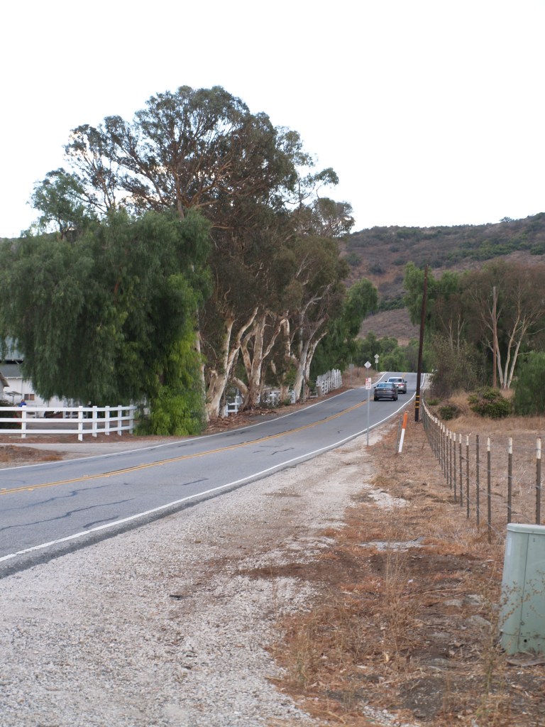
Today the trip from northern Conejo Valley (Thousand Oaks) to Oxnard and Port Hueneme on the Pacific, or Moorpark to the north, can be made via modern roads, but prior to the building of the Norwegian Grade, the journey was long and treacherous, especially when hauling dry farming crops.
The Norwegian Colony in the Conejo was founded by 5 families seeking a better future in the US. In 1890, they purchased 651 acres in the northern part of the valley from George Edwards, which they divided into 5 lots, which were then allocated by lottery:
Lot #1 – 199 acres to Ole Andersen;
Lot #2 – 111 acres to Lars Pedersen;
Lot #3 – 139 acres to Nils Olsen;
Lot #4 – 97 acres to Ole Nilsen;
Lot #5 – 105 acres to George Hansen.
With no source of irrigation water available, they were dry land farmers, working other jobs in the off season. Transporting their crops to market required traveling west to leave the valley over the Potrero and Conejo grades, or north on a precarious stagecoach road over a saddle in the mountains and down into the Santa Rosa Valley.*
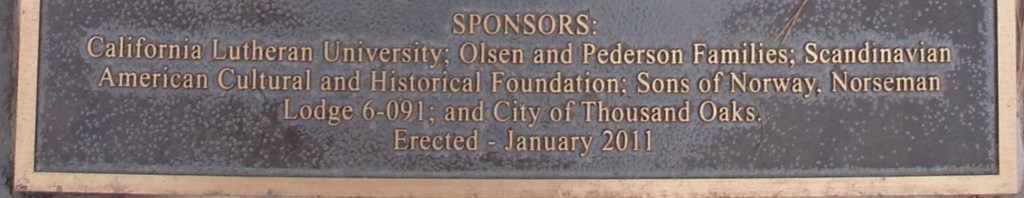
After an accident with the wagons, leaving George Hansen bedridden for a year, the families combined the upper right of way, donated by Nils Olsen, with a 40-foot right of way bought for $50 from Adolf and Roumaine Wyseur.

“Historic Norwegian Grade was built by hand between 1900 and 1911, using picks, shovels, crow bars, farm equipment and $60 worth of dynamite given by the County of Ventura.
“The grade was constructed by members of the Norwegian Colony and their hired help to provide a safe way to move bales of hay and sacks of wheat and barley to the farmers on the Oxnard Plain and to the Hueneme Wharf.
“The route for the grade was selected because it provided a gradual descent with no hairpin turns and would be safer than existing routes to the Oxnard Plain and Moorpark.**
“In the early 1900’s, there were no bulldozers, earth moving equipment, etc. Work was done by hand using a star drill and a sledge hammer to pound holes into the very hard volcanic rock; dynamite was inserted into the holes, fuses lit, everyone ran for cover, and it blew. The resulting rocks and debris were moved by hand and a horse-drawn fresno (scraper), to build the narrow one lane roadway.
“Construction was done in the winter and early spring months because baling and harvesting took precedence during the summer and fall. The road was later widened to two lanes.”
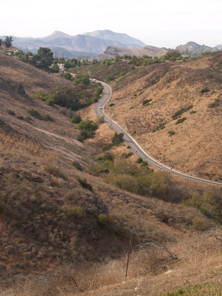
The new route cut a full day off the trip. Today the farms are long gone from the Conejo; the Santa Rosa Valley has farms and scattered housing developments. In 2010, the City of Thousand Oaks renovated the deteriorating road, and unveiled the memorial plaque at its reopening.
*I am still trying to pin down the location of the wagon trail north to the Santa Rosa Valley. Accounts I have read say it was partially obliterated by grading in the 1950’s.

Open Saturday & Sunday (except holidays) 1-4 pm.

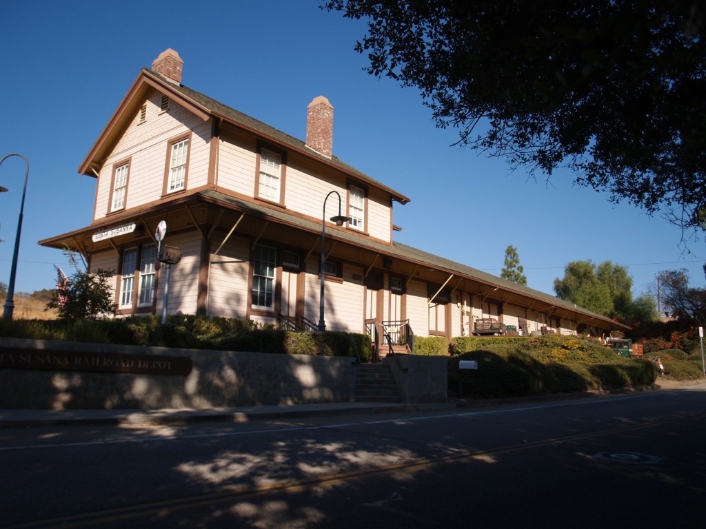
Built in 1903, Southern Pacific Santa Susana Depot sat on Los Angeles Ave. East of Tapo Street; it served the Rancho Simi area until the early 1970s when the SP closed it. Falling prey to age and vandalism, the deteriorating building was sold by the railroad for $1.06, and moved 2 miles east to its present site in May 1975 (6503 Katherine Road). After extensive restoration, the depot was reopened in 2000, as a museum and home of the local model railroaders club.
A passenger station, freight station, and telegraph office, it was based on Southern Pacific’s standard No. 22, combination depot plans; the depot has a recently restored stationmaster’s apartment on the second story.


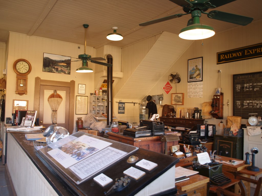
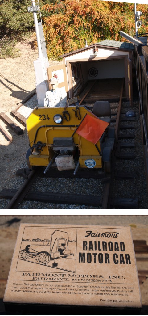
Exhibits between today’s Union Pacific tracks and the depot:

HO Model Railroad in depot:
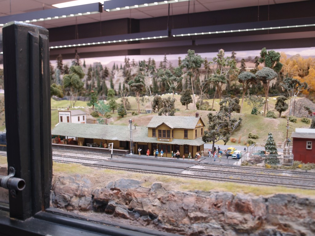

Freight Deck:
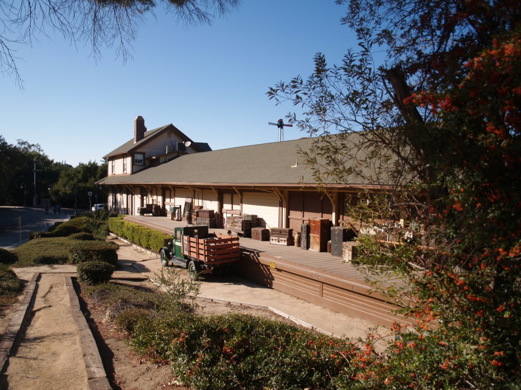
Also on the grounds:


On the second floor of this building, above the Santa Paula Hardware Company and the US Post Office, Union Oil Co. was founded October 17, 1890; when corporate headquarters were moved to Los Angeles in 1900, production offices remained in Santa Paula. In 1950, the building became Union Oil Museum. In 1988, Unocal announced a $2million restoration of the site, creating the California Oil Museum of today.
Much of the stone in the Queen Anne building came from the Santa Paul creek, and the purple Sespe sandstone trim came from a Fillmore quarry. The first floor has permanent interactive exhibits centered on the oil industry in California and rooms for changing exhibits; upstairs the building has been restored to its 19th century corporate Board Room and office space. The rig room, a modern structure adjacent to the original building, has a working, restored 1890s oil rig!
See https://www.caoilmuseum.org/about for more photos and information about current exhibits. I have a personal preference for museums that are interesting for both kids and adults!
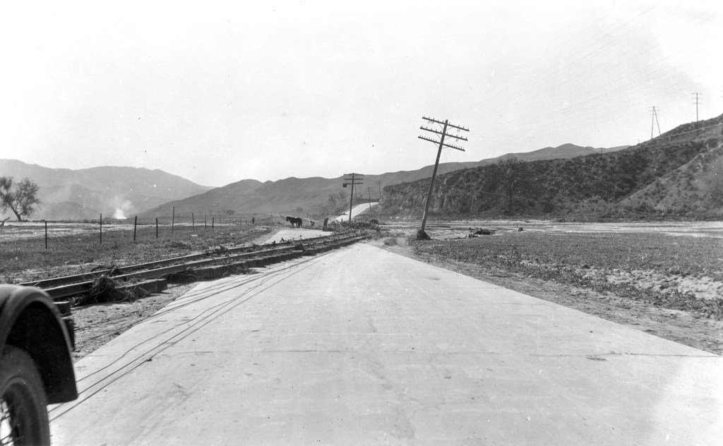
Just a quick note on the power of water: I found this dramatic March 18, 1928 USGS photo of the railroad tracks between Castaic Junction and Piru (Calif.), having been moved onto the highway by the flood caused by the Saint Francis Dam failure.
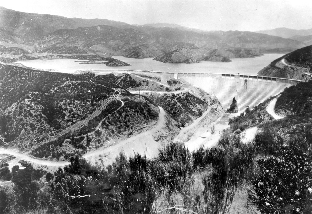
Below is a photo of the dam before it failed on March 12, 1928. From the USGS archives, courtesy of Los Angeles Bureau of Power & Light. Harold Thornton Stearns, photographer
Yesterday is already history, but for some of us, it will be the day the BIG BOY came to Indio.
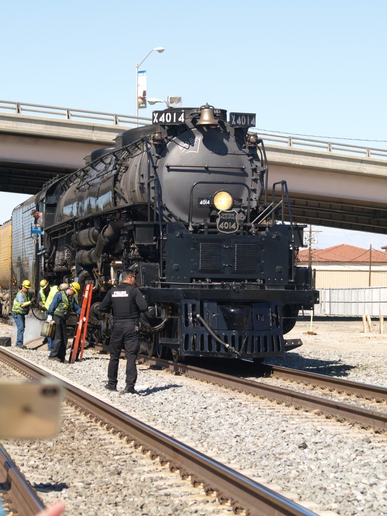
Needless to say, the crowds ranged from toddlers to the elderly, all here to see one of the largest steam locomotives ever built.
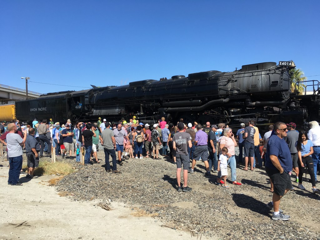
Originally delivered to the Union Pacific in December 1941, Engine No. 4014 has been fully restored and touring the country as part of the celebration of the 150th anniversary of the Meeting of the Rails at Promontory Point in 1869. More information on the Big Boy can be found at https://www.up.com/heritage/steam/4014/
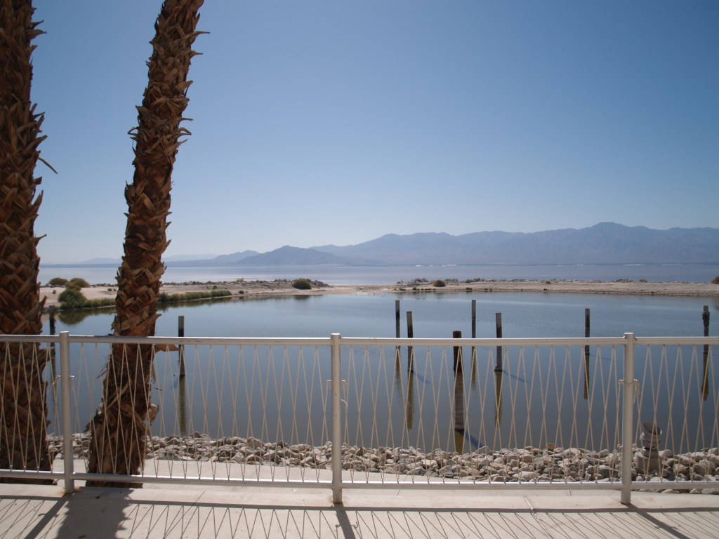
Designed by Swiss-born Modernist architect Albert Frey,* the Yacht Club is an architectural gem sitting in a pretty desolate location, the northeastern shore of the Salton Sea, across Highway 111 and the Southern Pacific tracks from the unincorporated community of North Shore. Built in 1959, the marina was used to dock boats, in an era when the Sea had more visitors per year than Yosemite.

With the jetty long gone and the Yacht Club abandoned and vandalized, in 2009, Riverside County restored the building. For about a year the Salton Sea Museum operated from the building, with over 7000 visitors signing in. Sadly the museum closed, and the facility is now primarily used as a community center by Desert Recreational District. BUT at least it is being used and maintained!
Now the “new” problem is the dropping Sea water level, leaving the inlet to the marina cut off from the Sea. Last month the Coachella Valley Mountains Conservancy** voted to approve a grant, which along with funds from the Bureau of Reclamation and the California Natural Resources Agency, would enable the Salton Sea Authority to rehabilitate the inlet and marina. If you go to Google Maps satellite image of the area, you can see a tiny, compromised inlet from the Sea to the marina. However, last Sunday I went down to take photos and stood “in the inlet,” on dry beach to take the photo below.

Last Spring Desert X https://www.desertx.org/ brought more visitors to the area to see the outdoor art installations around the Coachella Valley, including the Salton Sea. It reminds me a little of Marfa Texas, in that a gem of art, is sitting in an out of the way location.

Next week the Salton Sea Summit will convene at UCR Palm Desert campus; let us hope this will bring needed attention and solutions.
*Albert Frey’s architecture is Desert Modernism, centered on Palm Springs; his work includes the Palm Springs Tramway Valley Station and the Tramway Gas Station, now used an a Visitor’s Center on the entry into the City, as well as City Hall, etc.
** I am the State Senate appointee and current Chairwoman http://cvmc.ca.gov/
I only have a dim memory of this building from my childhood; as I recall, it was ramshackle by that time.
However, in its day, the Trading Post had been important. In April 1927, an article in the Los Angeles Times described an auto tour of the Coachella Valley to see the wild flowers and included a reference to a “fine new swimming pool” at the Coachella Valley Trading Post.
In his reminiscences to Katherine Ainsworth (The Man Who Captured Sunshine, 1978), artist John Hilton told her of picking up some good hints from Charles Safford, a graduate of the Chicago Institute of Art. “Stafford [sic]* lived and worked at the old Coachella Trading Post. He and I decorated the walls with our scenes. We were mighty proud of those pictures, but during World War II, the place became a U.S.O. center and the soldiers used our painting as dart boards.” (Ainsworth , page 99).
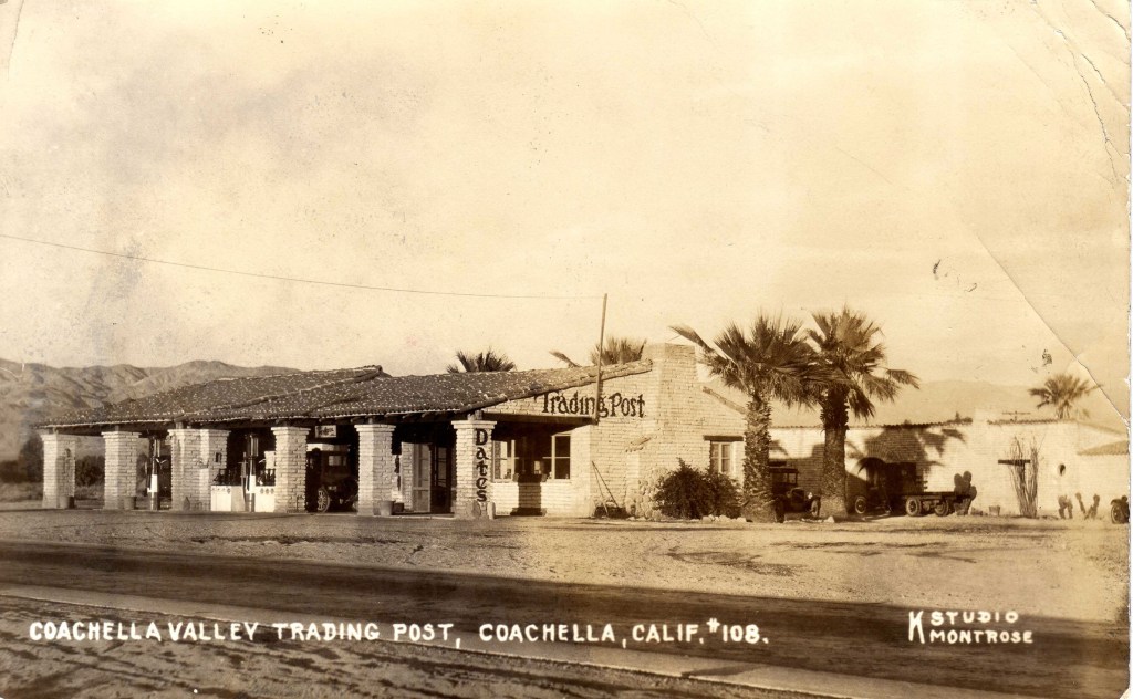
I remember seeing a photograph of soldiers posed on the front porch of the Trading Post. During World War II, there were US newspaper articles, across the country, that Mrs. Edward. G. Robinson had organized bus trips for girls from Beverly Hills to travel to the Trading Post to dance with the service men; it cost them $5 and they had to take an oath not to drink alcohol or to leave the premises of the Trading Post during the visit. These trips were even made in August when approximately 2500 Army men would come to dance with the 200 girls, who slept on army cots after the dance; on Sunday they went swimming in the pool before returning to L.A. At least one soldier is reported to have jumped in the pool fully clothed!
I hope to find more history of the building; if you have anything to add, please let me know; thanks.

I have found a real picture photograph (courtesy of the Eastman Collection, Univ. of Calif. Davis, circa 1940s) that shows the adobe building identified as the stage depot erected in 1856. At the time this was taken, the building as adjacent to US Route 80 (now designated as Historic U.S. Route 80 by California). See blog below for current photos.
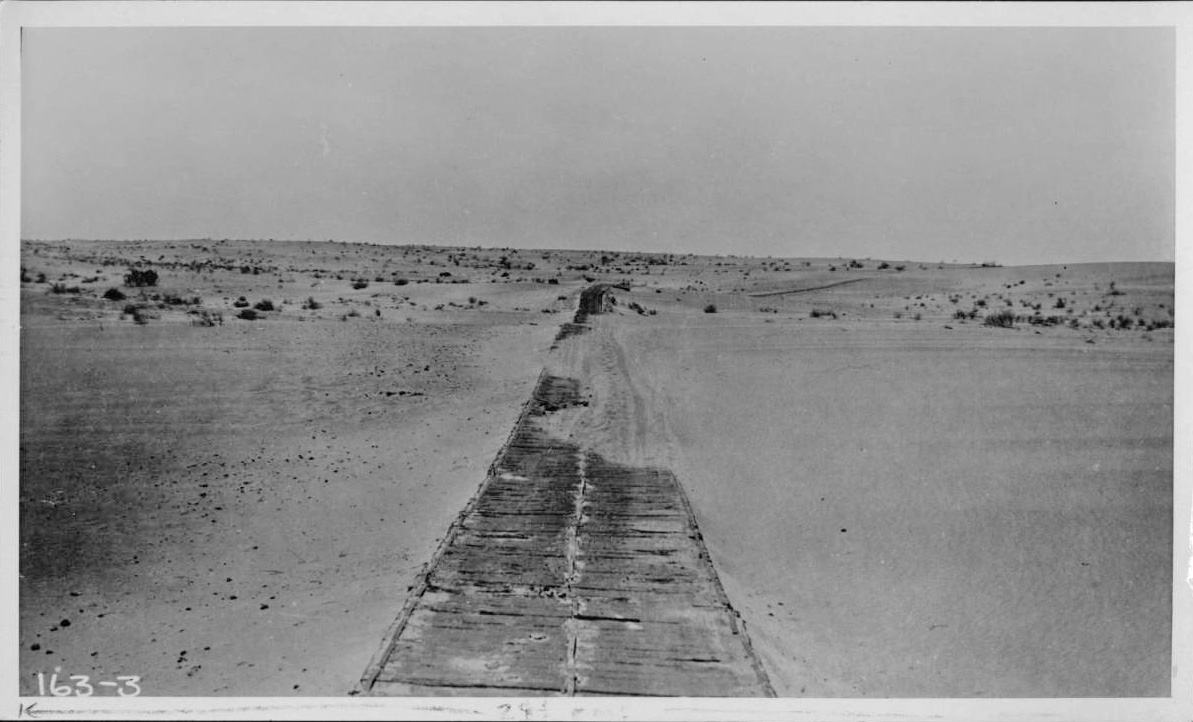
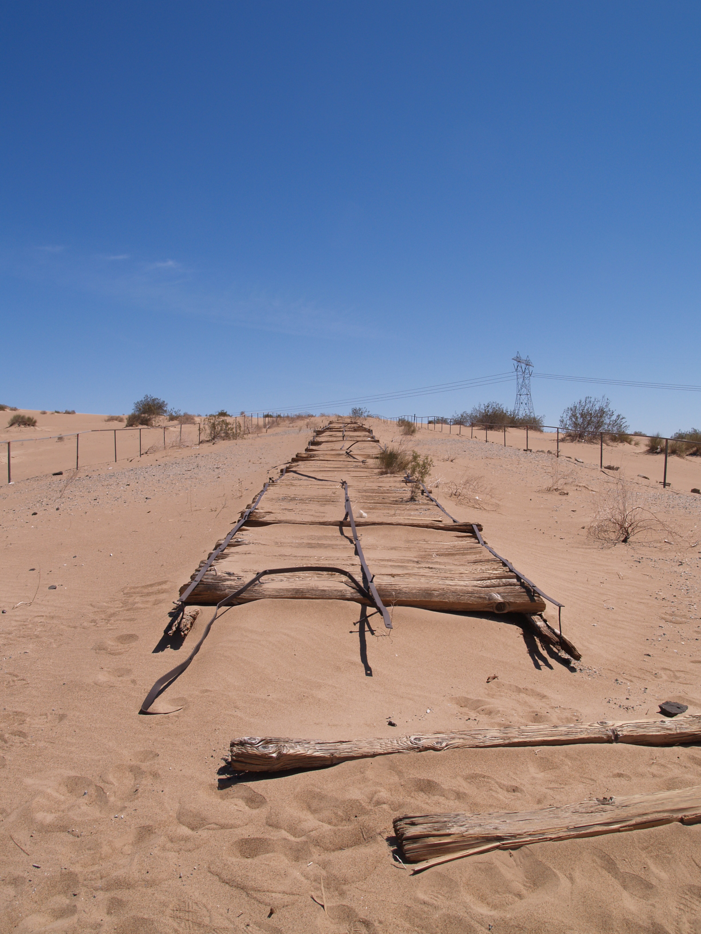
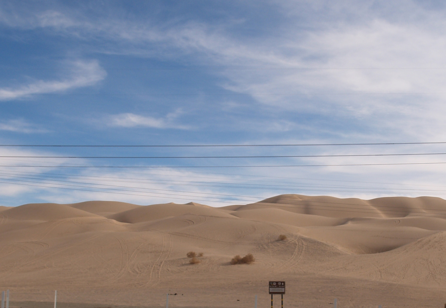
Not as obscure as some of the other sites, the plank road through the Algodones Sand Dunes of southeastern California, along with the first bridge across the lower Colorado River, allowed the completion of the Coast to Coast Highway (later US 80).
Prior to the late Nineteenth Century the common way to travel from Yuma to the California coast was via northern Mexico. Between the sand dunes and the lack of water, passage north of the border was virtually impossible. From Yuma, the Southern Pacific tracks (Indio to Yuma opened in 1877) turned north shortly after entering California, and ran on the east side of the dunes, rather than crossing what became the Imperial Valley. Irrigation and the resulting agricultural boom in the valley led to people wanting to traverse it, but by train the route required a loop south from Imperial Junction (later Niland) across the valley into Mexico at Calexico, east below the border approximately 50 miles, then north to Araz Junction to rejoin the SP mainline.
In 1915, completion of the Coast to Coast Bridge crossing the Colorado at Yuma and the one lane Plank Road across the dunes enabled vehicular travel on the US side of the border. Originally just two 25″ parallel “tracks” of wood, about a year later, the planks were fastened together in a full 8′ lane as shown in the photos. When the shifting sand drifted over the wood, sections were moved by horse drawn rigs. Turn outs, approximately a quarter of a mile apart, allowed traffic to pull to the side and allow the driver traveling the other direction to pass, sometimes resulting in arguments over right of way.

By 1926, highway construction engineering had advanced to the point that an asphalted concrete road could be built replacing the Plank Road. To see a short stretch of a replica of the original road and the Historical Marker, take exit 156 off Interstate 8, turn west on Grays Wells Road; the site will be on the left side of the road, off a parking lot.