Coachella / Woodspur ?

The Southern Pacific Railroad completed tracks from Los Angeles to Indio, California, in 1876; the following year the rails were extended to Yuma, and by 1883, the “Sunset Route” from Los Angeles to New Orleans was completed, opening a new route for California produce to reach markets.

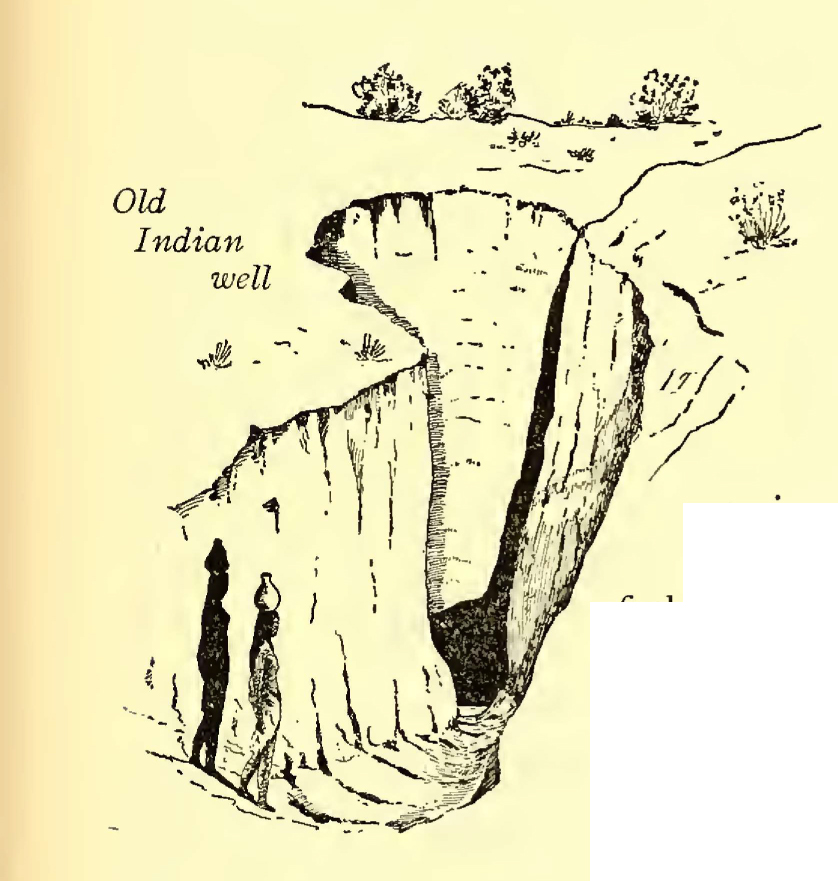
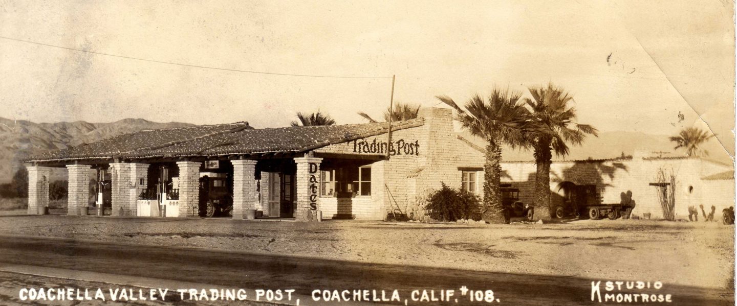
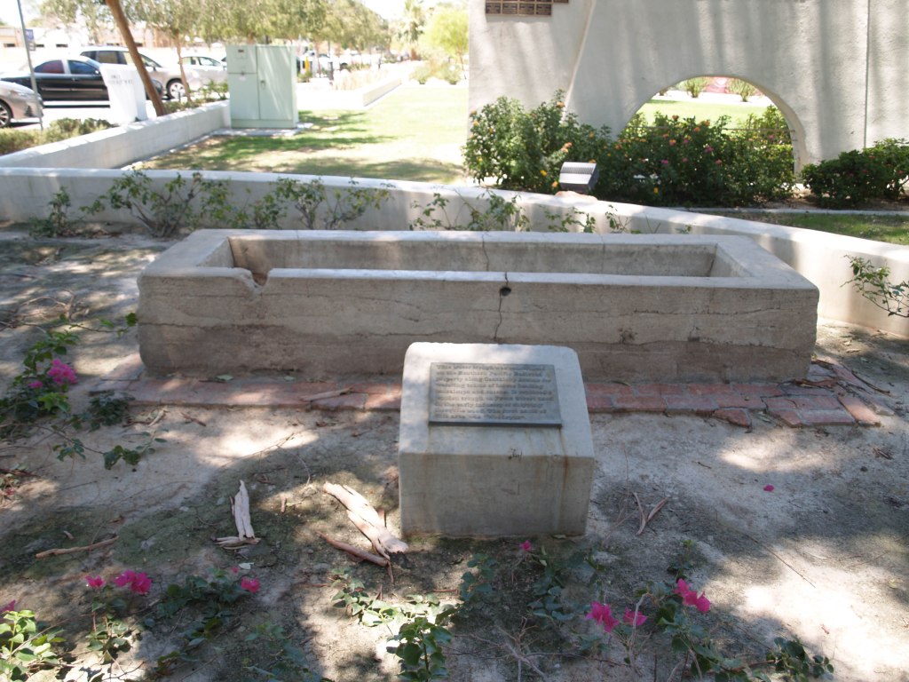
As part of the railroad line, a few miles south of Indio, a 3 car side spur was built at the site of present day City of Coachella. From there mesquite & ironwood were loaded onto boxcars for stove wood. Around 1900, Jason L. Rector pitched his tent and began harvesting wood for his employers, the Southern Pacific Railroad Co. And the A. N. Towne Estate. In 1901, he quite his job, tapped a well at an artesian spring, built an adobe house, and in 1902 organized the Coachella Valley Produce Association.*

1903 photo by CC Pierce, of artesian well located at Coachella from Strand Magazine, London, January 1905, page 22.

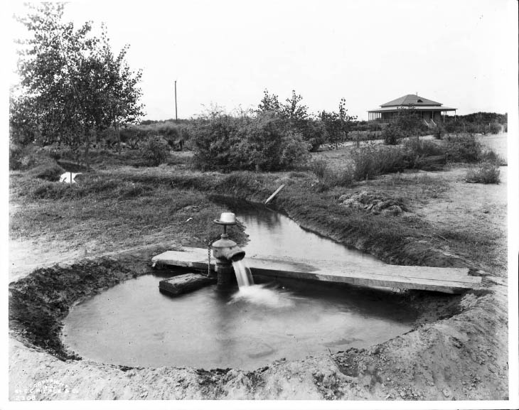
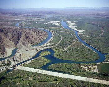
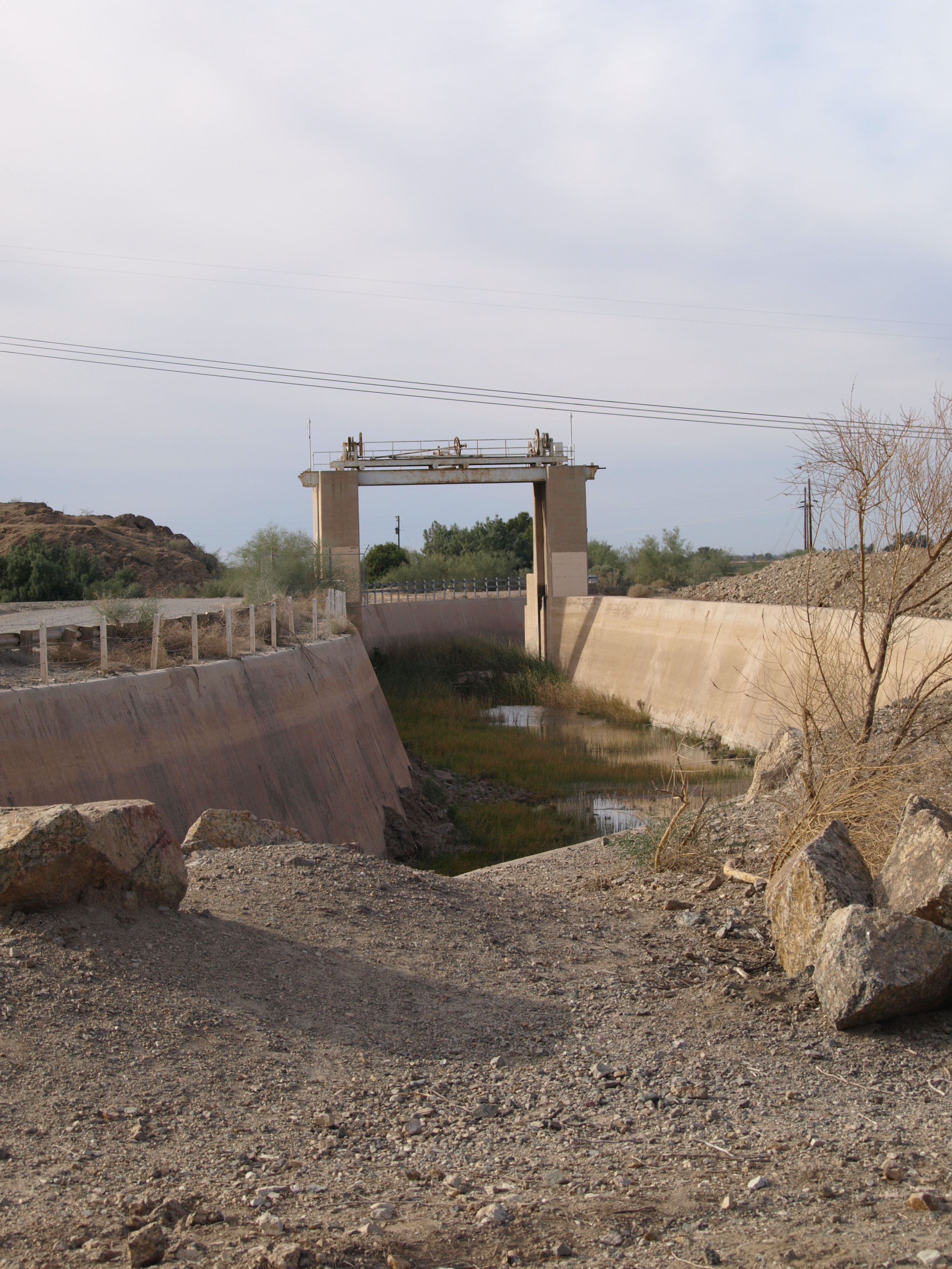
With irrigation now possible, cantaloupe became “king.” Indeed, Rector’s well was located on Cantaloupe Avenue (now Grapefruit Blvd./Highway 111).

Early water trough
“This water trough was constructed on the Southern Pacific Railroad property along Cantaloupe Avenue for watering teams of horses hauling cantaloupes and onions. It replaced a wooden trough on Front Street used in the early industry of shipping of mesquite wood. The first name of this areas was ‘Woodspur.’” Historical Marker located near corner of Orchard and Sixth Street, on the grounds of the City Hall.

How did Woodspur become Coachella?

There is debate about how the name came about, but there is no debate that the people in the area did not like the name Woodspur. The main two theories are that Coachella was a compromise (or cross) between Cahuilla (or Coahuilla, name of the local tribe) and Conchilla (Spanish, after the small shells found all over the area from when it had been underwater), or that it was a printer’s typographical error. The oldest “first person” account I have found is a letter from Elmer Proctor.**

What is in a Name? Fast forward to the late Twentieth Century, when annual the world famous Coachella Music Festival began. *** Today the two names, Woodstock and Coachella, are often linked, but could it have been Woodstock and Woodspur?


* From the biography of Jason L. Rector in History of Riverside County California with Biographical Sketches by Elmer, Wallace Holmes, Historic Record Company, Los Angeles, 1912.
Since Mr. Rector was still alive and active in 1912, I assume this information is correct.

**Desert Magazine, Palm Desert, November 1945, page 33; excerpts from letter to the editor from Elmo Proctor:

“A United Stites department of the interior engineer (I think his name was Mendenhall), by government authority, had made a survey of the Salton Sea quadrangle and it was suggested that then was an auspicious time to give the valley a more appropriate name. Suggestions were asked for. The name “Conchilla,” submitted by Mr. Tingman, was chosen by a vote of the few prospectors, homesteaders and railroaders present in the small gathering.

I was present when the maps arrived in Indio giving the valley its new name. Must have been about 1898. Before that it had been called “Salton Sea Sink.” I was a clerk in A. G. Tingman’s store, one of the two (the other belonged to a Mr. Talent, also in Indio) that served railroad and desert people for over a hundred miles in all directions.

I well remember how badly put out Mr. Tingman was when the maps arrived and it was found that the engineer’s longhand was so unreadable that the name had been interpreted “Coachella.”

When I was in elementary school in Coachella, the little shell version (Conchilla) was what I was told.

*** The festival is actually held in a still rural area annexed by the City of Indio.

CAHUILLA WALK-IN WATER WELL

walk-in well


If you are familiar with the history of the Cahuilla People, or the Coachella Valley, you probably are familiar with the water well shown above. Sources of water in the desert Valley were scarce, especially in its eastern end. A freshwater lake, Ancient Lake Cahuilla, was intermittently formed by flooding from the Colorado River, but when the river resumed its course south to the Sea of Cortez, the lake would slowly evaporate. In order to survive, the Desert Cahuilla were one of the few (if not the only) Native Americans to dig water wells.

This photo is generally credited to Charles C. Pierce, a photographer from Los Angeles. He probably took the photo on a trip to the Valley in October, 1903, which was the subject of Edmund Mitchell’s article, “On Desert Roaming” in The Strand Magazine (January 1905).* In the article, Mitchell does not name Pierce, but says one of the party of four was “a professional landscape photographer from Los Angeles” and all of the photos were credited to Pierce. Mitchell describes the party’s visit to the Martinez and Torres Reservations (Torres-Martinez Reservation) where they found “wells dug as inclined planes.” Pierce’s notes say the well was at Toro, and he was told it was dug about 75 years earlier (circa 1827).

George Wharton James’ The Wonders of the Colorado Desert (2 volumes, 1906) included a drawing (below) by Carl Eytel that is obviously from the same time period as the photograph.

Eytel well
Due to artesian wells being drilled in the eastern Coachella Valley, James describes the well as having a neglected appearance: “Brush and weeds grow freely around it and the water that accumulates has a yellow appearance and is somewhat brackish to the taste, so that even wild animals despise and forsake it.”

When J. Smeaton Chase wrote California Desert Trails (1919), about his travels in the desert, he describes the wells as having become “shapeless pits filled with mesquit and other brush.”

*Per the notes on the Huntington Library’s collection of Pierce photographs in Online Archive of California, “The most outstanding aspect of his business, however, was the vast picture library he amassed over three decades at work. Aside from making his own photographs, Pierce acquired the negatives and prints of other regional photographers such as Emil Ellis, Parker and Knight, Ramsey, Herve Friend, L.M. Clendenon, George P. Thresher, George Wharton James, and F.M. Huddleston. Pierce eradicated the existing signatures from the photographs, stamped his own name on the images, and organized the lot into subject files. The consequence of Pierce’s business practices assured that most, if not all, of the connections between the images and their original creator are now lost. However, the archive which he advertised as the ‘C.C. Pierce Collection of Rare, Historical and Curious Photographs, Illustrating California, the Pacific Coast and the Southwest,’ became an invaluable resource for researchers and boosters alike, all of whom came to Pierce’s shop to locate an image for their purposes.” https://oac.cdlib.org/findaid/ark:/13030/kt7199q9m3/

Laguna Dam & Swastika Bridge

OLYMPUS DIGITAL CAMERA

Sluiceway of Laguna Dam, 2017                                                                                photo by author

Construction of Laguna Dam, the first dam across the Colorado River, began in July 1905; plagued by contractor and supply problems, plus flooding, it was completed in March 1909. During its planning, core samples had shown the dam site was layer upon layer of silt carried down by the river over the ages, so a conventional dam design could not be used. US Reclamation Service engineers ultimately based the design on a weir dam on the Jumna (Yuamna) River in northern India that was successfully built on silt (USBR, 1902-1923, was the predecessor to the US Bureau of Reclamation).

BOR Pictures 180
Laguna Dam from California side, circa 1910                              US Bureau of Reclamation photo,                                                                                                                                     National Archives

Located north of Yuma, its principal gate (bottom width 116′) was built on the western (California) side of the river to divert water into a canal that carried water down the western side of the River until it was opposite the town of Yuma, where it was directed into a twelve foot siphon that went under the River to carry irrigation to the Yuma Valley in Arizona. Water was also diverted to Fort Yuma Resesrvation and the Bard Valley in California.

view-into-siphon

“Ground hags” working in the siphon during construction                                                                                          US Bureau of Reclamation photo, National Archives

Connected by a weir dam across the river bed that raised the water level 10–13 feet, on the eastern side was a smaller gate (bottom width 42′) and canal to carry water to agriculture in Arizona along the Gila River. Both sluicegates were based on bedrock & paved with concrete.

usbr1

View of the Colorado River at Laguna today; California sluiceway is on the left.  The white stretch of concrete across the river bed is the wier dam; the Arizona gateway is not visible to the left of the photo.  The man-made “river” to the right is the All American Canal.                                                                                                    US Bureau of Reclamation photo, Yuma project.

LagunaDamArizonaSluiceGate

Sluiceway on the Arizona side, April 4, 1909.                                     US Bureau of Reclamation photo


OLYMPUS DIGITAL CAMERA

Sluiceway on the Arizona side, today.                                                                                photo by the author

According to the Arizona Sun (2/2/2013), while studying Indian dam construction, the US Reclamation Service also learned about an ancient Hindu Goddess, who had the power to control water and was sometimes represented by a four armed swastika, a symbol that had a history of peace in many cultures going back 9,500-10,000 years; it was not until the 1930s when the Nazis adopted the symbol that it came to stand for evil. Near the eastern gate they built a concrete bridge adorned with swastikas (whirling counter-clockwise) and also some were incised on the sluiceway.

IMG_0199


Swastika Bridge on the Arizona side                                                                           photos by the author


In 1948, Imperial Dam replaced Laguna as the means to divert water to the Yuma Valley (as well as to the new All American Canal). Since then Laguna has served as a sluice gate and regulator for Imperial Dam releases through the main river channel to Mexico.

Much of the infomration in this segment is based on US Bureau of Reclamation and National Park Service sites, and articles in Engineering News, (February 27, 1908 & June 10, 1909) by Edwind D. Vincent, USBR Resident Engineer, Yuma Project.