Poston, Arizona, during WWII

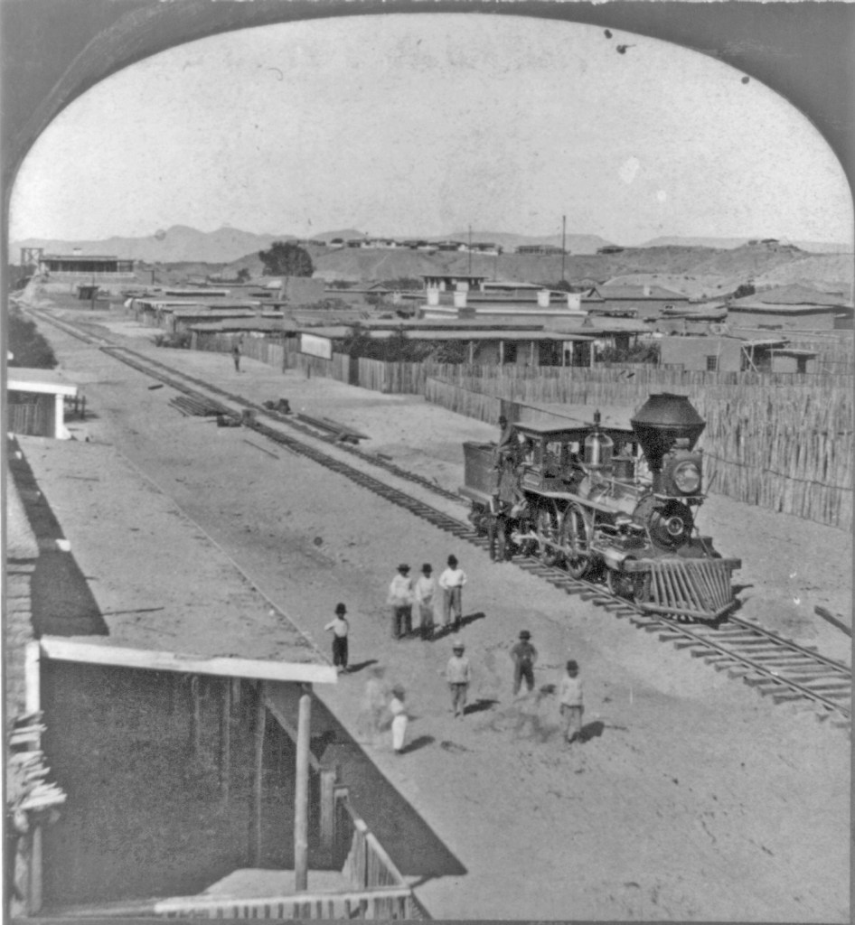
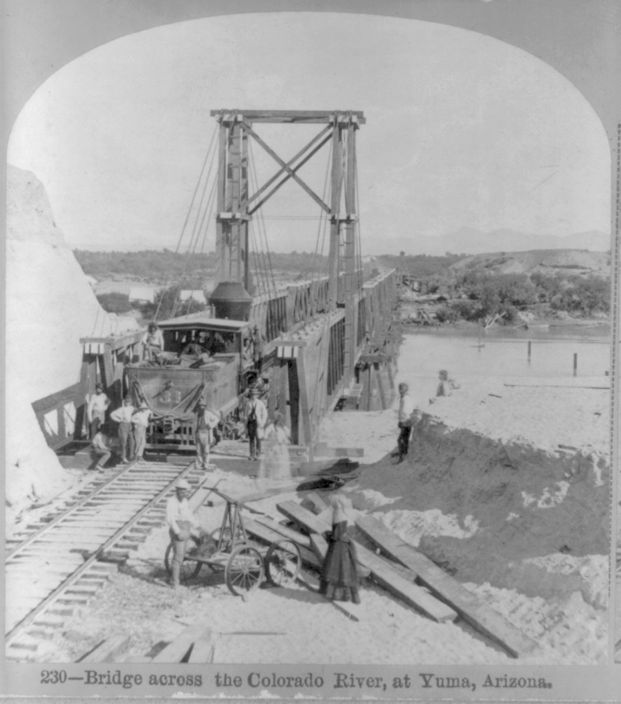
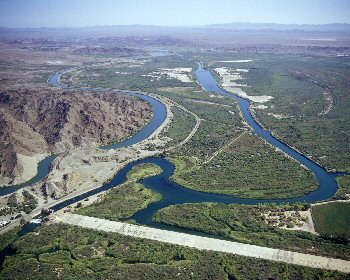
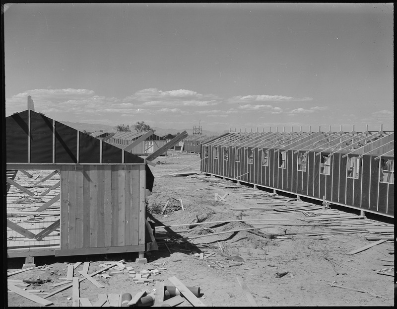
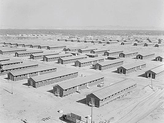
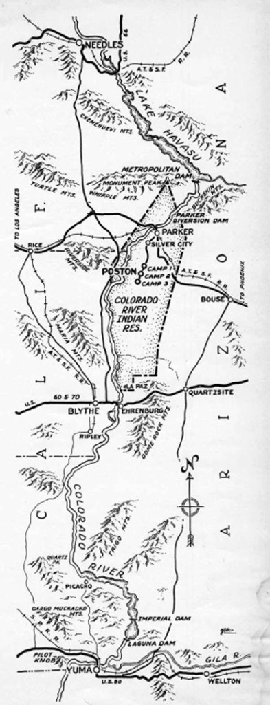
Today, Poston is a small agricultural community in the middle of the Colorado River Indian Reservation in western Arizona. On the south edge of town stands a tall monument to the people of Japanese ethnicity interned in the Poston Camps during WWII. Three camps were built on the reservation over the objections of the Tribal Council; at their peak, over 17,000 people were interned for no reason other than they or their ancestors had come from Japan.

OLYMPUS DIGITAL CAMERA

Plaque on the Memorial:

“This memorial is dedicated to all those men, women and children who suffered countless hardships and indignities at the hands of a nation misguided by wartime hysteria, racial prejudice and fear. May it serve as a constant reminder of our past so that Americans in the future will never again be denied their constitutional rights and may the remembrance of that experience serve to advance the evolution of the human spirit.

This memorial monument is erected in cooperation with the Colorado River Indian Tribes, former internees of Poston, Veterans and Friends of the Fiftieth year observance of the evacuation and internment.

October 6, 1992″

Desert at Poston in 2020
1942 contruction of the Camp (National Archives, Fred Clark photographer)
June 1, 1942, from the top of the water tower looking southwest (National Archives, Fred Clark)
Opening day at the Community Store, 1942 (National Archives, Fred Clark)
September, 1945 (National Archives , Hikaru Iwasaki photographer)

One of the most haunting photos; Left to right: George, son of Hisa and Yasubei Hirano with a photograph of their other son, Shigera, who had enlisted October 22, 1941. (National Archives, unknown photographer).

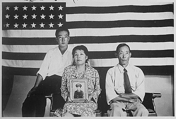
George Hirano was among the 611 internees who enlisted from the camps. Twenty-four internees from Poston Camp lost their lives fighting for the U.S. in WWII.

THAT DAMNED FENCE

(anonymous poem circulated at the Poston Camp)

They’ve sunk the posts deep into the ground
They’ve strung out wires all the way around.
With machine gun nests just over there,
And sentries and soldiers everywhere.

We’re trapped like rats in a wired cage,
To fret and fume with impotent rage;
Yonder whispers the lure of the night,
But that DAMNED FENCE assails our sight.

We seek the softness of the midnight air,
But that DAMNED FENCE in the floodlight glare
Awakens unrest in our nocturnal quest,
And mockingly laughs with vicious jest.

With nowhere to go and nothing to do,
We feel terrible, lonesome, and blue:
That DAMNED FENCE is driving us crazy,
Destroying our youth and making us lazy.

Imprisoned in here for a long, long time,
We know we’re punished–though we’ve committed no crime,
Our thoughts are gloomy and enthusiasm damp,
To be locked up in a concentration camp.

Loyalty we know, and patriotism we feel,
To sacrifice our utmost was our ideal,
To fight for our country, and die, perhaps;
But we’re here because we happen to be Japs.

We all love life, and our country best,
Our misfortune to be here in the west,
To keep us penned behind that DAMNED FENCE,
Is someone’s notion of NATIONAL DEFENCE!

From the National Archives

September 1942 Desert Magazine, p5; from an article that tries to downplay the hardships faced by the internees.

When I was growing up, one of my best friends was the daughter of a “Japanese-American” who had served in Europe, while his wife and their parents had been interned. They were as American as any of us.

The Southern Pacific comes to Yuma

Marvelous photos from 1877!

I found the first three photographs (circa 1877) in the Library of Congress collection, published by the Continent Stereoscopic Company in the series “Descriptive views of the American Continent.”

254 — Arrival of the first locomotive in Arizona*

According to LoC: “Written in pen on back of mount: Fort Yuma, Cal. on bluff in background.”

I believe the shot was taken looking north from Yuma, Arizona Territory; Fort Yuma on the California side of the Colorado River can be seen on the bluff, just as the note on back reads. If you look along the tracks, you can see a glimpse of the swing bridge built by the railroad across the river.

237 — “Old 31″ The Pioneer Engine of Arizona*

According to LoC: “Written in pen on back of mount: Yuma, Ariz., Fort Yuma, Cal. on bluff in background.”

Looking carefully, when enlarged, the tender is has the initials “S” and “P.”

The bridge was built to swing a section aside so large boats could ply the River. Starting in 1852, steamboats were used to transport goods and people on the lower Colorado.

The Southern Pacific completed tracks from Los Angeles to Indio, California in 1876, and on to Yuma, Arizona in 1877. That year, photographer Enoch Conklin traveled in Arizona, taking his own pictures as well as acquiring photos from others. “Picturesque Arizona: Being the Result of Travels and Observations in Arizona During the Fall and Winter of 1877” was published by the Mining Record Printing Establishment, in which his pictures were credited to the Continent Stereoscopic Company. An incomplete set of the images were deposited in the LoC by an unknown source in 1907.

Searchlight delivering a barge load of provisions to the work camp for closing the break in the Colorado bank that created the Salton Sea (circa 1905-1907). US Bureau of Reclamation photograph

With the arrival of the Southern Pacific Railroad in 1877, steamboat travel declined. The completion of Laguna Dam in 1909, was the end of viable steamboating on the lower Colorado (see my blog entry on the Swastika Bridge for more on Laguna Dam).

Sold to the US Reclamtion Service, the Seachlight was lost on the River in October 1916; as the last steamboat on the lower Colorado, its loss ended an era.

  • The copies of these two available digitally do not have the title captions, but the numbers and titles are given on the LoC information documents

HI JOLLY’S GRAVE

Quartzsite, Arizona

All of my life, a stop at Quartzsite has included a visit to Hi Jolly’s grave:

Growing up in the southwest I learned about the US Army’s experiment with importing camels before the Civil War, to determine if they would be more suited pack animals for our desert climate. Hadji Ali came as a camel driver in 1856. Records are sketchy, but it seems he was the son of a Greek and a Syrian, born somewhere in Syria (Smyrna?) around 1828. The soldiers called him Hi Jolly, inspiring the folk song of that name.

Eventually the Army abandoned the experiment, sold camels at auction, and released the remaining camels into the desert. Hi Jolly stayed in the Southwest as an army scout/packer, freight hauler and miner; he married, and became a US citizen in 1880 as Philip Tedro. On December 16, 1902, he passed away in Quartzsite, to be buried in a simple grave with a wooden marker.

His story does not end there. On December 15, 1935, the Arizona Republic reported that Jim Edwards (foreman for building that section of US Highway 60) and his crew worked on their own time, Sundays and holidays, building the monument with materials paid for by Mr. Edwards. A copper camel is atop a pyramid built of stones gathered from “Northern Yuma county.”

The Arizona Republic urged the state legislature to create a fund to mark historic sites. Today, the site is on the National Register of Historic Places.

Exit 17 from Interstate 10, north on Business 10, east (right) on Business 10 (Main Street); the entrance to the cemetery will be on your left (about 1800 feet).

Laguna Dam & Swastika Bridge

OLYMPUS DIGITAL CAMERA

Sluiceway of Laguna Dam, 2017                                                                                photo by author

Construction of Laguna Dam, the first dam across the Colorado River, began in July 1905; plagued by contractor and supply problems, plus flooding, it was completed in March 1909. During its planning, core samples had shown the dam site was layer upon layer of silt carried down by the river over the ages, so a conventional dam design could not be used. US Reclamation Service engineers ultimately based the design on a weir dam on the Jumna (Yuamna) River in northern India that was successfully built on silt (USBR, 1902-1923, was the predecessor to the US Bureau of Reclamation).

BOR Pictures 180
Laguna Dam from California side, circa 1910                              US Bureau of Reclamation photo,                                                                                                                                     National Archives

Located north of Yuma, its principal gate (bottom width 116′) was built on the western (California) side of the river to divert water into a canal that carried water down the western side of the River until it was opposite the town of Yuma, where it was directed into a twelve foot siphon that went under the River to carry irrigation to the Yuma Valley in Arizona. Water was also diverted to Fort Yuma Resesrvation and the Bard Valley in California.

view-into-siphon

“Ground hags” working in the siphon during construction                                                                                          US Bureau of Reclamation photo, National Archives

Connected by a weir dam across the river bed that raised the water level 10–13 feet, on the eastern side was a smaller gate (bottom width 42′) and canal to carry water to agriculture in Arizona along the Gila River. Both sluicegates were based on bedrock & paved with concrete.

usbr1

View of the Colorado River at Laguna today; California sluiceway is on the left.  The white stretch of concrete across the river bed is the wier dam; the Arizona gateway is not visible to the left of the photo.  The man-made “river” to the right is the All American Canal.                                                                                                    US Bureau of Reclamation photo, Yuma project.

LagunaDamArizonaSluiceGate

Sluiceway on the Arizona side, April 4, 1909.                                     US Bureau of Reclamation photo


OLYMPUS DIGITAL CAMERA

Sluiceway on the Arizona side, today.                                                                                photo by the author

According to the Arizona Sun (2/2/2013), while studying Indian dam construction, the US Reclamation Service also learned about an ancient Hindu Goddess, who had the power to control water and was sometimes represented by a four armed swastika, a symbol that had a history of peace in many cultures going back 9,500-10,000 years; it was not until the 1930s when the Nazis adopted the symbol that it came to stand for evil. Near the eastern gate they built a concrete bridge adorned with swastikas (whirling counter-clockwise) and also some were incised on the sluiceway.

IMG_0199


Swastika Bridge on the Arizona side                                                                           photos by the author


In 1948, Imperial Dam replaced Laguna as the means to divert water to the Yuma Valley (as well as to the new All American Canal). Since then Laguna has served as a sluice gate and regulator for Imperial Dam releases through the main river channel to Mexico.

Much of the infomration in this segment is based on US Bureau of Reclamation and National Park Service sites, and articles in Engineering News, (February 27, 1908 & June 10, 1909) by Edwind D. Vincent, USBR Resident Engineer, Yuma Project.