Holidays
One of my readers asked me what I knew about the history of the name “Salton,” as in the Salton Sink, Salton Sea, Salton Station on the Southern Pacific Railroad line. I reread my post on the New Liverpool Salt Works and discovered I had made a typographical error; the salt works were incorporated in November 1883, not 1893! I am grateful for the opportunity to correct my error.
If you are interested, the earliest reference I can find regarding the name Salton was an article in the May 11, 1884 edition of the Los Angeles Herald:
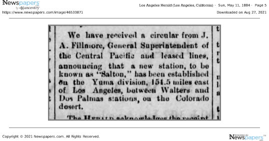
All the earlier maps show names for the area such as the “Colorado Desert” (1856); Coahuilla Valley, Cabazon Valley, Frink Dry Lake (late 1870s). By the time of the natural overflow of the Colorado in 1891, Salton was in use.
FYI: Walters became Mecca.
The Southern Pacific Railroad completed tracks from Los Angeles to Indio, California, in 1876; the following year the rails were extended to Yuma, and by 1883, the “Sunset Route” from Los Angeles to New Orleans was completed, opening a new route for California produce to reach markets.
As part of the railroad line, a few miles south of Indio, a 3 car side spur was built at the site of present day City of Coachella. From there mesquite & ironwood were loaded onto boxcars for stove wood. Around 1900, Jason L. Rector pitched his tent and began harvesting wood for his employers, the Southern Pacific Railroad Co. And the A. N. Towne Estate. In 1901, he quite his job, tapped a well at an artesian spring, built an adobe house, and in 1902 organized the Coachella Valley Produce Association.*
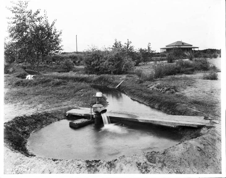
With irrigation now possible, cantaloupe became “king.” Indeed, Rector’s well was located on Cantaloupe Avenue (now Grapefruit Blvd./Highway 111).

There is debate about how the name came about, but there is no debate that the people in the area did not like the name Woodspur. The main two theories are that Coachella was a compromise (or cross) between Cahuilla (or Coahuilla, name of the local tribe) and Conchilla (Spanish, after the small shells found all over the area from when it had been underwater), or that it was a printer’s typographical error. The oldest “first person” account I have found is a letter from Elmer Proctor.**
What is in a Name? Fast forward to the late Twentieth Century, when annual the world famous Coachella Music Festival began. *** Today the two names, Woodstock and Coachella, are often linked, but could it have been Woodstock and Woodspur?
* From the biography of Jason L. Rector in History of Riverside County California with Biographical Sketches by Elmer, Wallace Holmes, Historic Record Company, Los Angeles, 1912.
Since Mr. Rector was still alive and active in 1912, I assume this information is correct.
**Desert Magazine, Palm Desert, November 1945, page 33; excerpts from letter to the editor from Elmo Proctor:
“A United Stites department of the interior engineer (I think his name was Mendenhall), by government authority, had made a survey of the Salton Sea quadrangle and it was suggested that then was an auspicious time to give the valley a more appropriate name. Suggestions were asked for. The name “Conchilla,” submitted by Mr. Tingman, was chosen by a vote of the few prospectors, homesteaders and railroaders present in the small gathering.
I was present when the maps arrived in Indio giving the valley its new name. Must have been about 1898. Before that it had been called “Salton Sea Sink.” I was a clerk in A. G. Tingman’s store, one of the two (the other belonged to a Mr. Talent, also in Indio) that served railroad and desert people for over a hundred miles in all directions.
I well remember how badly put out Mr. Tingman was when the maps arrived and it was found that the engineer’s longhand was so unreadable that the name had been interpreted “Coachella.”
When I was in elementary school in Coachella, the little shell version (Conchilla) was what I was told.
*** The festival is actually held in a still rural area annexed by the City of Indio.

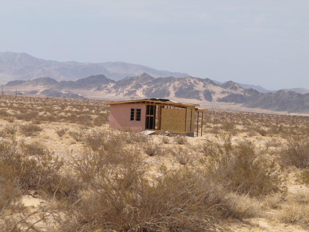
My parents had a heavy earthwork construction company; during my childhood, it was headquartered in Coachella, CA, in the American Southwest. Post World War II, there was a lot of water infrastructure being built, both new plans but also projects that had been delayed due to the War. I spend a lot of my young days looking out car windows as we went on road trips to check out potential job sites. I remember seeing lots of funny, tiny houses dotting the rural, mostly deserted countryside of the western US, so different from my home surrounded by agriculture.
When I asked my mother about some in the desert; I remember her telling me those were cabins built by city people who wanted to get away on weekends. As I grew older many of the tiny houses grew shabbier and then they started disappearing.

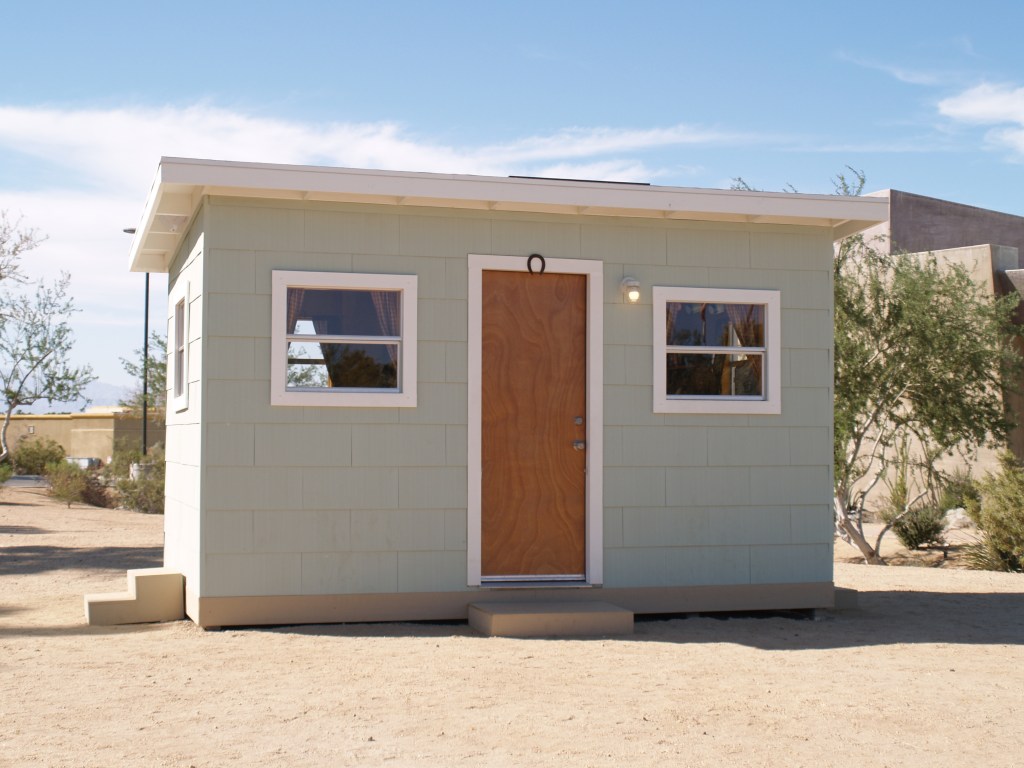
The Small Tract Homestead Act of 19381 opened the door to homesteading 5 acre parcels of public land; “settlers” had to stake their claim, and erect a minimum 192 foot cabin, costing at least $300 in building materials within 3 years, plus comply with the government paperwork. In 1955, the size of the required building became 400 square feet. By the 1970s, the boom of homesteading a “get away” cabin had waned, and in 1976, the act was repealed.
The ones near Interstate highways are pretty much gone, but on the back roads they still exist, ranging from abandoned, collapsing structures to ones that sport new windows and paint. There are also “builtmores” where the owners enlarged the homes, turning them into more substantial homes. Of course, this was more practical in areas where electricity and water became available.
When I was appointed to the Governing Board of Coachella Valley Mountains Conservancy, I became involved in the process of acquiring land for conservation in the Coachella Valley and surrounding foothills and mountains. A lot of the land we’ve helped preserve in perpetuity has been by purchase of 5 acre parcels (mostly vacant, always from willing sellers), piecing together larger areas to protect wildlife (animal and plant), so future generations can enjoy majestic scenery in our part of the Southwest.

Desert X, a mostly outdoor art exhibit spread across the valley, held in alternative years, was once again created, despite the pandemic. One of its great advantages was the ability of the public to go, for free, to sites without close contact to others. Off a parking lot in Palm Desert, CA, Kim Stringfellow2 erected s small (122 sq. ft.) cabin based on the jackrabbit cabins; furnishing it in the manner of those early cabins.


1 In the midst of the Great Depression, there were a lot of Veterans from World War I who were homeless; after the horrors of trench warfare, many wanted space around them. However, World War II was looming and building materials were being diverted from the civilian market to war production, slowing down homesteading under the Act.
2 My daughter gave a copy of Stringfellow’s Jackrabbit Homestead for Mother’s Day, 2021, bringing back so many memories. If you are interested in more information on this latter day pioneer effort, I highly recommend checking out kimstringfellow.com and jackrabbithomestead.com. Her main focus is on the cabins of Wonder Valley north of Joshua Tree National Park, and east of Twentynine Palms, CA.
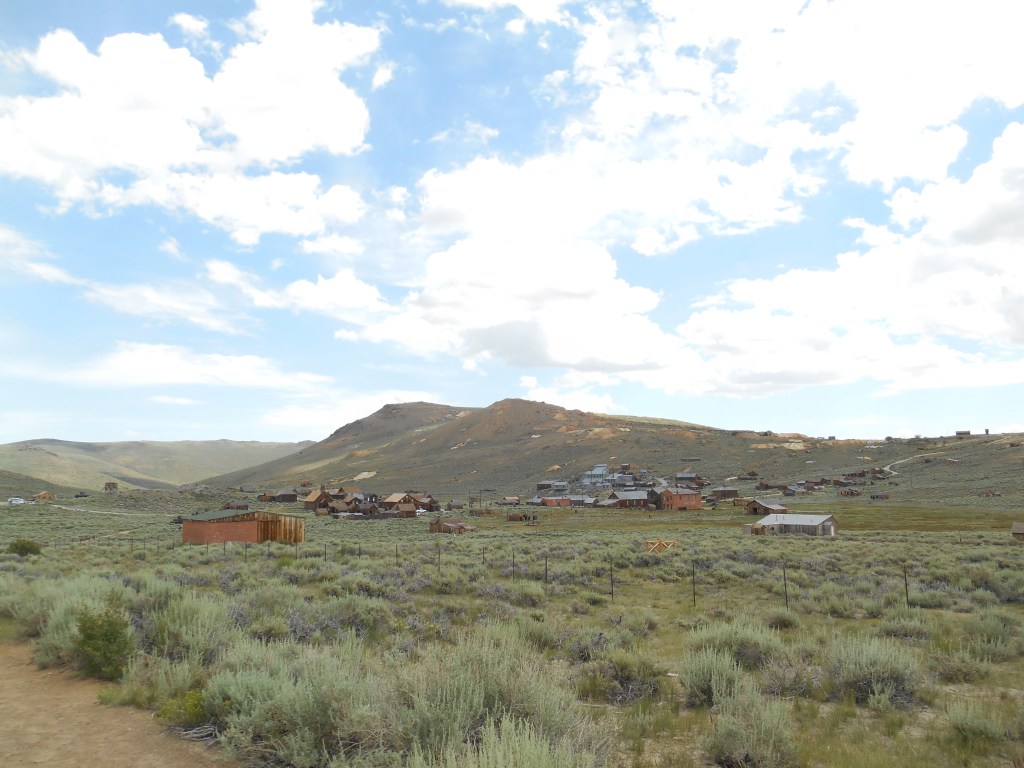
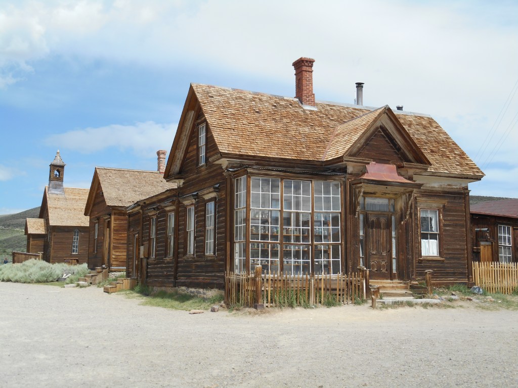
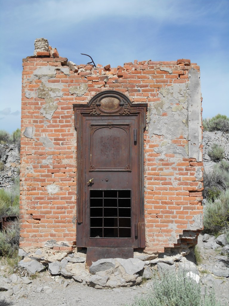
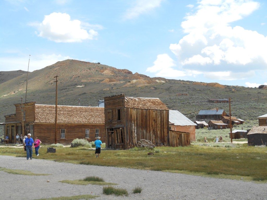
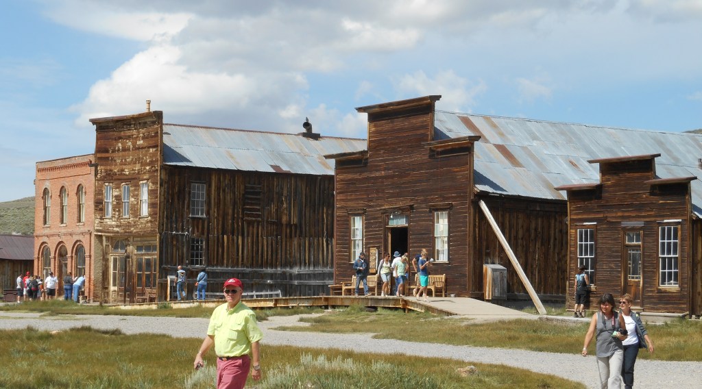
In the California Sierra Nevada Mountains, down a side road off US 395 (last three miles graded but not paved), lies the town of Bodie, shown here in the Twenty-first Century. A part of the California State Park System, it is preserved in a state of “arrested decay.”
Like many ghost stories, the story of the Bodie ghost town is based on a death.
There are several versions of what happened, but it is generally accepted that in the summer of 1859, W. S. Bodey** found gold and silver in what became the Bodie mining district. That Fall/Winter he died in a blizzard and the body was found the next Spring. Tales of the gold led to the Bodie mining camp.
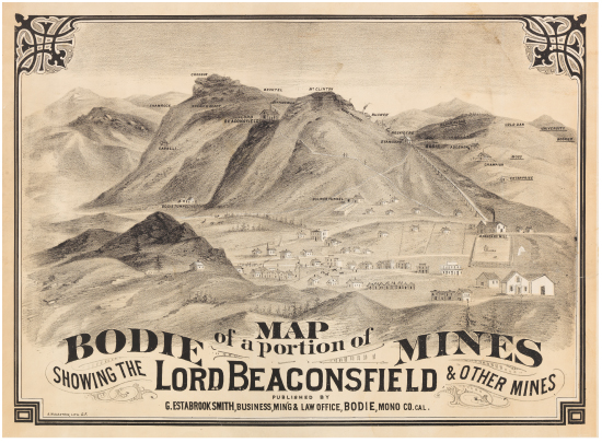
Map circa 1877, courtesy of the Calif. State Library
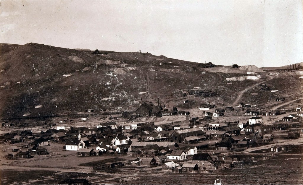
By 1890, Bodie had changed from a rough mining camp to a thriving town for families
(Public Domain, Wikimedia Commons)
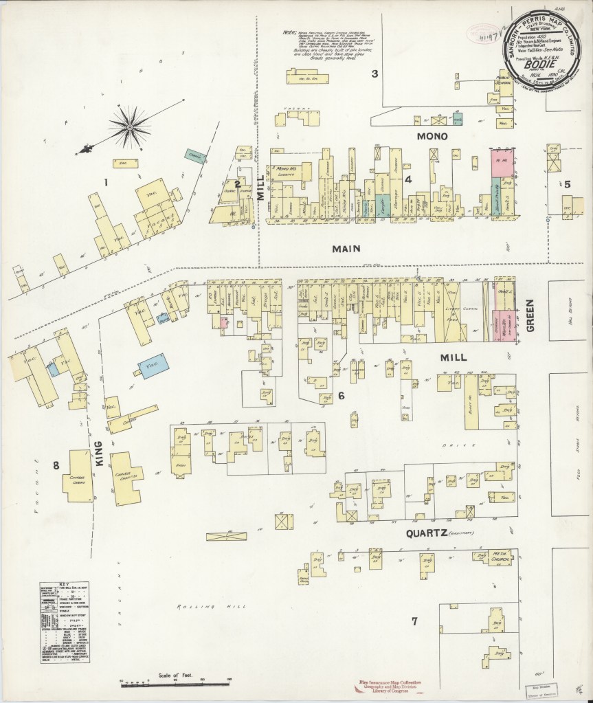
Sanborn Fire Insurance map of Brodie, 1890 (Public Domain; Library of Congress)
Sadly, Bodie suffered two major fires, the first in 1892 and the second in 1932. Most of the residents of Bodie gave up and left town; by 1910 the population had already dwindled to approximately 698, and by 1920 to 120.
During World War II, the War Production Board ordered conversion of industries to war production which led to the last mine closing in 1942, followed by the closing of the US Post Office.
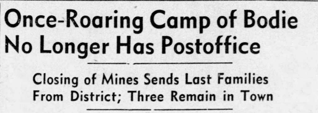
Reno Gazette Journal, November 26, 1942.
By 1962, Bodie was a ghost town, and the largest land owners, the Cains sold their holdings to the State of California.
A visit to Bodie is a step back in time, whether you want to believe the legends or the research. But keep in mind, Bodie is one of the coldest places in the lower 48 states of the US, based on Western Regional Climate Center records. As of 2012, the record high for July was 91F (33C), but the record low for July was 12F (-11C). The record low was -36F (-38C) in February.
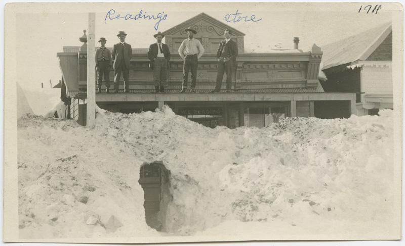
Readings store postcard dated 1911. Courtesy of California State Library (Public Domain, published before 1922)
So shall we wander down a few of the streets in town to see some of the roughly 200 structures still standing in Bodie today?
James Stuart Cain and his wife, Martha Delilah Well, lived here. A lumber merchant and banker, he bought many of the properties in Bodie.

The only church left standing in town, the Methodist Church was built in 1882.
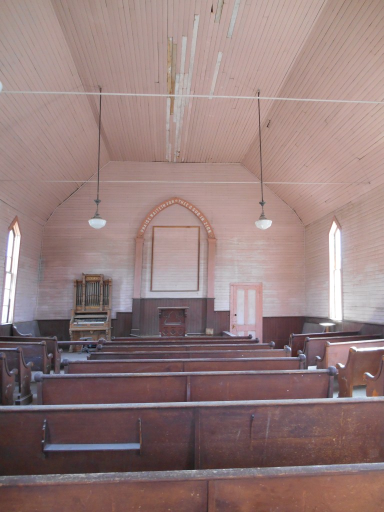
Interior of the church today.
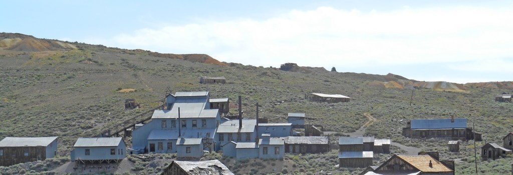
The Standard Consolidated Mining Company operated this stamp mill where ore was crushed to remove gold and silver deposits. The first mill on the site burned in October 1898 and was rebuilt, starting in 1899, adding corrugated steel siding and roof to the wood frame. Future U.S. President Herbert Hoover’s brother, Theodore was Superintendent of the Mill, circa 1905.
The vault of the Bodie Bank; the contents of the vault survived, but the building was destroyed by 1932 fire.

Boone Store and Warehouse, with Shell gas station to the right.

The wooden firehouse in a town known for fires. It was rebuilt by the California Conservation Corps in the 1930s.
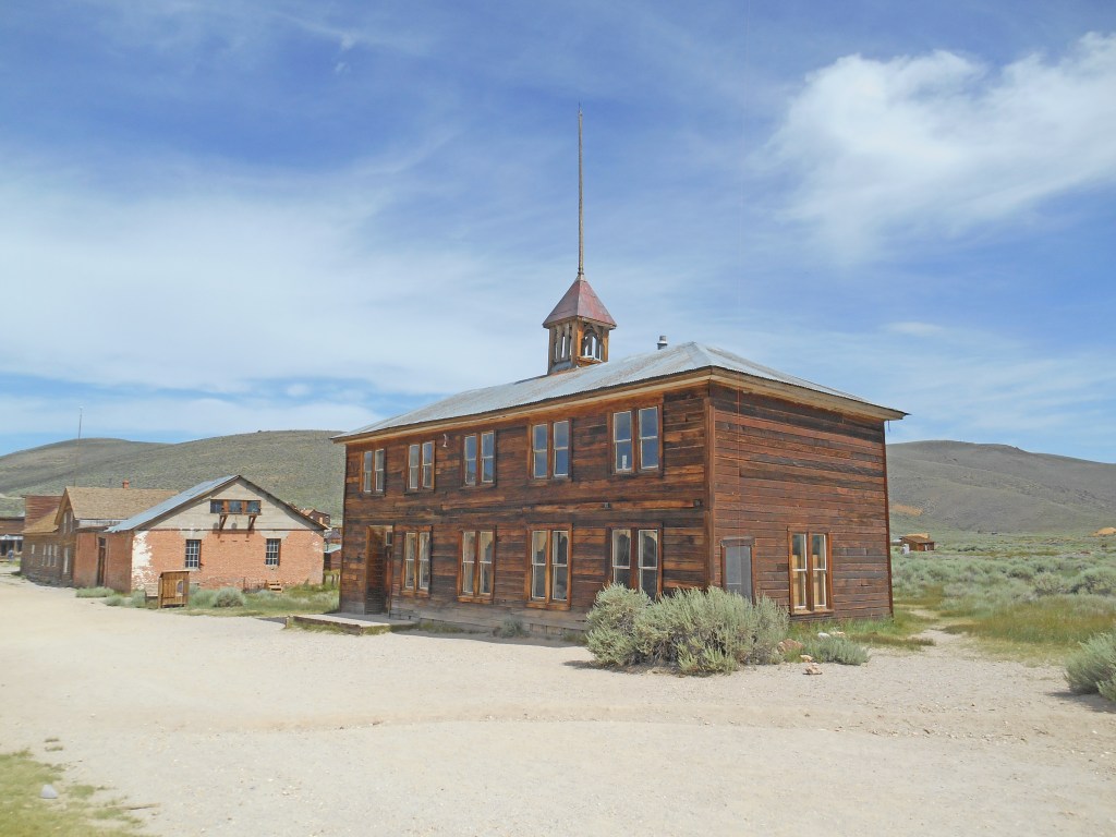
The schoolhouse, built in 1879 as the Bon Ton Lodging House; when the last families with children moved away in November 1942, it closed.
The Swasey (or Swazey) Hotel (center) was probably a brothel. The Wheaton & Luhrs (or Wheaton & Hollis) Hotel is to the left across Green Street; it had various incarnations as land office, store and hotel. The confusion of names comes from overlapping painted signs where the paint is fading.
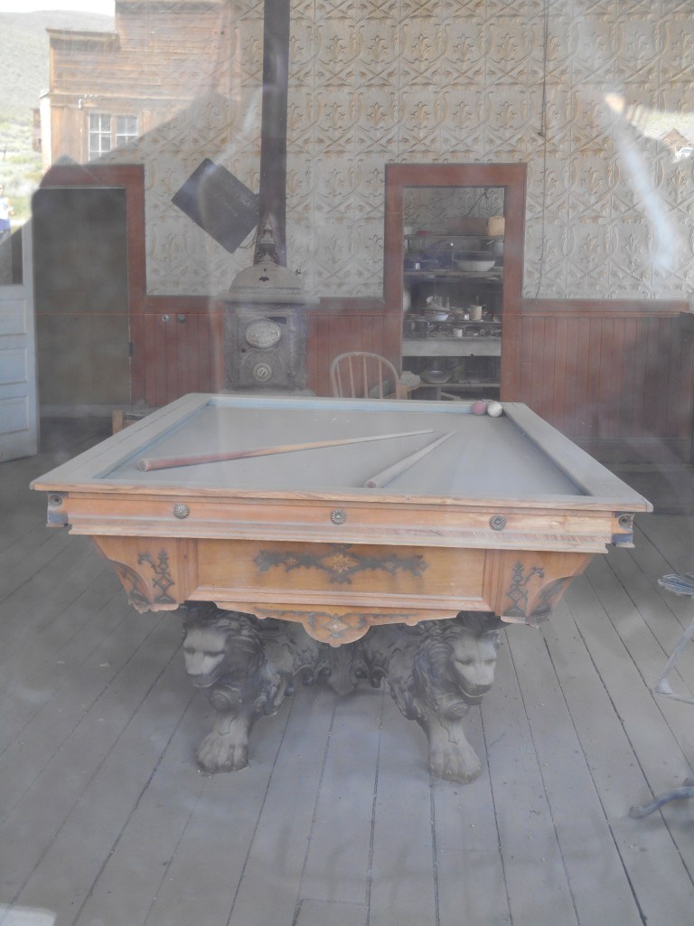
Through the window at the Wheaton and Luhrs.
Left to Right beginning with brick building: DeChambeau Hotel (built as the Post Office in 1879); Independent Order of Odd Fellows building; Miners’ Union Hall (built 1878), Morgue (smaller building on right)
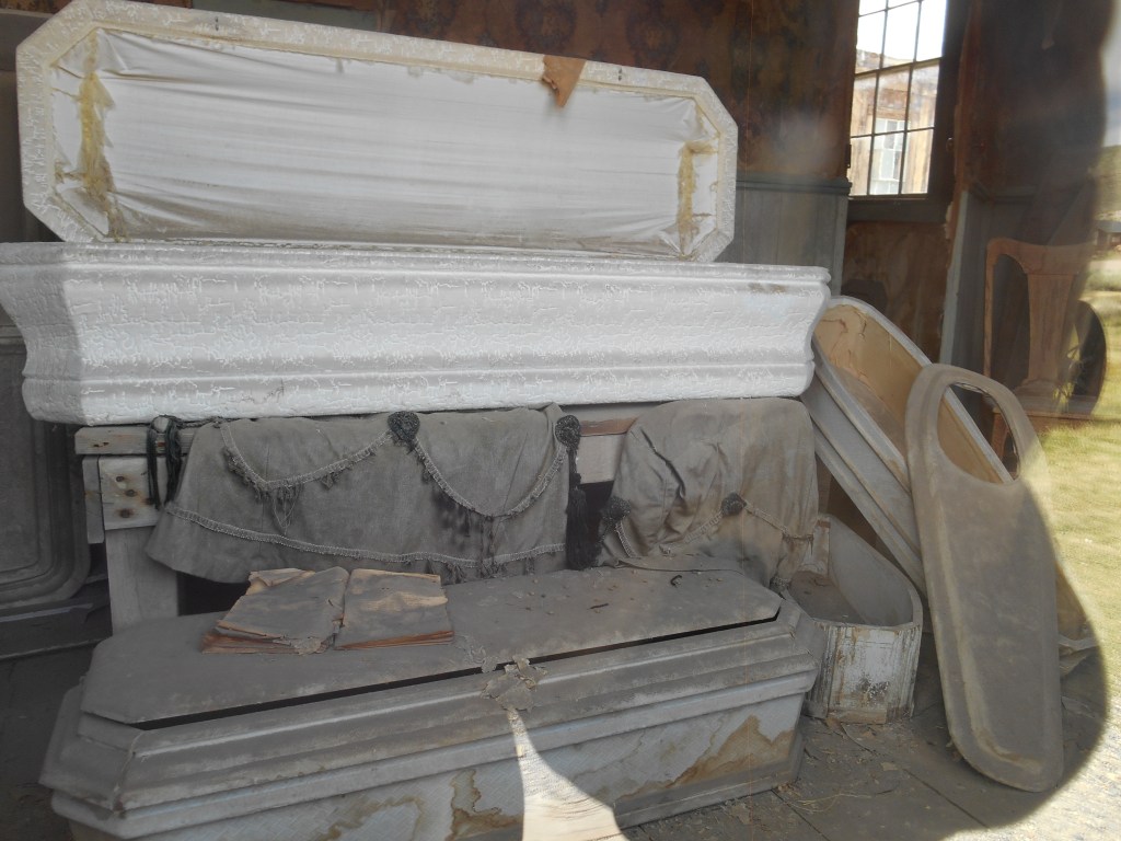
A peek in the window at the morgue.
*There are lots of books and internet sites on the history of Bodie, and a lot of it is based on legend. If you want real history, the best I’ve found are http://www.bodiefoundation.org and http://www.bodiehistory.com. My blog isn’t intended to be as in depth as the history of town and mining deserve; I am only trying to give you a “taste” of Bodie!
**The spelling of his last name was somewhat inconsistent, some versions are Body & apparently his mother used Boddy; “Bodie” is supposed to be a mistake made by a sign painter. Even his first name has been cited as Williams, Waterman or Wakeman. The story of finding gold and Bodey’s death wasn’t recorded until 20 years later.
*** Legend has it that a little girl in Truckee in the 1870s learned her family was moving to Bodie, “a sea of sin,” and was overheard saying her prayers: “Goodbye, God, we’re going to Bodie.” When various newspapers picked up the story, the Bodie paper countered that it was a grammatical error and should have read: “Good, by God, we’re going to Bodie!”

Located in the Mohave Desert at the southern tip of the Sierra Nevada Mountains, Red Rock Canyon is a “pass” between the Sierra Nevada and the El Paso Mountains; it was used by Native Americans as a trading route for centuries. The local Kawaiisu used the area as a winter settlement at the dawn on recorded history in the area, calling it “the canyon with rocks on fire.”
In January/February 1850, pioneers who crossed Death Valley in the “lost ’49’s party” followed a native trail through here, finding water and passage to the west after having spent months in the desert on a “shortcut” to the coast. By 1862, a wagon route was established, used by freight wagons and stage coaches. In the 1890s, gold was mined, but the deposits were never plentiful.


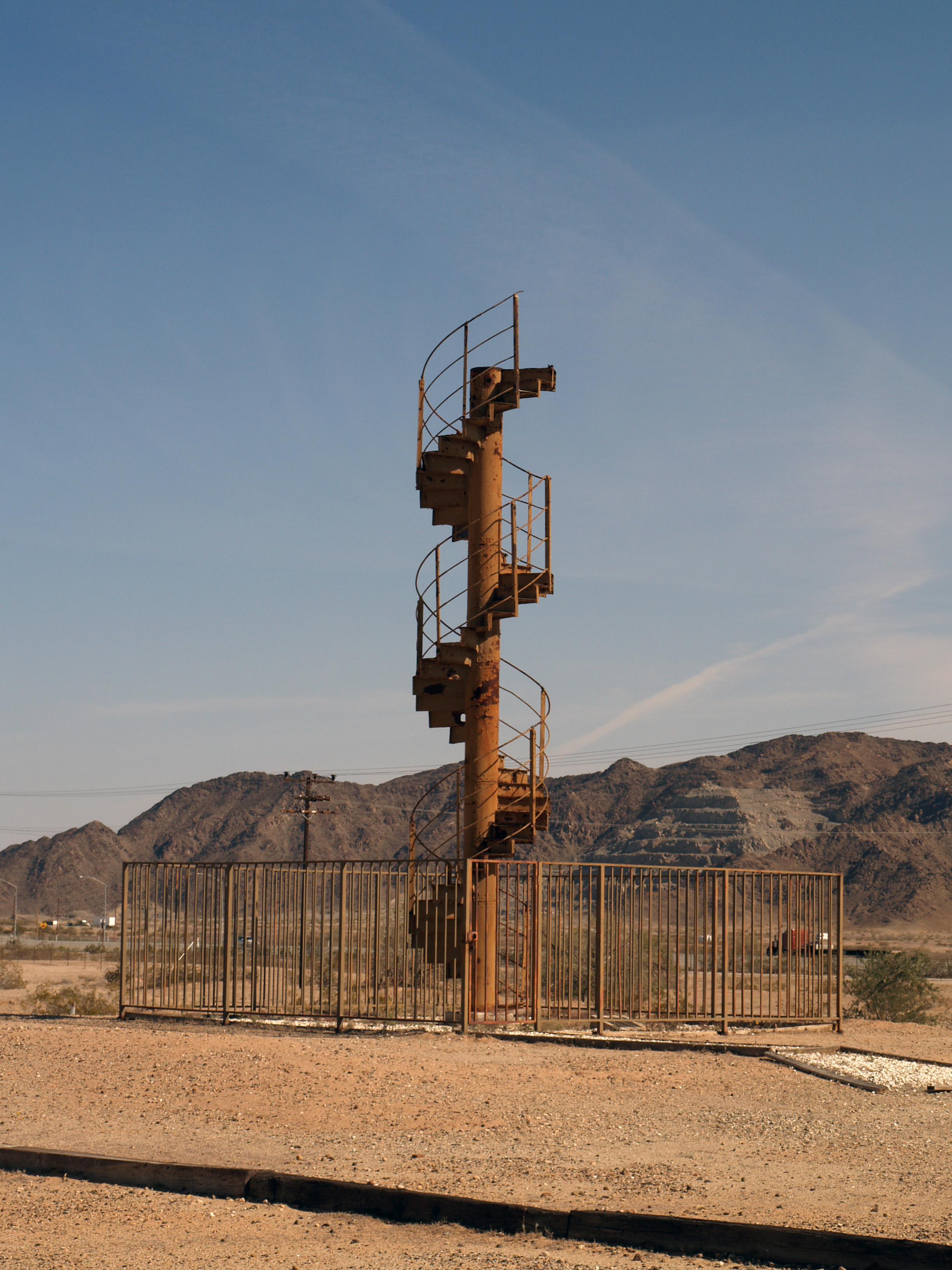
From October 1908 until December 1910, the 8.35 mile Red Rock Railroad carried supplies to the local camp of the workers constructing the Los Angeles Aqueduct from the Owens Valley to Los Angeles.
Purportedly the first automobile trip through the Canyon was in 1905. By the 1930s, a paved road ran through the canyon on the route from Los Angeles to Bishop (along the eastern side of the Sierra Nevadas).
By the 1920s, tourists has discovered the area, and soon the spectacular scenery caused it to be used for location filming for numerous movies and TV programs (Jurassic Park, Westworld, Wagon Train, Battle Star Galactica, to name but a few).

After decades to talk about preserving the Canyon, in 1968 the area became a California State Park.

Yuccas are not as prevalent due to climate and geological changes, as well as humans disturbing the soil.

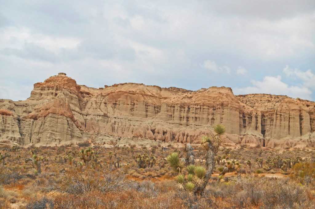

These photos were taken on a trip up the Eastern Sierras in 2015; State Route 14 runs through the State Park. It was a hot summer day on the desert and the Park was not manned due to budget issues in the State government, so there was no one around when we turned into the parking area (there is very limited camping). This would be a spectacular year to visit the park as we had late rain and the wildflowers must be magnificent.
Red Rock Canyon is only a couple of hours out of Los Angeles, but a world away!

I have found a real picture photograph (courtesy of the Eastman Collection, Univ. of Calif. Davis, circa 1940s) that shows the adobe building identified as the stage depot erected in 1856. At the time this was taken, the building as adjacent to US Route 80 (now designated as Historic U.S. Route 80 by California). See blog below for current photos.
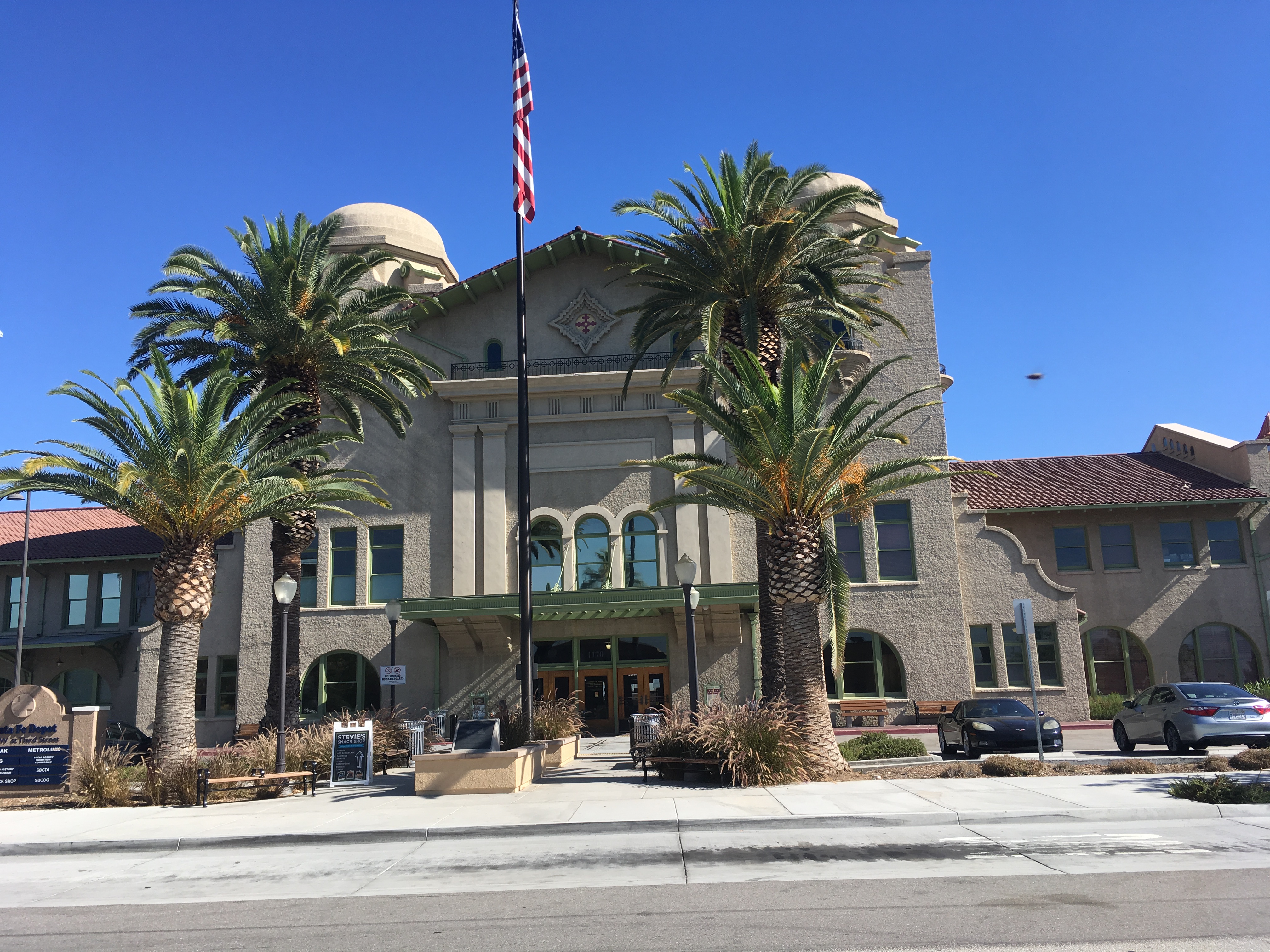
A hundred years old July 15, 2018, the depot was the largest west of the Mississippi when it opened in 1918. Today it has been beautifully restored and not only functions as an Amtrak and Metrolink Station, but also houses a wonderful History and Railroad Museum. Entering the lobby is stepping back in time to the heyday of rail travel.
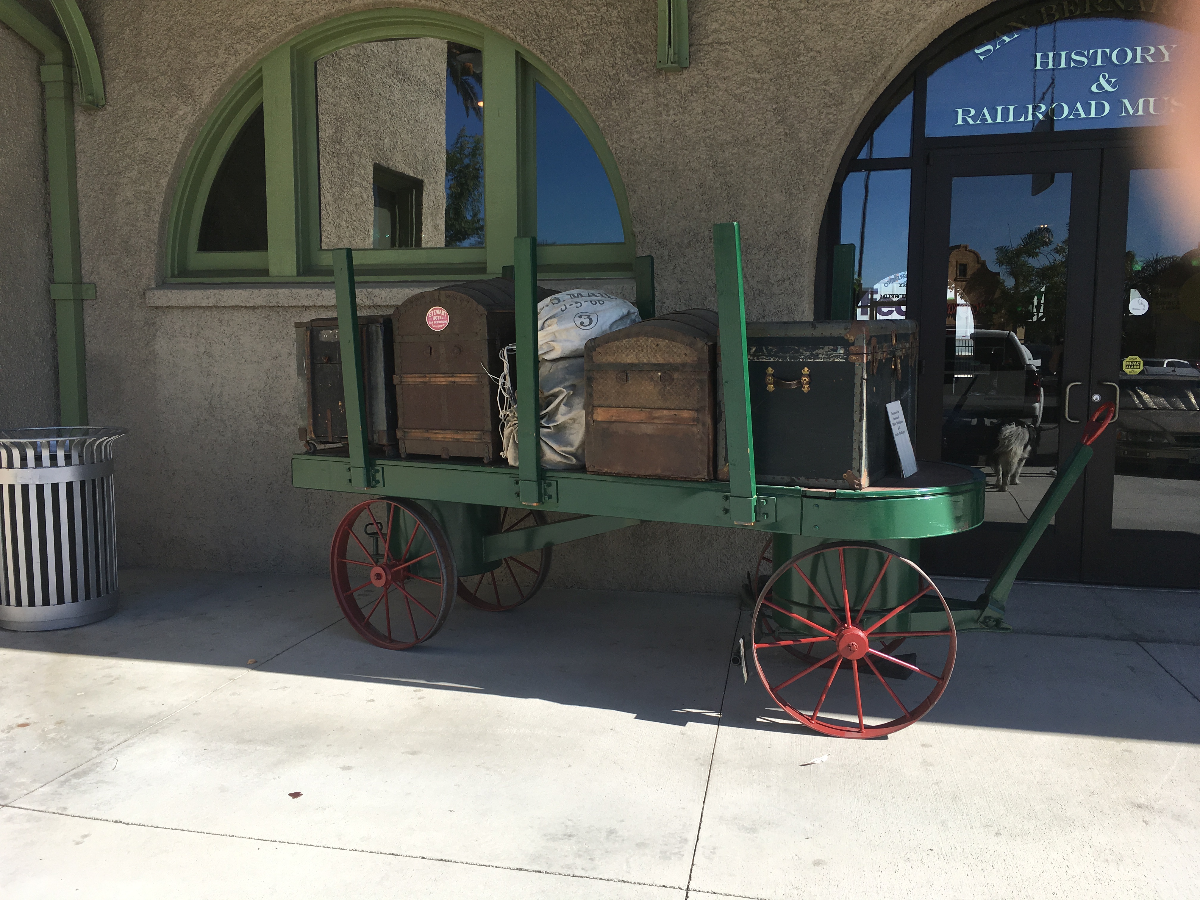
I’ve been tied up first with a number of repairs here on the ranch and then caught some hideous “bug” that laid me low, but a dear friend encouraged me to make the effort to go the the Depot and it is was wonderful!
The Museum is staffed by great volunteers, and is open Wednesdays 9-12 and Saturdays 10-3. Take the 2nd/3rd Street exit off I 215, planning to turn west on 2nd Street, follow the signs to the Amtrak Station, 1170 West Third Street.
Felicity is both a treasure trove of history and history in the making.

Created by Jacques-Andre Istel and his lovely wife, Felicia, the Town of Felicity is the Center of the World, and the location of the History of the World in Granite. It’s hard to describe and monumental to see.
Open December 1 – March 30 of each year, 10 miles east of Yuma on Interstate 8 (exit 164), it is well worth a visit; take sunscreen, wear a hat, and prepare for an outing. The guided tour (nominal fee) takes you into the pyramid that houses the plaque locating the Center of the World.


Between there and the tiny inter-denominational church on the hill, there are massive red granite plaques engraved with history lessons.

The people who own Felicity are extremely nice and helpful. You can spend as long as you wish, exploring the grounds and the relatively new Court of Honor. Each year they add something new!
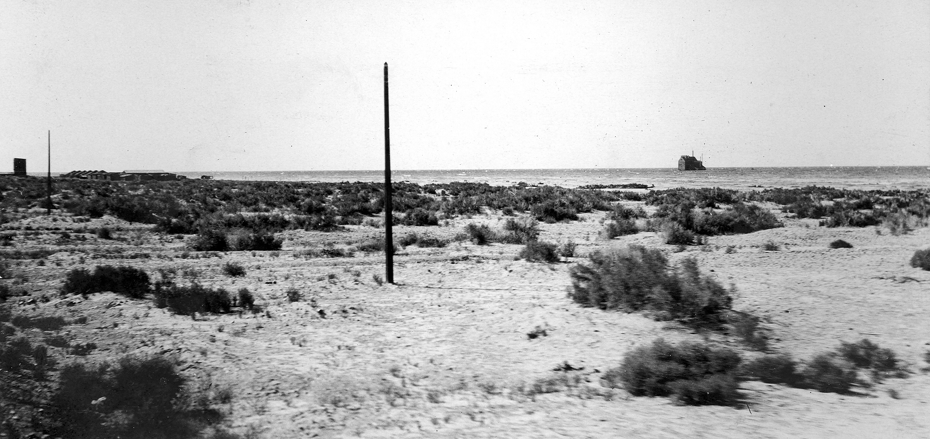
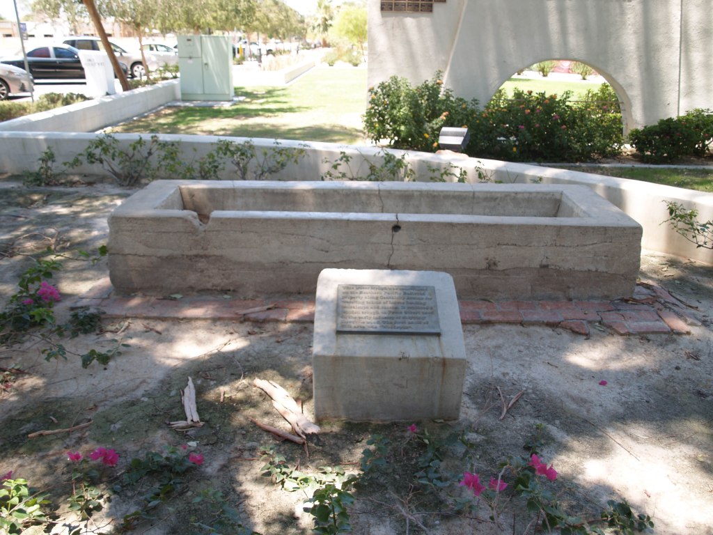
In 1883, George Durbrow and investors incorporated the New Liverpool Salt Company at Salton, on the Southern Pacific main line, south of Mecca, CA. (see correction posted Aug. 27, 2021)
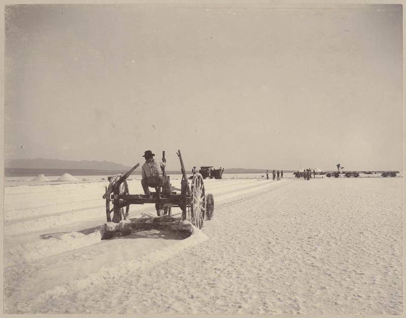
Salt was deposited on approximately 1000 acres of dry sea bed (ancient Lake Cahuilla) by seepage from salt springs in the foothills. Although called a mine, the salt works actually resembled a harvest operation, needing only to cut salt from the field, crush it, bag it, and send it by narrow gauge rail to the nearby railway station at Salton.
The quality, quantity, and uniqueness of its gathering led to it being featured in an 1899 issue of Strand Magazine and a 1901 issue of the National Geographic Magazine.
In “The Saline Deposits of California,” California State Mining Bureau, Bulletin No. 24 (1902), Gilbert E. Bailey, described the operation:
“The sight at the salt works is an interesting one, for thousands of tons are piled up like huge snow drifts,…Indians operate cable plows, harvesting over 700 tons of pure salt per day. A portable railroad conveys the salt to the works.
The [crystal] lake is constantly being supplied by numerous springs in the adjacent foothills, which flow into the basin and quickly evaporate, leaving deposits of very pure salt that vary from 10 to 20 inches in thickness.”
In February 1891, the Colorado overflowed its banks, into the Mexican delta, leaving water standing in low areas. The following June, it overflowed again, reaching the standing water; the resulting flood from the commingled waters reached the Salton Basin, creating a lake approximately 30 miles long and 10 miles wide, but only 5 feet deep. Being shallow, it evaporated, leaving the Salt Works intact.
However, in 1905-1907, when the Colorado River overwhelmed the California Development Co. intakes for the Imperial Canal, the diverted water flooded the Salton Basin creating the Salton Sea. First the salt field was submerged, then the salt plant, and then the town of Salton and the rail lines.