History is made every day. We’re all touched by what is happening; this reblog celebrates Dr. Wenliang’s courage:
A Hero’s Story: Dr. Li Wenliang

History is made every day. We’re all touched by what is happening; this reblog celebrates Dr. Wenliang’s courage:
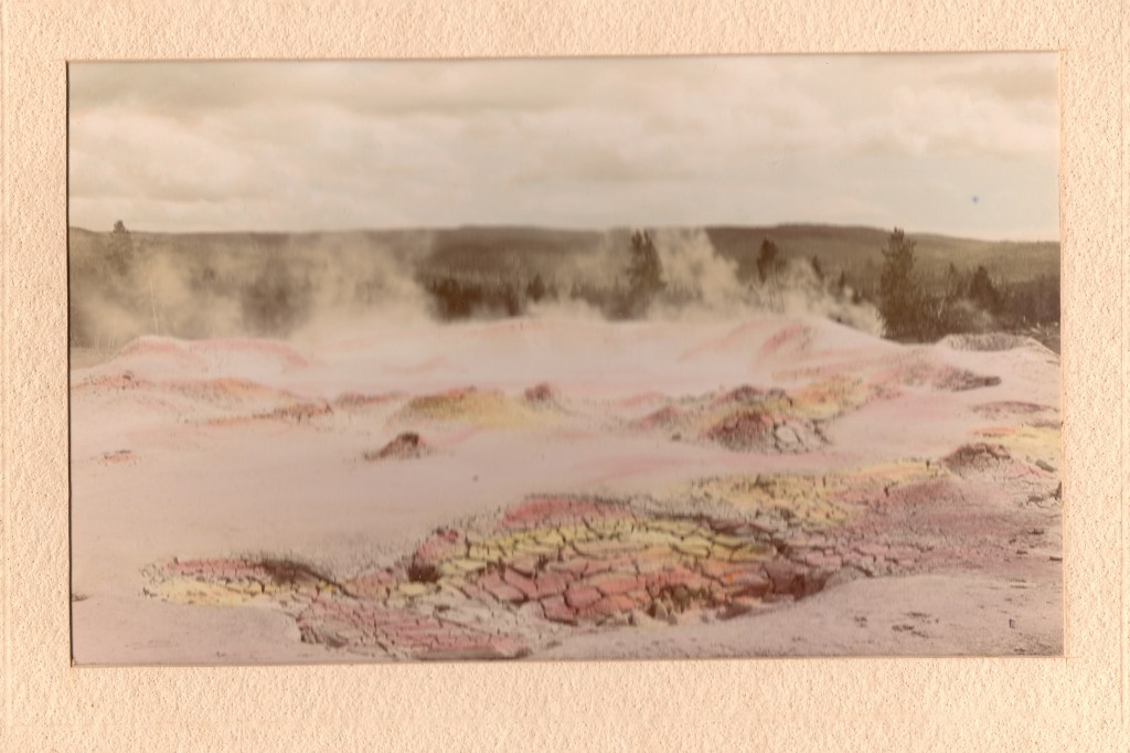
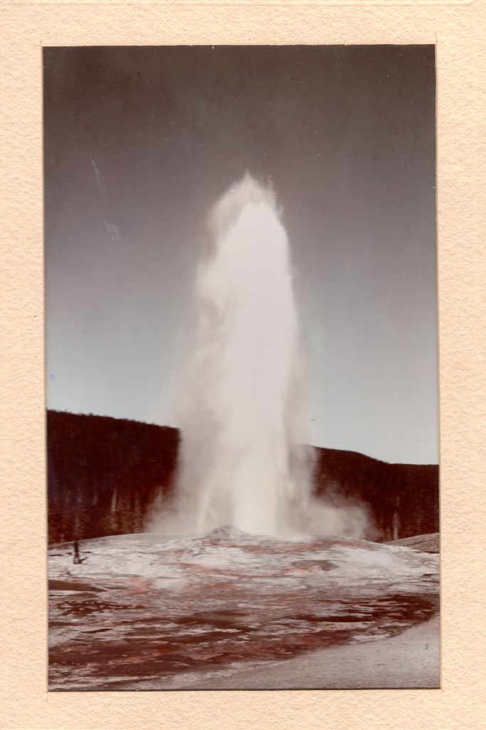
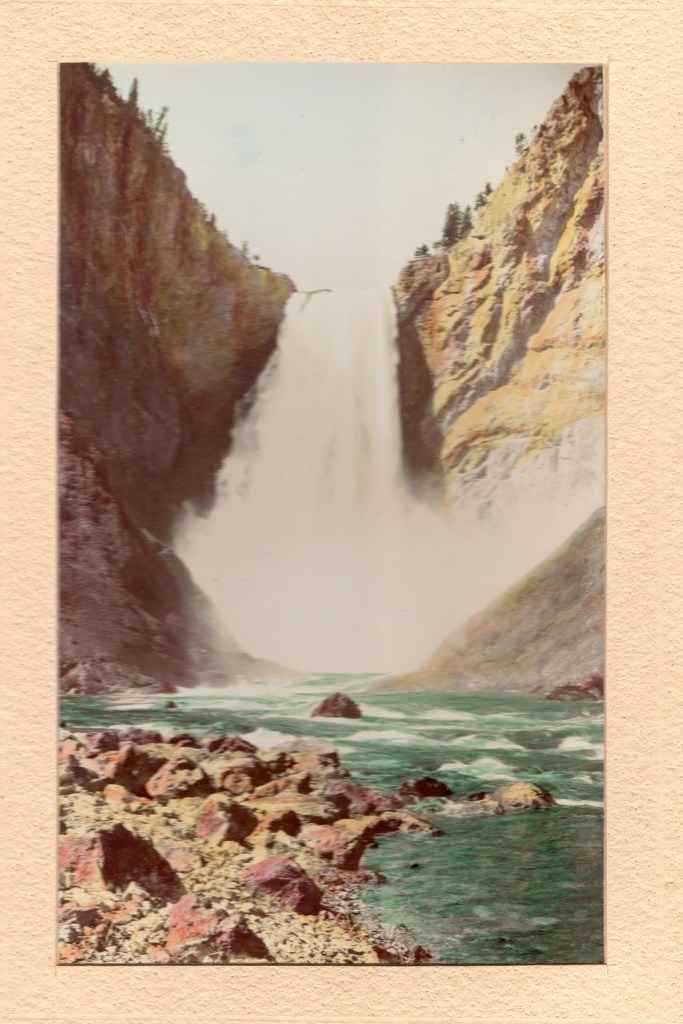
COVID-19 has most of us staying home or only working in essential industries; a large part of my work is the farm I live on, so I’m doing both. In my “spare time,” I’m going through some of the things stashed away when a family lives in a house for 70 years; among the gems I found when my mother passed away 20 years ago was a red box of photographs with a gold label: “Yellowstone National Park in Water Color. Published by F. Jay Haynes, St. Paul, Minn.”
She loved books, new, used, antique, so I assume she purchased it in a bookstore. Inside the box was handwrotten “1897” so I think they were purchased at Haynes’ store in Yellowstone that year. Haynes was the official photographer for the Northern Pacific Railway and received his first photo concession in Yellowstone in 1884.


I hope you have enjoyed this tour in time and space.
My heart goes out to everyone who has lost someone; Stay Strong!

As most of you know, I love the real life stories that make up the history of the Southwest. But, my time is now taken up with living through what will be tomorrow’s history.
While most of California has been very quiet as we try to stay at home, I live in an agricultural area where life goes on with many, many precautions. We have fruit trees, dates, figs & sweet limes, so we’re in a “Critical Infrastructure Industry. ” We wear home made face masks, wash our hands constantly, & try to talk to our workers at a distance, which is a challenge to my hearing as I get older. My knees and back are also complaining.
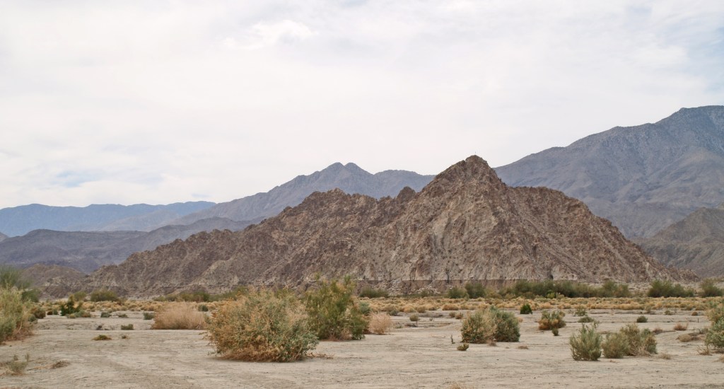
Often the beginning of April is marked by a heat wave, and the attendees of the Coachella and Stagecoach Music Festivals walk around sporting lobster red sunburns from standing in the sun. However, this year even the weather is sad this year as the sky cries rain. I took this picture during a clearing in the middle of the storm that is slowly making it way east.
To anyone who reads this, STAY STRONG & WELL. I pray we will all come out safe on the other side.
Prehistorically, the Gulf of California extended north through the Imperial and Coachella Valleys; over time geologic shifts and water borne silt changed the topography of the land near the Mexican Border, cutting it off from the Gulf to create the Salton Sink. Subsequently, the Colorado River would change course, on and off creating a vast inland sea, now called Ancient Lake Cahuilla. Around 1580, the last vast lake evaporated.
Before construction of Laguna Dam in the early twentieth century, the Colorado was still an active river, draining much of the Western US. Springing from watershed high in the snowy Rockies, the “Red River” raced southward and downward, carving the Grand Canyon and other marvelous canyons as it dashed on to the Sea of Cortez. As it approached the Gulf of California, the landscape changed, leaving behind the rock canyons and allowing the river to meander, creating an alluvial delta with the material carried downstream. Captain J. H. Mellon, who operated steamboats on the Lower Colorado, estimated the silt extended the delta fan into the Gulf by more than 6 miles over the course of the 40 years prior to 1905. (H.T. Cory, The Imperial Valley and The Salton Sink, Part IV, (John J. Newbegin, 1915), a reprint of Irrigation and River Control in the Colorado River Delta, from Vol. LXXVI, Transactions American Society of Engineers, p. 1214.)
Smaller overflows of the Colorado River banks continued into the nineteenth century, down the New and Alamo River channels, flowing into the Salton Basin and duly evaporating.
The winter of 1890/91 was the wettest since readings began being kept in 1850. In February, 1891, a number of breaks in the west bank of the Colorado allowed water to spill over into the delta and the New River channel. In June, when Spring runoff brought high water again, more water spilled into the streams running north into the Salton Trough reaching Salton, site of the New Liverpool Salt Works.

The sea was approximately 40 miles long and 10 miles wide, but only 4 feet deep. (B. A. Cecil-Stephens, “The Colorado Desert and its Recent Flooding,” Journal of the American Geographical Society of New York, Vol. 23 (1891), pp. 367-377)
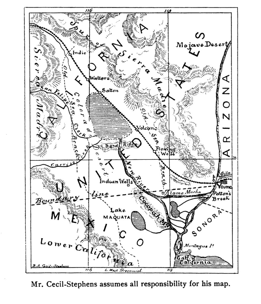
In July 1891, the New York Times printed remarks by John Wesley Powell, Director of the U.S. Geological Survey, that even if the lake were filled to the level of the river, it would evaporate at the rate of approximately 6 feet per year.
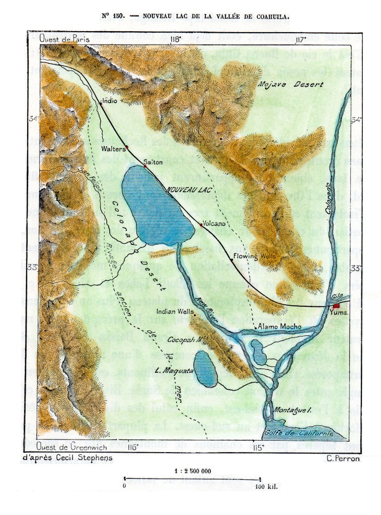
The first Salton Sea did indeed evaporate due to the extreme heat and lack of sufficient incoming water sources. The situation was totally different following the 1905/07 flooding, as the entire river was diverted into the trough creating the lake, and runoff from agriculture in the Imperial Valley provided a new source of water to replenish that lost to evaporation.
For information on the 1905/07 flooding that created the current Salton Sea, my blog page Creation of the Salton Sea has a preview of a book I’ve written. historytrove.com/creation-of-the-salton-sea/
A Time to Stop and Think About What Is Really IMPORTANT – I revisit a grade school lesson

In grade school we learned the Pilgrims and the local Native Americans came together to give thanks for the harvest. It makes a lovely picture book moment, but sadly our country has had much to learn; the color of one’s skin is, as the old saying goes, “only skin deep.”
Politics don’t enter into it, we should all Give Thanks this year, and every year for all those who risked/lost their lives for our freedom. And, for all those who have stood up for our freedom in other ways.
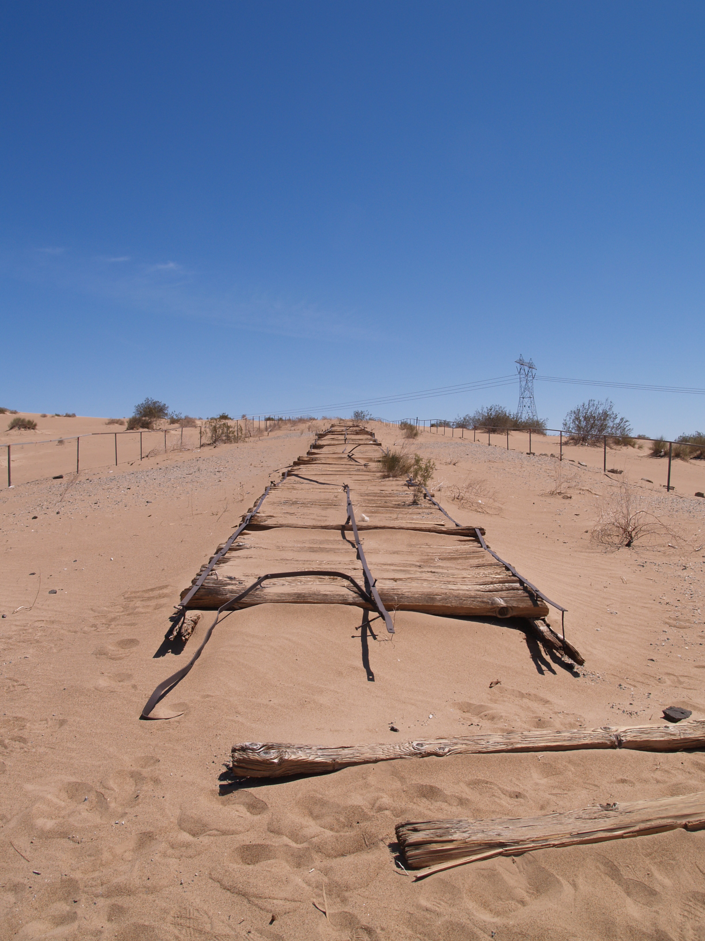
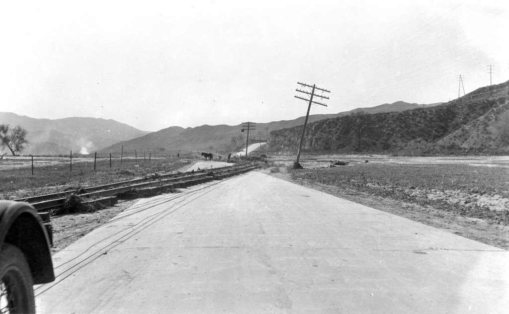
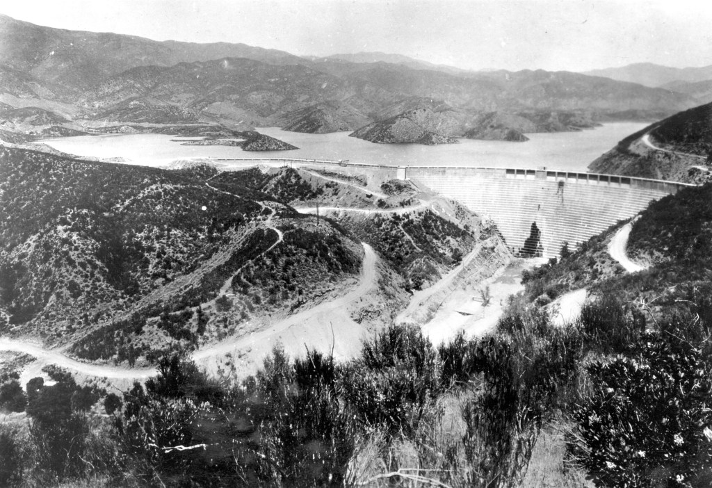
Just a quick note on the power of water: I found this dramatic March 18, 1928 USGS photo of the railroad tracks between Castaic Junction and Piru (Calif.), having been moved onto the highway by the flood caused by the Saint Francis Dam failure.
Below is a photo of the dam before it failed on March 12, 1928. From the USGS archives, courtesy of Los Angeles Bureau of Power & Light. Harold Thornton Stearns, photographer
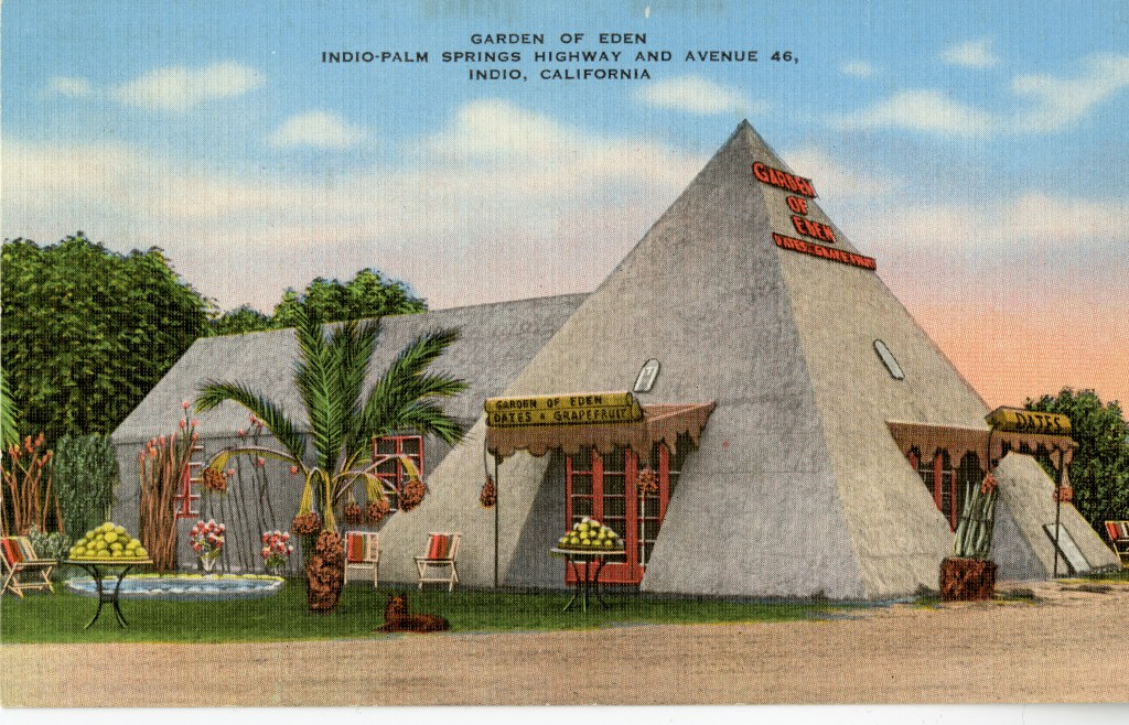
Date harvest is underway in the Coachella Valley, which brings back memories of the date shops that once lined the main roads for tourists to buy dates, citrus, figs, etc.
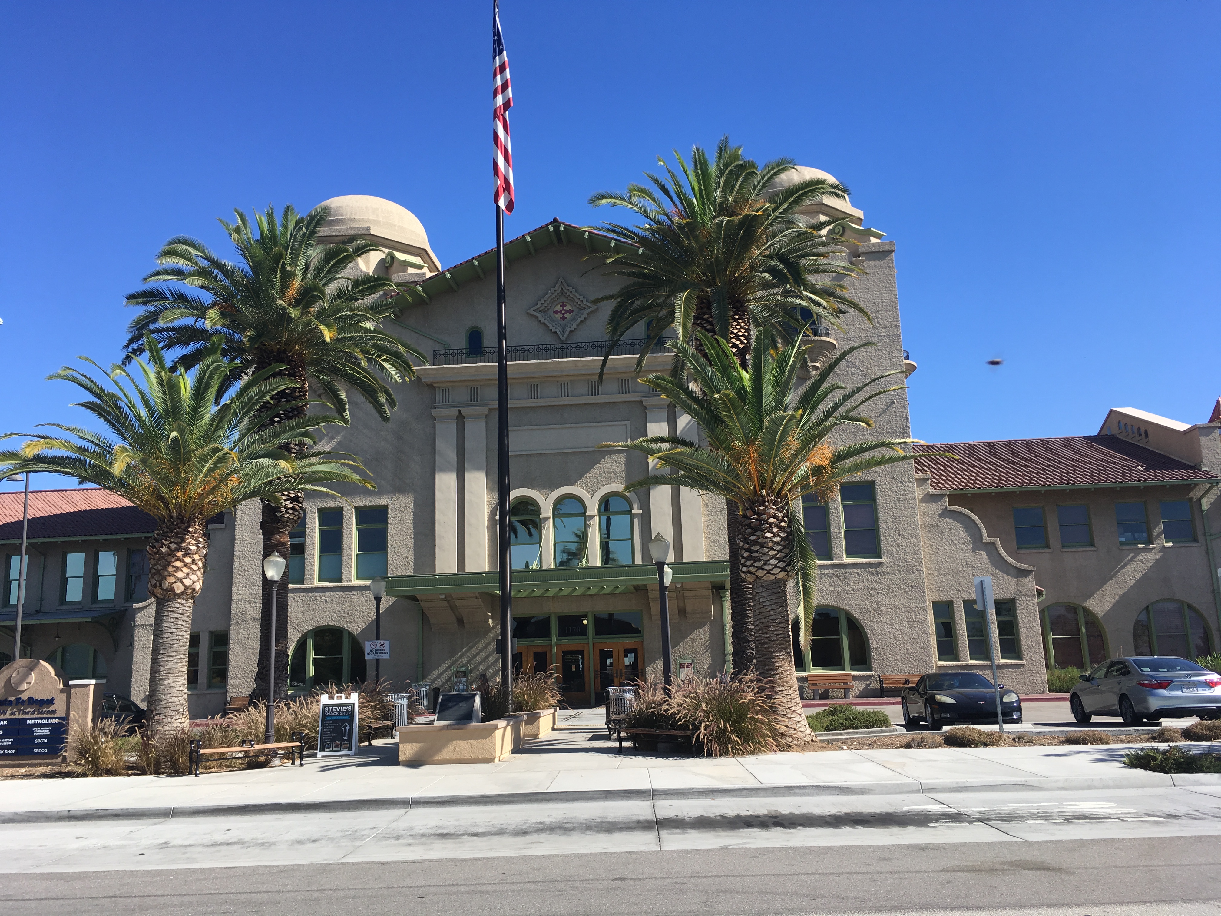
A hundred years old July 15, 2018, the depot was the largest west of the Mississippi when it opened in 1918. Today it has been beautifully restored and not only functions as an Amtrak and Metrolink Station, but also houses a wonderful History and Railroad Museum. Entering the lobby is stepping back in time to the heyday of rail travel.
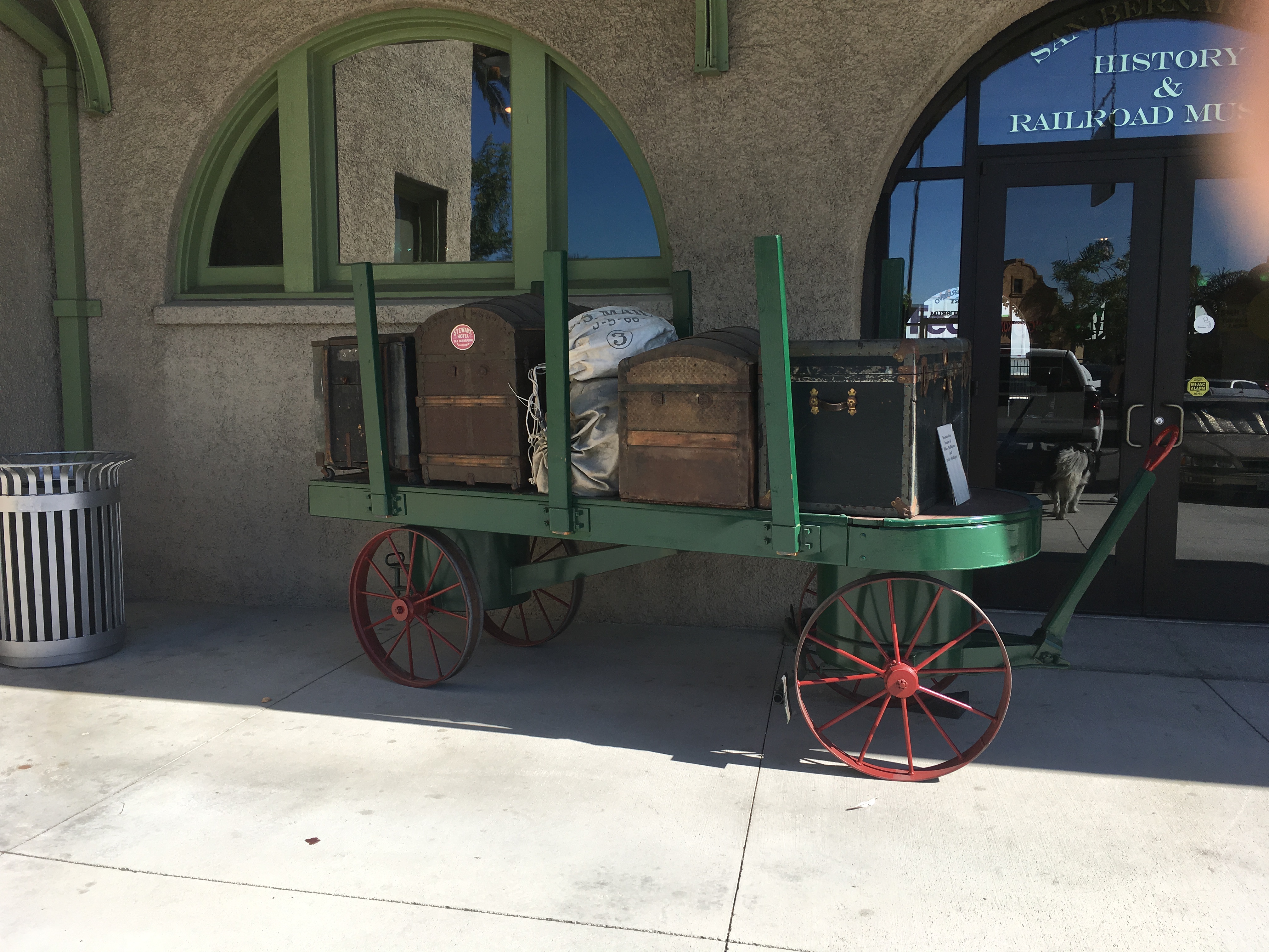
I’ve been tied up first with a number of repairs here on the ranch and then caught some hideous “bug” that laid me low, but a dear friend encouraged me to make the effort to go the the Depot and it is was wonderful!
The Museum is staffed by great volunteers, and is open Wednesdays 9-12 and Saturdays 10-3. Take the 2nd/3rd Street exit off I 215, planning to turn west on 2nd Street, follow the signs to the Amtrak Station, 1170 West Third Street.
Felicity is both a treasure trove of history and history in the making.

Created by Jacques-Andre Istel and his lovely wife, Felicia, the Town of Felicity is the Center of the World, and the location of the History of the World in Granite. It’s hard to describe and monumental to see.
Open December 1 – March 30 of each year, 10 miles east of Yuma on Interstate 8 (exit 164), it is well worth a visit; take sunscreen, wear a hat, and prepare for an outing. The guided tour (nominal fee) takes you into the pyramid that houses the plaque locating the Center of the World.


Between there and the tiny inter-denominational church on the hill, there are massive red granite plaques engraved with history lessons.

The people who own Felicity are extremely nice and helpful. You can spend as long as you wish, exploring the grounds and the relatively new Court of Honor. Each year they add something new!
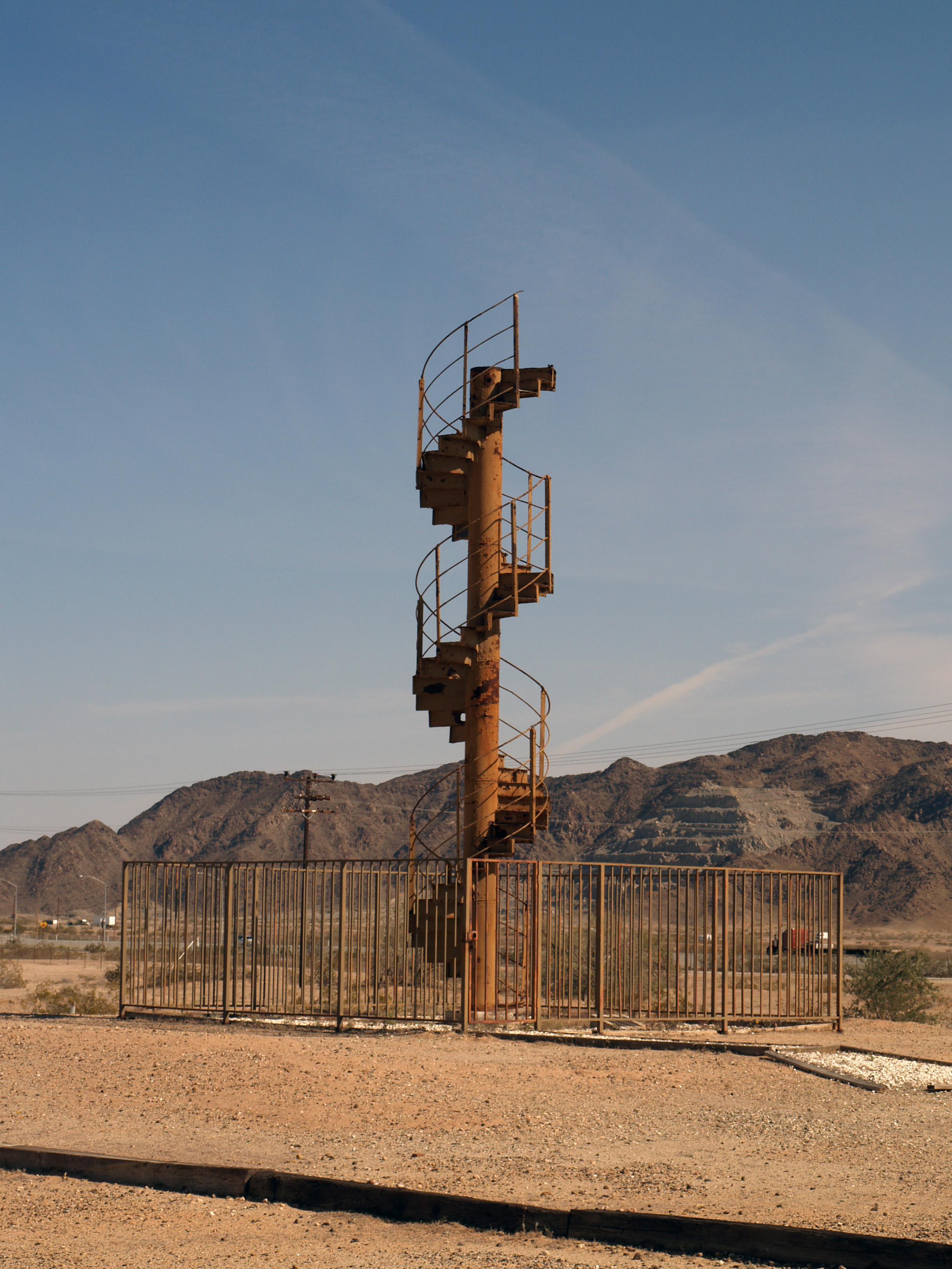
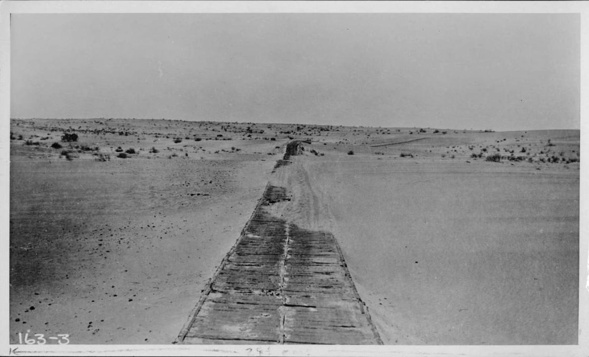
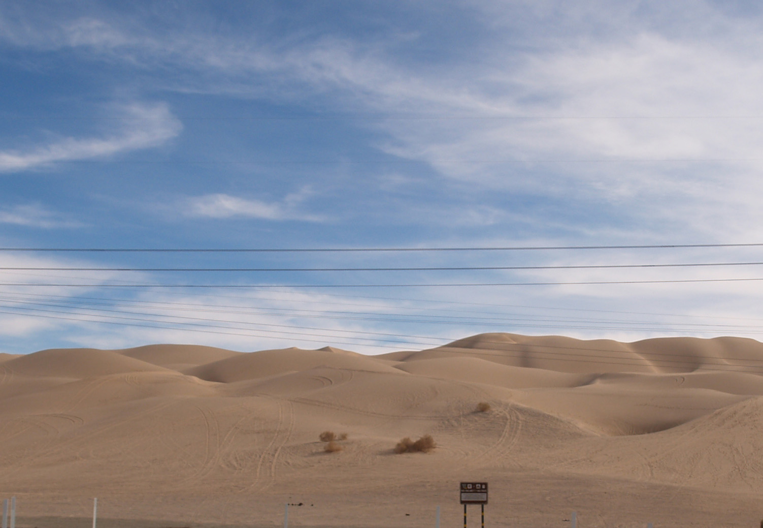
Not as obscure as some of the other sites, the plank road through the Algodones Sand Dunes of southeastern California, along with the first bridge across the lower Colorado River, allowed the completion of the Coast to Coast Highway (later US 80).
Prior to the late Nineteenth Century the common way to travel from Yuma to the California coast was via northern Mexico. Between the sand dunes and the lack of water, passage north of the border was virtually impossible. From Yuma, the Southern Pacific tracks (Indio to Yuma opened in 1877) turned north shortly after entering California, and ran on the east side of the dunes, rather than crossing what became the Imperial Valley. Irrigation and the resulting agricultural boom in the valley led to people wanting to traverse it, but by train the route required a loop south from Imperial Junction (later Niland) across the valley into Mexico at Calexico, east below the border approximately 50 miles, then north to Araz Junction to rejoin the SP mainline.
In 1915, completion of the Coast to Coast Bridge crossing the Colorado at Yuma and the one lane Plank Road across the dunes enabled vehicular travel on the US side of the border. Originally just two 25″ parallel “tracks” of wood, about a year later, the planks were fastened together in a full 8′ lane as shown in the photos. When the shifting sand drifted over the wood, sections were moved by horse drawn rigs. Turn outs, approximately a quarter of a mile apart, allowed traffic to pull to the side and allow the driver traveling the other direction to pass, sometimes resulting in arguments over right of way.

By 1926, highway construction engineering had advanced to the point that an asphalted concrete road could be built replacing the Plank Road. To see a short stretch of a replica of the original road and the Historical Marker, take exit 156 off Interstate 8, turn west on Grays Wells Road; the site will be on the left side of the road, off a parking lot.