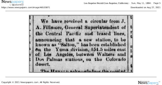
One of my readers asked me what I knew about the history of the name “Salton,” as in the Salton Sink, Salton Sea, Salton Station on the Southern Pacific Railroad line. I reread my post on the New Liverpool Salt Works and discovered I had made a typographical error; the salt works were incorporated in November 1883, not 1893! I am grateful for the opportunity to correct my error.
If you are interested, the earliest reference I can find regarding the name Salton was an article in the May 11, 1884 edition of the Los Angeles Herald:
All the earlier maps show names for the area such as the “Colorado Desert” (1856); Coahuilla Valley, Cabazon Valley, Frink Dry Lake (late 1870s). By the time of the natural overflow of the Colorado in 1891, Salton was in use.
The Southern Pacific Railroad completed tracks from Los Angeles to Indio, California, in 1876; the following year the rails were extended to Yuma, and by 1883, the “Sunset Route” from Los Angeles to New Orleans was completed, opening a new route for California produce to reach markets.
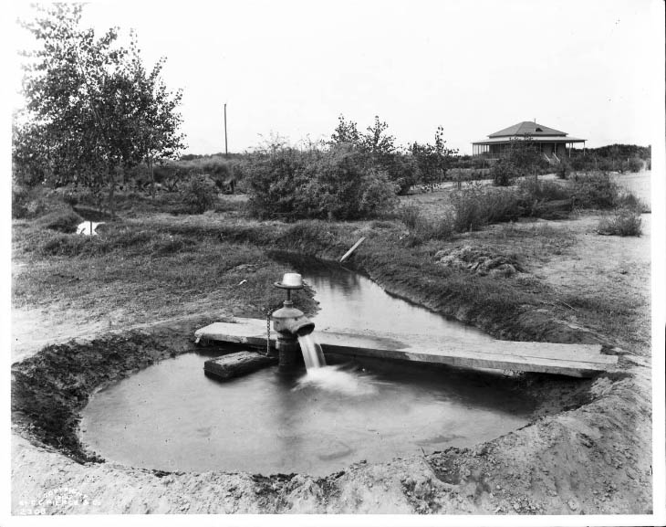
As part of the railroad line, a few miles south of Indio, a 3 car side spur was built at the site of present day City of Coachella. From there mesquite & ironwood were loaded onto boxcars for stove wood. Around 1900, Jason L. Rector pitched his tent and began harvesting wood for his employers, the Southern Pacific Railroad Co. And the A. N. Towne Estate. In 1901, he quite his job, tapped a well at an artesian spring, built an adobe house, and in 1902 organized the Coachella Valley Produce Association.*
1903 photo by CC Pierce, of artesian well located at Coachella from Strand Magazine, London, January 1905, page 22.
With irrigation now possible, cantaloupe became “king.” Indeed, Rector’s well was located on Cantaloupe Avenue (now Grapefruit Blvd./Highway 111).
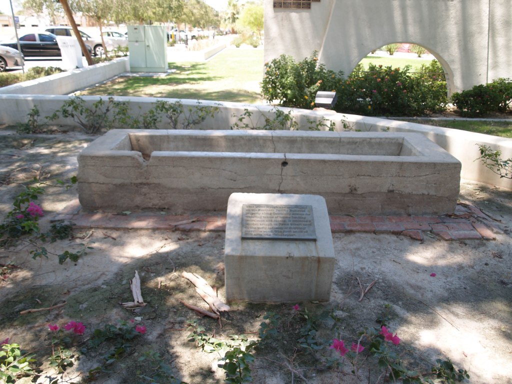
Early water trough “This water trough was constructed on the Southern Pacific Railroad property along Cantaloupe Avenue for watering teams of horses hauling cantaloupes and onions. It replaced a wooden trough on Front Street used in the early industry of shipping of mesquite wood. The first name of this areas was ‘Woodspur.’” Historical Marker located near corner of Orchard and Sixth Street, on the grounds of the City Hall.
How did Woodspur become Coachella?
There is debate about how the name came about, but there is no debate that the people in the area did not like the name Woodspur. The main two theories are that Coachella was a compromise (or cross) between Cahuilla (or Coahuilla, name of the local tribe) and Conchilla (Spanish, after the small shells found all over the area from when it had been underwater), or that it was a printer’s typographical error. The oldest “first person” account I have found is a letter from Elmer Proctor.**
What is in a Name? Fast forward to the late Twentieth Century, when annual the world famous Coachella Music Festival began. *** Today the two names, Woodstock and Coachella, are often linked, but could it have been Woodstock and Woodspur?
* From the biography of Jason L. Rector in History of Riverside County California with Biographical Sketches by Elmer, Wallace Holmes, Historic Record Company, Los Angeles, 1912. Since Mr. Rector was still alive and active in 1912, I assume this information is correct.
**Desert Magazine, Palm Desert, November 1945, page 33; excerpts from letter to the editor from Elmo Proctor:
“A United Stites department of the interior engineer (I think his name was Mendenhall), by government authority, had made a survey of the Salton Sea quadrangle and it was suggested that then was an auspicious time to give the valley a more appropriate name. Suggestions were asked for. The name “Conchilla,” submitted by Mr. Tingman, was chosen by a vote of the few prospectors, homesteaders and railroaders present in the small gathering.
I was present when the maps arrived in Indio giving the valley its new name. Must have been about 1898. Before that it had been called “Salton Sea Sink.” I was a clerk in A. G. Tingman’s store, one of the two (the other belonged to a Mr. Talent, also in Indio) that served railroad and desert people for over a hundred miles in all directions.
I well remember how badly put out Mr. Tingman was when the maps arrived and it was found that the engineer’s longhand was so unreadable that the name had been interpreted “Coachella.”
When I was in elementary school in Coachella, the little shell version (Conchilla) was what I was told.
*** The festival is actually held in a still rural area annexed by the City of Indio.
The stairs going up from the parking lot in Santa Susana Park.
Open Saturday & Sunday (except holidays) 1-4 pm.
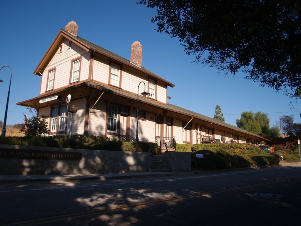
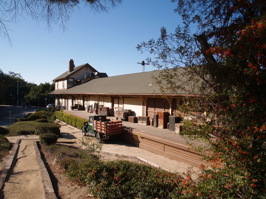
The depot still sits next to the tracks where Amtrak and Union Pacific freight trains still travel.
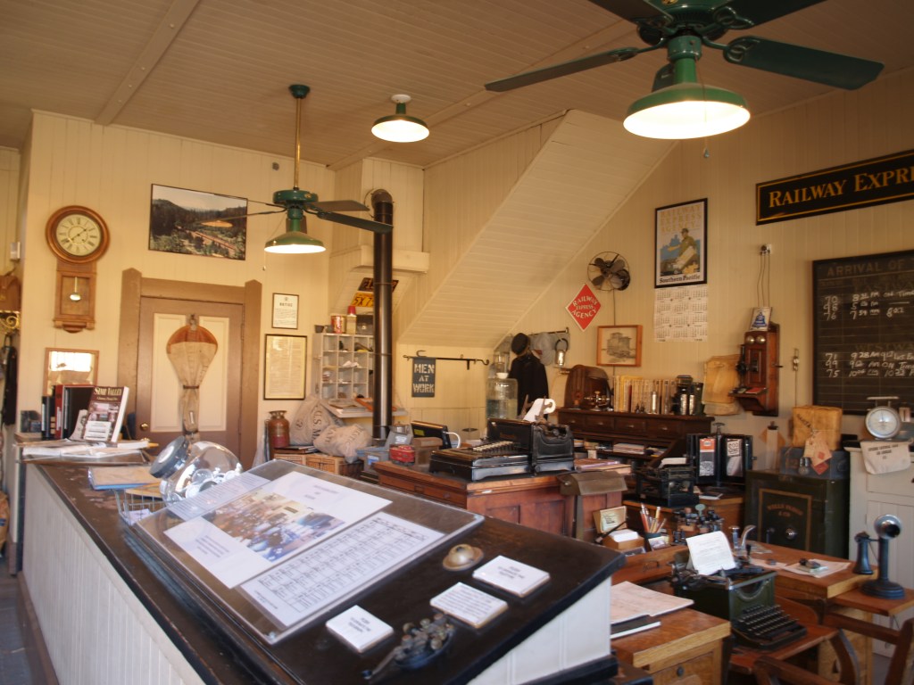
Built in 1903, Southern Pacific Santa Susana Depot sat on Los Angeles Ave. East of Tapo Street; it served the Rancho Simi area until the early 1970s when the SP closed it. Falling prey to age and vandalism, the deteriorating building was sold by the railroad for $1.06, and moved 2 miles east to its present site in May 1975 (6503 Katherine Road). After extensive restoration, the depot was reopened in 2000, as a museum and home of the local model railroaders club.
A passenger station, freight station, and telegraph office, it was based on Southern Pacific’s standard No. 22, combination depot plans; the depot has a recently restored stationmaster’s apartment on the second story.
Ticket sales and waiting room.The other side of the ticket window. The hub of the depot, ticket sales, dispatch, telegraph office.Note the mail bag hanging on the door; the train slowed but didn’t need to stop to pick up mail.
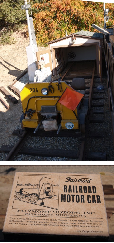
Exhibits between today’s Union Pacific tracks and the depot:
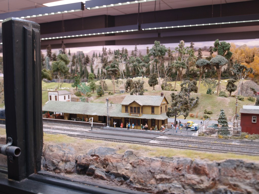
HO Model Railroad in depot:
The Santa Susana Depot in HO scale: the model railroad in the depot recreates the Southern Pacific through the region in the 1950s. Businesses near the Depot in the 1950s.
Freight Deck:
As recently as June 2018, the freight deck (street side today) was rebuilt to original specifications.
Also on the grounds:
A telephone booth, made of cast concrete by Southern Pacific in Oakland: they were used by the SP, Pacific Electric, and San Diego Arizona and Eastern Railways. This one dates from the early 1920sSafe Journeys!
I found the first three photographs (circa 1877) in the Library of Congress collection, published by the Continent Stereoscopic Company in the series “Descriptive views of the American Continent.”
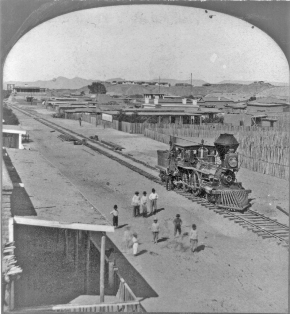
254 — Arrival of the first locomotive in Arizona*
According to LoC: “Written in pen on back of mount: Fort Yuma, Cal. on bluff in background.”
I believe the shot was taken looking north from Yuma, Arizona Territory; Fort Yuma on the California side of the Colorado River can be seen on the bluff, just as the note on back reads. If you look along the tracks, you can see a glimpse of the swing bridge built by the railroad across the river.
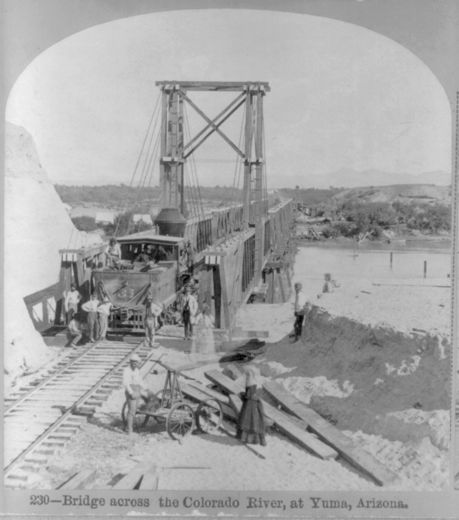
237 — “Old 31″ The Pioneer Engine of Arizona*
According to LoC: “Written in pen on back of mount: Yuma, Ariz., Fort Yuma, Cal. on bluff in background.”
Looking carefully, when enlarged, the tender is has the initials “S” and “P.”
The bridge was built to swing a section aside so large boats could ply the River. Starting in 1852, steamboats were used to transport goods and people on the lower Colorado.
The Southern Pacific completed tracks from Los Angeles to Indio, California in 1876, and on to Yuma, Arizona in 1877. That year, photographer Enoch Conklin traveled in Arizona, taking his own pictures as well as acquiring photos from others. “Picturesque Arizona: Being the Result of Travels and Observations in Arizona During the Fall and Winter of 1877” was published by the Mining Record Printing Establishment, in which his pictures were credited to the Continent Stereoscopic Company. An incomplete set of the images were deposited in the LoC by an unknown source in 1907.
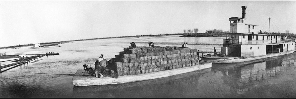
Searchlight delivering a barge load of provisions to the work camp for closing the break in the Colorado bank that created the Salton Sea (circa 1905-1907). US Bureau of Reclamation photograph
With the arrival of the Southern Pacific Railroad in 1877, steamboat travel declined. The completion of Laguna Dam in 1909, was the end of viable steamboating on the lower Colorado (see my blog entry on the Swastika Bridge for more on Laguna Dam).
Sold to the US Reclamtion Service, the Seachlight was lost on the River in October 1916; as the last steamboat on the lower Colorado, its loss ended an era.
The copies of these two available digitally do not have the title captions, but the numbers and titles are given on the LoC information documents
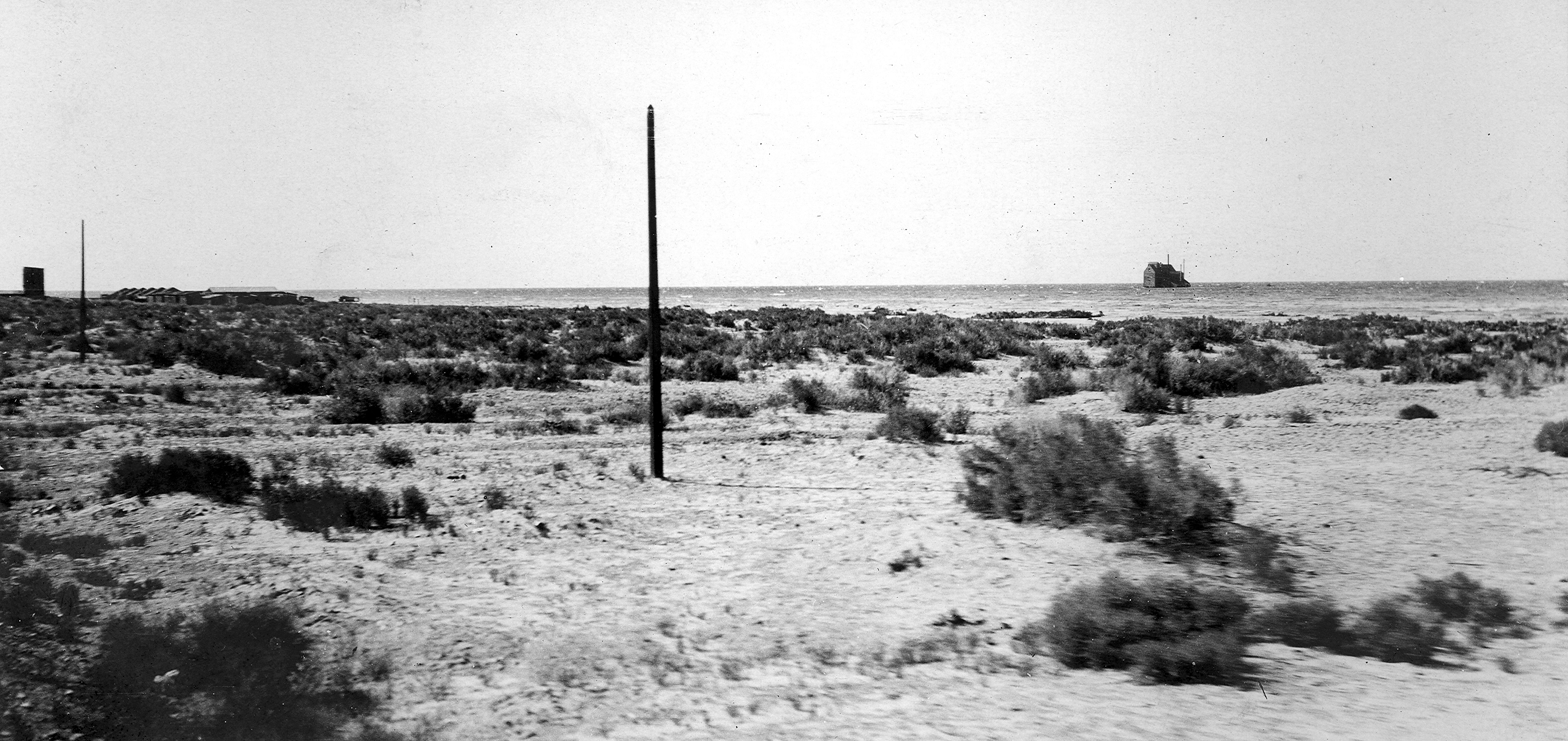
In 1883, George Durbrow and investors incorporated the New Liverpool Salt Company at Salton, on the Southern Pacific main line, south of Mecca, CA. (see correction posted Aug. 27, 2021)
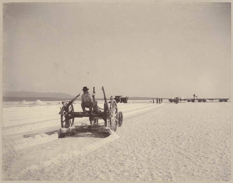
Salt was deposited on approximately 1000 acres of dry sea bed (ancient Lake Cahuilla) by seepage from salt springs in the foothills. Although called a mine, the salt works actually resembled a harvest operation, needing only to cut salt from the field, crush it, bag it, and send it by narrow gauge rail to the nearby railway station at Salton. The quality, quantity, and uniqueness of its gathering led to it being featured in an 1899 issue of Strand Magazine and a 1901 issue of the National Geographic Magazine.
salt plow published in “A Common Crystal” by John R. Watkins, Strand Magazine 1899
In “The Saline Deposits of California,” California State Mining Bureau, Bulletin No. 24 (1902), Gilbert E. Bailey, described the operation: “The sight at the salt works is an interesting one, for thousands of tons are piled up like huge snow drifts,…Indians operate cable plows, harvesting over 700 tons of pure salt per day. A portable railroad conveys the salt to the works.
The [crystal] lake is constantly being supplied by numerous springs in the adjacent foothills, which flow into the basin and quickly evaporate, leaving deposits of very pure salt that vary from 10 to 20 inches in thickness.”
In February 1891, the Colorado overflowed its banks, into the Mexican delta, leaving water standing in low areas. The following June, it overflowed again, reaching the standing water; the resulting flood from the commingled waters reached the Salton Basin, creating a lake approximately 30 miles long and 10 miles wide, but only 5 feet deep. Being shallow, it evaporated, leaving the Salt Works intact.
However, in 1905-1907, when the Colorado River overwhelmed the California Development Co. intakes for the Imperial Canal, the diverted water flooded the Salton Basin creating the Salton Sea. First the salt field was submerged, then the salt plant, and then the town of Salton and the rail lines.