The Southern Pacific comes to Yuma

Marvelous photos from 1877!

I found the first three photographs (circa 1877) in the Library of Congress collection, published by the Continent Stereoscopic Company in the series “Descriptive views of the American Continent.”

254 — Arrival of the first locomotive in Arizona*

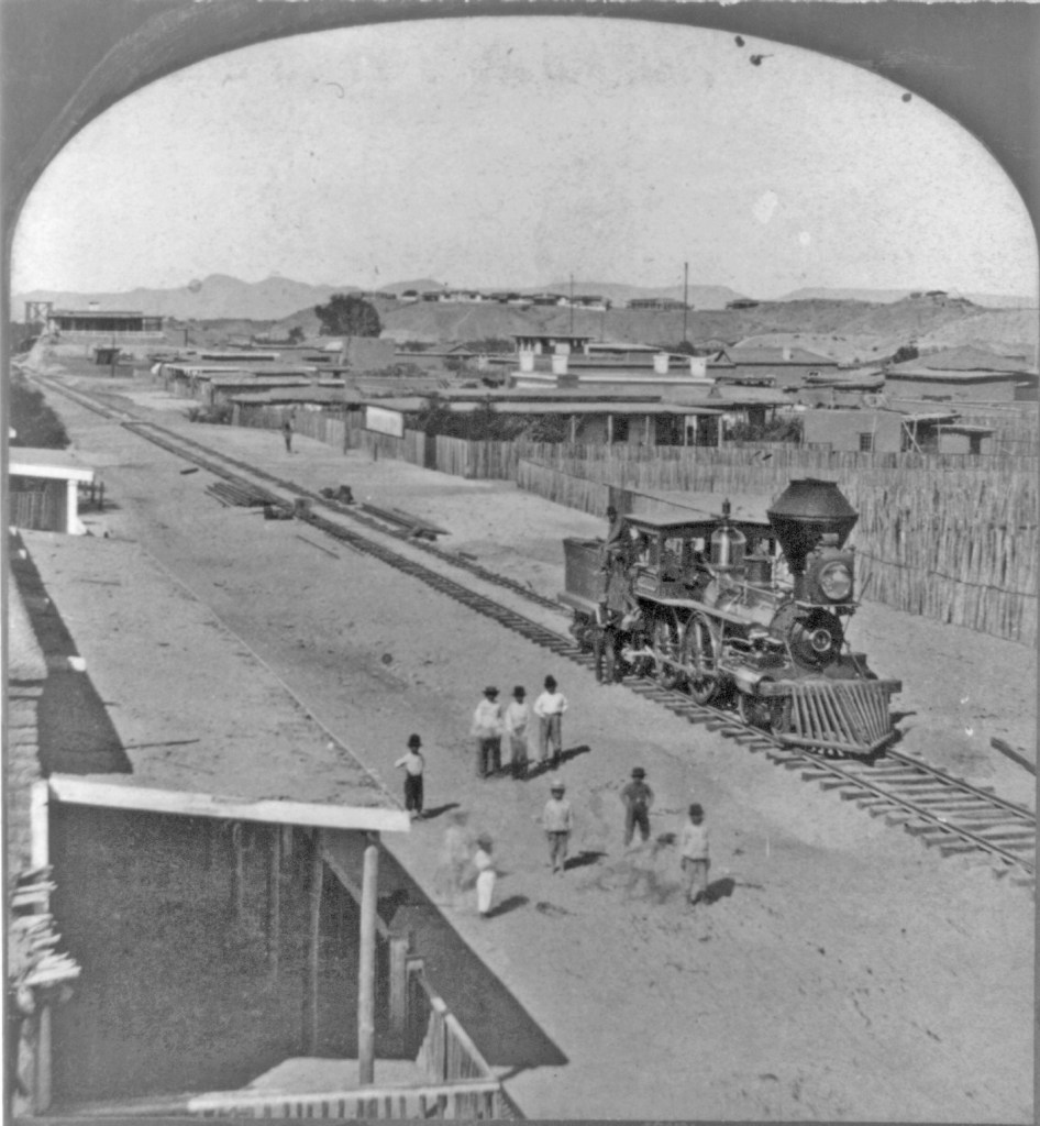
According to LoC: “Written in pen on back of mount: Fort Yuma, Cal. on bluff in background.”

I believe the shot was taken looking north from Yuma, Arizona Territory; Fort Yuma on the California side of the Colorado River can be seen on the bluff, just as the note on back reads. If you look along the tracks, you can see a glimpse of the swing bridge built by the railroad across the river.

237 — “Old 31″ The Pioneer Engine of Arizona*

According to LoC: “Written in pen on back of mount: Yuma, Ariz., Fort Yuma, Cal. on bluff in background.”

Looking carefully, when enlarged, the tender is has the initials “S” and “P.”

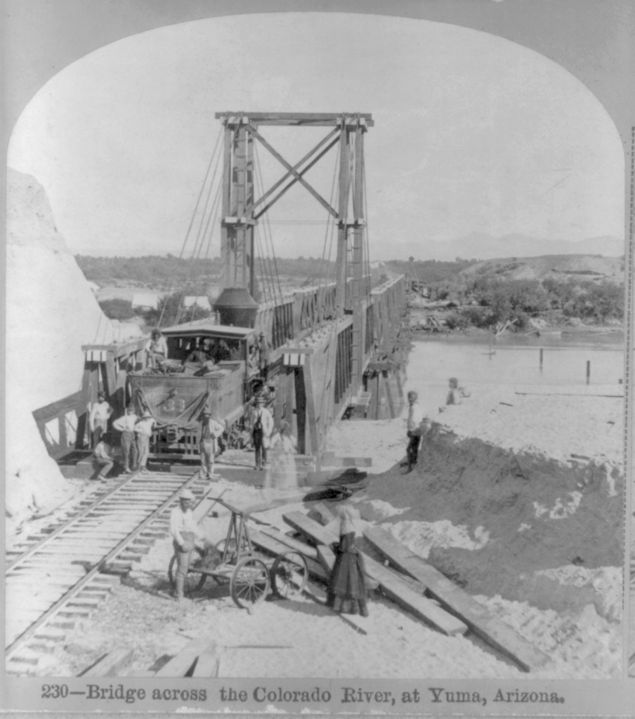
The bridge was built to swing a section aside so large boats could ply the River. Starting in 1852, steamboats were used to transport goods and people on the lower Colorado.

The Southern Pacific completed tracks from Los Angeles to Indio, California in 1876, and on to Yuma, Arizona in 1877. That year, photographer Enoch Conklin traveled in Arizona, taking his own pictures as well as acquiring photos from others. “Picturesque Arizona: Being the Result of Travels and Observations in Arizona During the Fall and Winter of 1877” was published by the Mining Record Printing Establishment, in which his pictures were credited to the Continent Stereoscopic Company. An incomplete set of the images were deposited in the LoC by an unknown source in 1907.

Searchlight delivering a barge load of provisions to the work camp for closing the break in the Colorado bank that created the Salton Sea (circa 1905-1907). US Bureau of Reclamation photograph

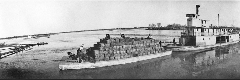
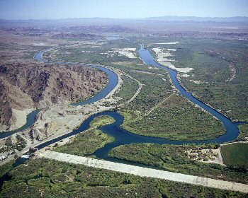
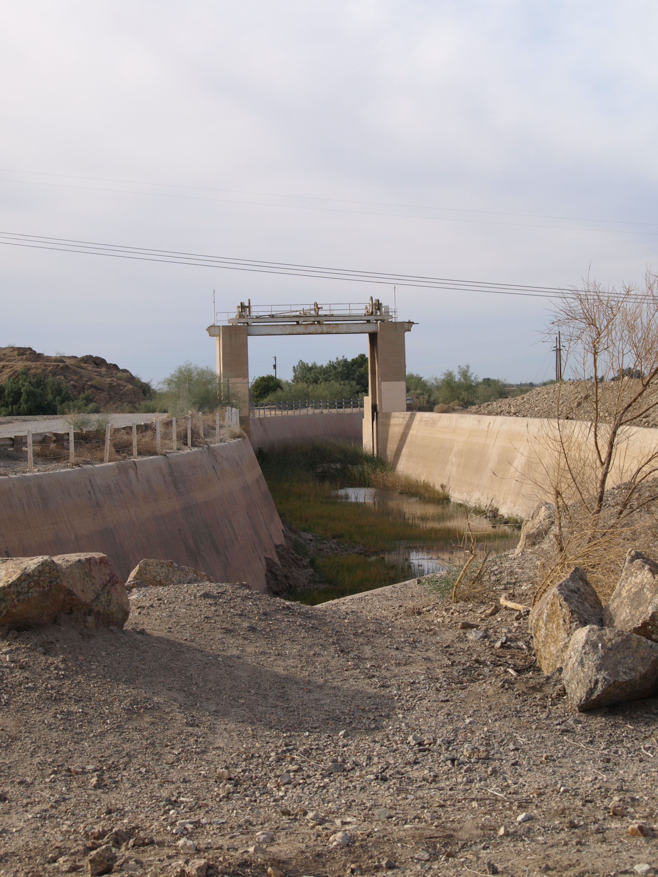
With the arrival of the Southern Pacific Railroad in 1877, steamboat travel declined. The completion of Laguna Dam in 1909, was the end of viable steamboating on the lower Colorado (see my blog entry on the Swastika Bridge for more on Laguna Dam).

Sold to the US Reclamtion Service, the Seachlight was lost on the River in October 1916; as the last steamboat on the lower Colorado, its loss ended an era.

  • The copies of these two available digitally do not have the title captions, but the numbers and titles are given on the LoC information documents

FELICITY, CALIFORNIA A HISTORY TROVE TWO WAYS!

Felicity is both a treasure trove of history and history in the making.

.

Created by Jacques-Andre Istel and his lovely wife, Felicia, the Town of Felicity is the Center of the World, and the location of the History of the World in Granite. It’s hard to describe and monumental to see.

Open December 1 – March 30 of each year, 10 miles east of Yuma on Interstate 8 (exit 164), it is well worth a visit; take sunscreen, wear a hat, and prepare for an outing. The guided tour (nominal fee) takes you into the pyramid that houses the plaque locating the Center of the World.

The hand of God points to the Center of the World and to the Church on the Hill (not visible behind the pyramid). Photo by author
.

Between there and the tiny inter-denominational church on the hill, there are massive red granite plaques engraved with history lessons.

View of Felicity from the Church on the hill

The people who own Felicity are extremely nice and helpful. You can spend as long as you wish, exploring the grounds and the relatively new Court of Honor. Each year they add something new!

Eiffel Tower stairs

Laguna Dam & Swastika Bridge

OLYMPUS DIGITAL CAMERA

Sluiceway of Laguna Dam, 2017                                                                                photo by author

Construction of Laguna Dam, the first dam across the Colorado River, began in July 1905; plagued by contractor and supply problems, plus flooding, it was completed in March 1909. During its planning, core samples had shown the dam site was layer upon layer of silt carried down by the river over the ages, so a conventional dam design could not be used. US Reclamation Service engineers ultimately based the design on a weir dam on the Jumna (Yuamna) River in northern India that was successfully built on silt (USBR, 1902-1923, was the predecessor to the US Bureau of Reclamation).

BOR Pictures 180
Laguna Dam from California side, circa 1910                              US Bureau of Reclamation photo,                                                                                                                                     National Archives

Located north of Yuma, its principal gate (bottom width 116′) was built on the western (California) side of the river to divert water into a canal that carried water down the western side of the River until it was opposite the town of Yuma, where it was directed into a twelve foot siphon that went under the River to carry irrigation to the Yuma Valley in Arizona. Water was also diverted to Fort Yuma Resesrvation and the Bard Valley in California.

view-into-siphon

“Ground hags” working in the siphon during construction                                                                                          US Bureau of Reclamation photo, National Archives

Connected by a weir dam across the river bed that raised the water level 10–13 feet, on the eastern side was a smaller gate (bottom width 42′) and canal to carry water to agriculture in Arizona along the Gila River. Both sluicegates were based on bedrock & paved with concrete.

usbr1

View of the Colorado River at Laguna today; California sluiceway is on the left.  The white stretch of concrete across the river bed is the wier dam; the Arizona gateway is not visible to the left of the photo.  The man-made “river” to the right is the All American Canal.                                                                                                    US Bureau of Reclamation photo, Yuma project.

LagunaDamArizonaSluiceGate

Sluiceway on the Arizona side, April 4, 1909.                                     US Bureau of Reclamation photo


OLYMPUS DIGITAL CAMERA

Sluiceway on the Arizona side, today.                                                                                photo by the author

According to the Arizona Sun (2/2/2013), while studying Indian dam construction, the US Reclamation Service also learned about an ancient Hindu Goddess, who had the power to control water and was sometimes represented by a four armed swastika, a symbol that had a history of peace in many cultures going back 9,500-10,000 years; it was not until the 1930s when the Nazis adopted the symbol that it came to stand for evil. Near the eastern gate they built a concrete bridge adorned with swastikas (whirling counter-clockwise) and also some were incised on the sluiceway.

IMG_0199


Swastika Bridge on the Arizona side                                                                           photos by the author


In 1948, Imperial Dam replaced Laguna as the means to divert water to the Yuma Valley (as well as to the new All American Canal). Since then Laguna has served as a sluice gate and regulator for Imperial Dam releases through the main river channel to Mexico.

Much of the infomration in this segment is based on US Bureau of Reclamation and National Park Service sites, and articles in Engineering News, (February 27, 1908 & June 10, 1909) by Edwind D. Vincent, USBR Resident Engineer, Yuma Project.